Not Giving In

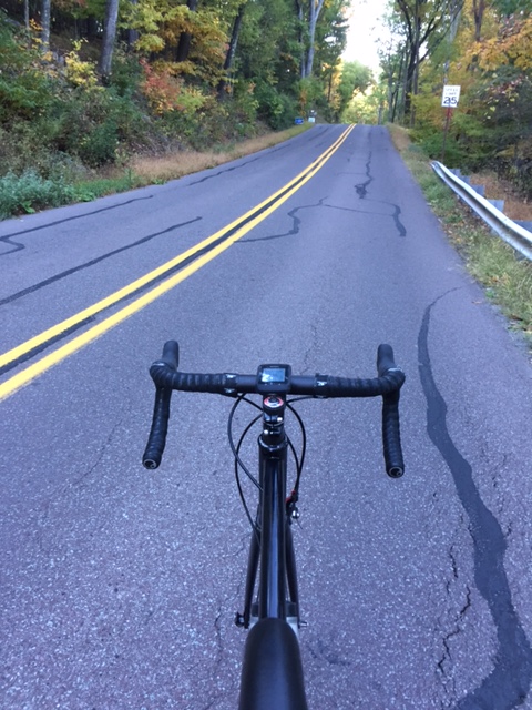
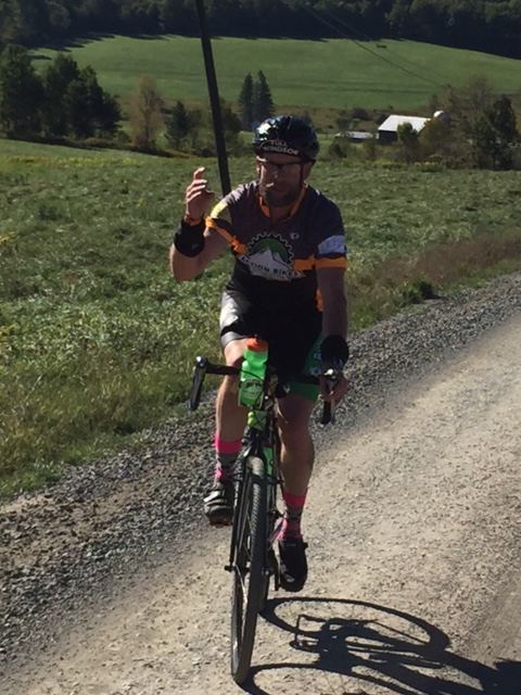
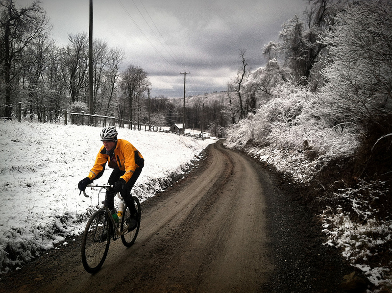
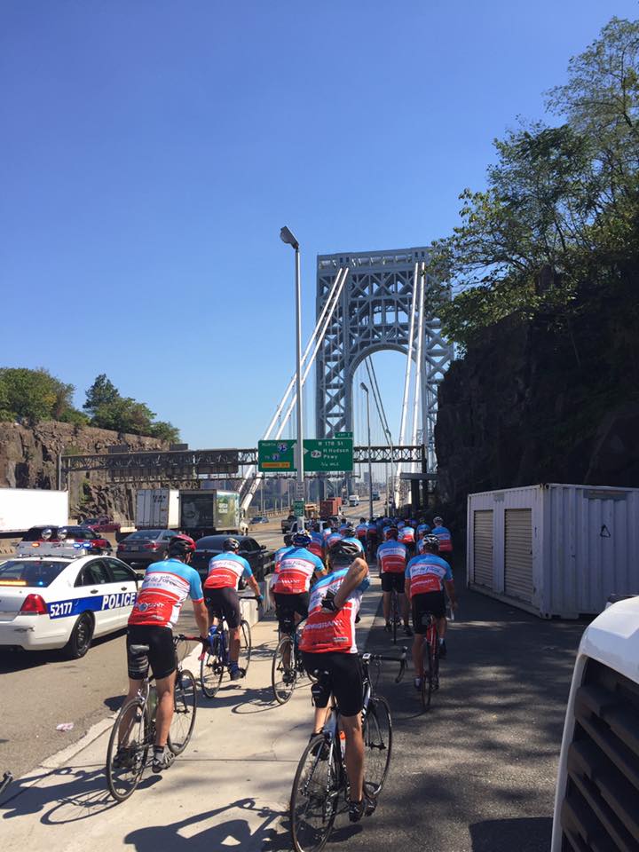
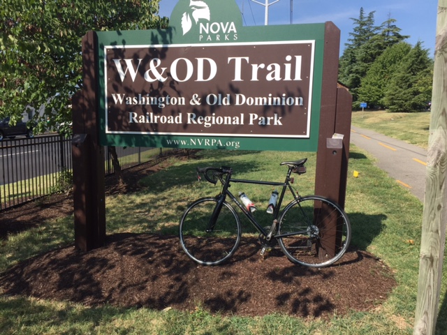
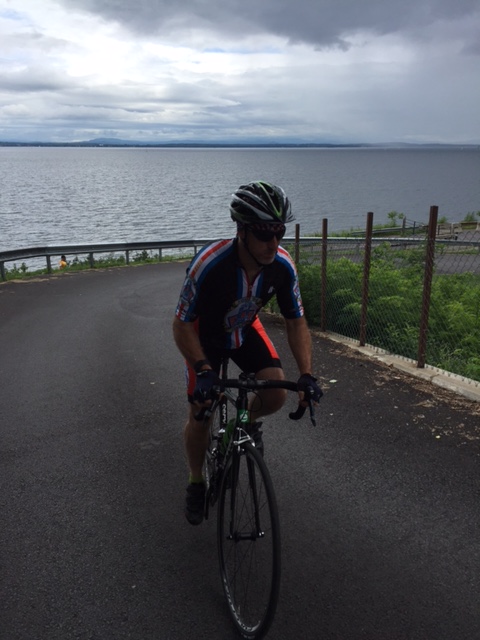
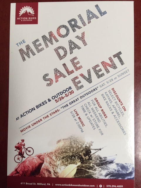
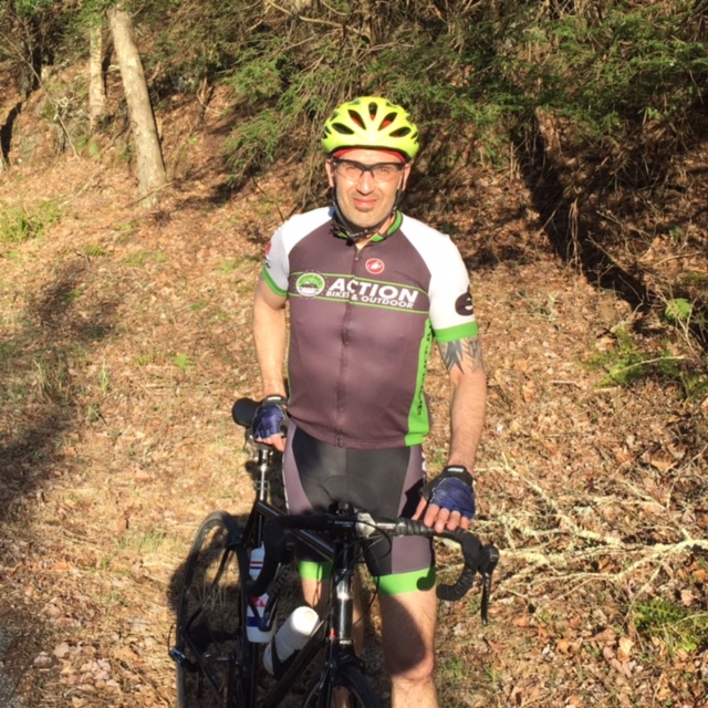
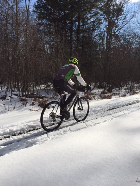
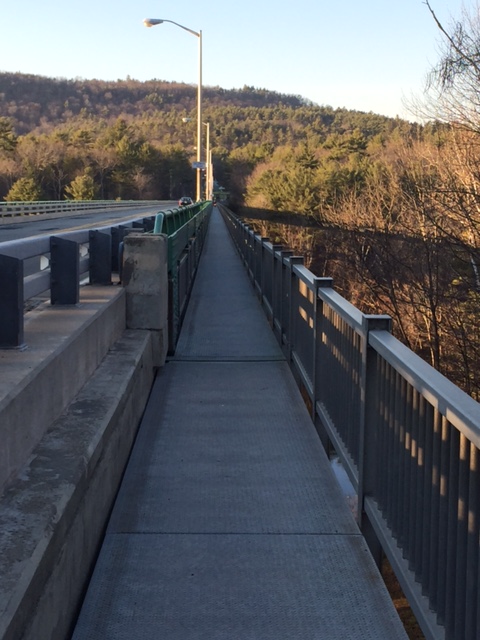
As the days get shorter and the weather gets cooler, opportunities for road rides begin to dwindle. It’s either early morning rides and that means layering up for the 35-45 degree tempatures or after work rides that finish in the dark.

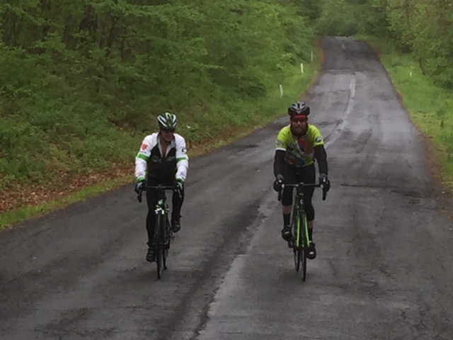
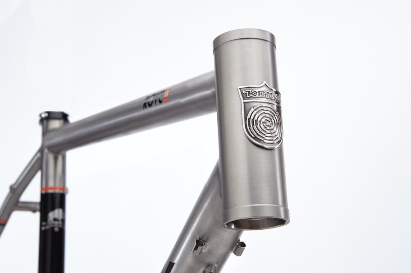
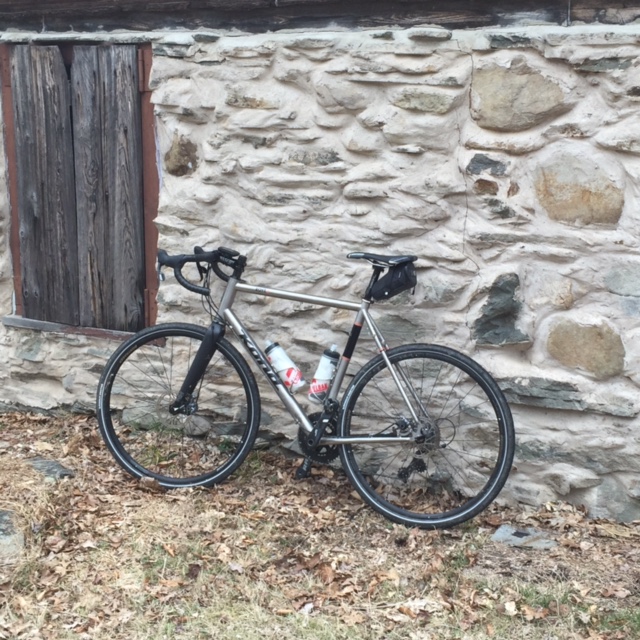
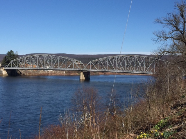
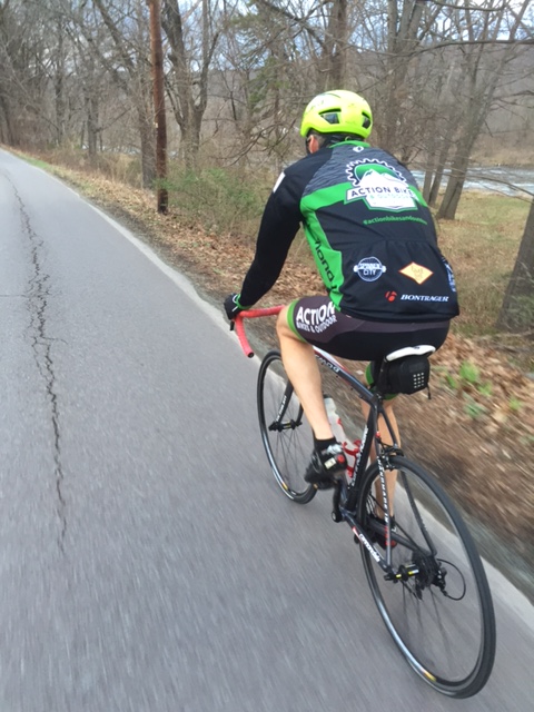
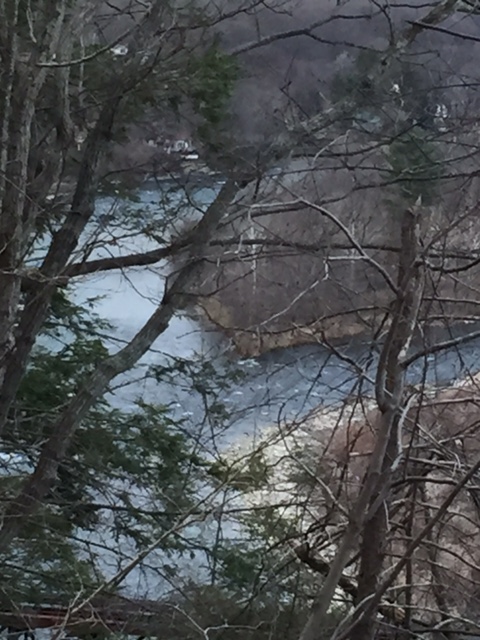
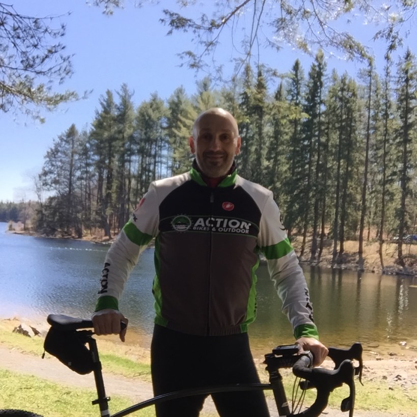
I knew that I wanted to get a ride in yesterday or today. I tried yesterday and suffered through a mechanical incident that saw me abandon after 3 miles. Today, with renewed vigor, I hoped on my bike at Action Bikes and Outdoor and headed towards Port Jervis. I was aiming for a climb up Point Peter and a loop around River Road, but just as I hit Matamoras, I rode right into a pothole.

img_0045
Tire Sidewall Puncture

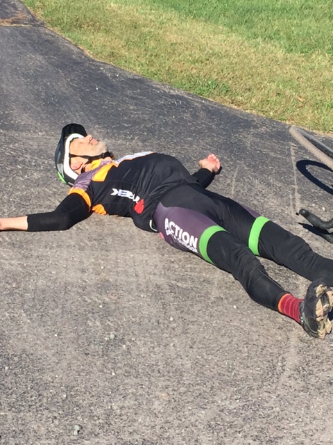
As soon as I heard the loud pop, I knew I had a flat and pulled over to assess the damage. Realizing that the sidewall of my tire was ripped, I had to figure out a way to repair the tire enough to get me back to the shop. After pulling out the old tube, I took a piece of cardboard out of my seat bag and placed it inside the tire, over the tear. I replaced the tube and blew up the tire to about 50lbs of pressure. I did not want to blow the tire up to capacity as I was afraid the tube would come through. It was just enough to pedal the 5.5 miles back to Milford. Once at the shop, I immediately changed the tire and headed back out to finish what I started.

img_0042

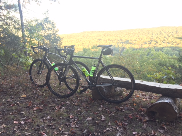
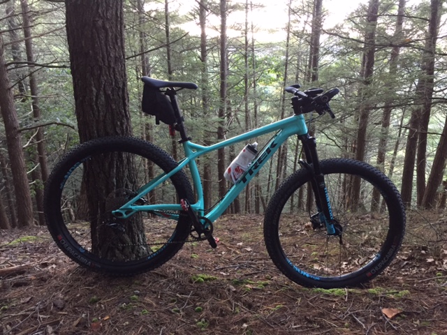
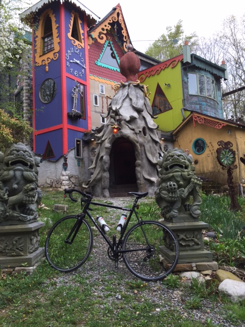
With daylight at a premium, I decided that quantity was not as important as quality. I rode through Milford and made a right on Foster Hill Road for a 2+ mile climb. Foster Hill starts out rather steep, levels off in sections, gets steeper in other sections and continually climbs right up to the Malibu Dude Ranch, an 800 acre resort that offers old west style vacations, horse back rides on scenic trails and a rustic restaurant and tavern.

img_0043

Getting up the hill is the work, stopping at the ranch is the reward. Horses come right up to the fence, like they’re greeting you as you enter. I took a quick photo op and zipped up for the descent. At the bottom of the hill, I took Pear Alley back to the shop. I almost gave in and called it a day when I flatted. I’m so glad I regrouped and made it happen.

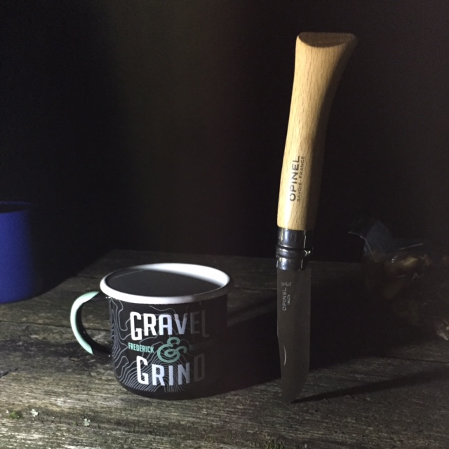
What’s Playing (what am I listening to while writing or what’s dancing around in my head while riding) Today – The Steve Miller Band – Jet Airliner

img_0046


Press Release: Erie 80 Mountain Bike Race

erie-80

The City of Port Jervis Holds Erie 80 Mountain Bike Race in City Park before Halloween

Port Jervis, NY – The city is working hard at showcasing the new trail system in the newly opened Watershed Park which will host the Erie 80 Mountain Bike Race on October 29th.  The race will have three distance options for participants including a 12 mile, 25 mile, and 50 mile course.  Trail crews have been working hard to build a fun, challenging, fast, and technical course attracting mountain bike riders and racers of all abilities.  Racers will face single track terrain with rocks, logs, roots, and water crossings.

The start of the race will take place on Front Street with a police escort to Brewers Reservoir.  From there, racers will give it their personal best and finish the course in the fastest time possible.   Racers will be categorized by age, bicycle type, and ability level.  Prizes will be distributed to all of the top 3 finishers within each category.

The City of Port Jervis has had a tremendous amount of help and support with the organization of the Erie 80 race.  Dejay Birtch is heading off the event and has designed the course.  Other sponsors include Action Bikes and Outdoor, Polar Bottle, Dark Horse Cycles, Fox N Hare Brewing Co, Joe Fix Its, BTI, Honey Stinger, Swift Wick Apparel, Newburgh Brewing, Dumonde Tech Racing Oils, Stan’s No Tubes, Port Jervis Brick Oven Pizza, Advocate Cycles, and Shop Rite of Montague.

Registration is open now on Bikereg.com!!   Information and registration is also available at http://www.discoverportjervis.com.

A New Gravel Loop

There is no better way to take full advantage of the incredible fall foliage than a bike ride. On this picture perfect day, a gravel ride was in order. So I hooked up with Eric at Action Bikes and Outdoor for a late afternoon ride through the Zimmerman Farm and the Conashaugh Horse Trail.

img_0015

We left the shop and cruised through Milford, to Milford Beach and onto the McDade Trail. At Raymondskill Road, we hopped onto Rt. 209 and made a right at the second Zimmerman Road entrance. Zimmerman Road goes through the Zimmerman Farm and onto horse trails that lead up to Raymondskill Falls. We made a right at the horse trail and went through two creek crossings before climbing an extremely steep and winding hill with loose gravel that made the climb doable at best. I walked up the middle section as my rear wheel was all over the place.

img_0018

After crossing a rather deep, dried up creek bed, we beared left and that’s where the real climbing began. The roadway, full of gullys from water run off, became an obstacle course that just kept going up. Somehow, we both managed to grind it out as we capped the hill and turned left on Conashaugh Road, a hard packed pea gravel road that goes from Milford Road to Long Meadow Chapel Road.

img_0019

After about a mile, we went around the gate and onto the Conashaugh Horse Trail. This was new territory for me. Immediately, we dropped down they rail, which was just a bit wider than single track. The trail surface contained wooden steps, every 50 feet or so for almost a half mile. The road came down in a swampy valley and went back up for a little bit and dropped back down to Zimmerman Road, right at the driveway of the Marie Zimmerman Estate. We cruised onto the property and rode around the house and through the gardens.

img_0024

We pedaled out of the he estate, down Zimmerman Road and made a left on Rt. 209 and back to the McDade Trail. Finally, some flat terrain. Although we were moving pretty quickly we talked all the way back as we rode from daylight to darkness, from open trail to hidden forest. Rolling off the trail, we rode past the Metz ice house and down the gravel trail along the river (Delaware River). The trail, only a half mile long, ends at a steep, paved hill that puts you right in the middle of Milford.

Every bike ride gives you the opportunity to explore new areas. Today, we were lucky enough to find a new loop through the horse trails and see another part of the Zimmerman Farm. Here’s some more pics:

The Knob

If you ride anywhere near Milford, you’ve heard of the The Knob. If you’ve even been through Milford at night, you’ve seen The Knob. The Knob sits atop the Raymondskill Ridge in the Cliff Park section of the Delaware Water Gap National Recreation Area. The Cliff Trail and the Quarry Trail intersect the Knob Trail. There are more than eight miles of Trail to connect in the Cliff Park area. Any one of the climbs rewards the rider or hiker with a fantastic view. In fact, the cover photo for this blog was one I took about 3 years ago, after hiking to the top.

img_0012
Another view from The Knob

img_0011

Today, I left from the Action Bikes and Outdoor and accessed the Milford Knob trailhead at the North Contact Station. After climbing for about a mile, I made a left on the Quarry Trail and a right on the Cliff Trail and rode up to the Knob. I pedaled down the single track along the ridge to also get a view of the Milford Bridge, the Delaware River and the vast corn fields along the river.

img_0013

I descended into the Milford Cemetary, turned around and rode back up and around to the North Contact Station. My aim was to ride out to Raymonskill Road and Jump on the McDade Trail for an easy spin back to Milford. I lost my navigational skills for a moment and ended up coming out the same way I went in. I rode down Rt. 209 to Raymondskill and entered the McDade Trail.

The Knob is a nice easy hike or bike ride that can be started from anywhere in town. There are some steep sections that require low gears or possibly a little hike a bike.

Whats Playing (what am I listening to while writing or what’s dancing around in my head while riding) today – Supertramp – The Logical Song

img_0014

Lazy Weekend Spin

Rain, rain go away. After five straight days of rain, enough already! Anyway, I got a small window today to get out and get the blood flowing through my legs again. I had more than the required recovery period, following last weekend’s monster ride.

I decided to do a road ride and stay out of the mud and puddles that cover the gravel roads and trails.

img_0005

Matt at Action Bikes and Outdoor, suggested a route that covered some familiar roads and some new ones. I headed out under the dark grey skies at around 3:30pm. After navigating Milford, I pedaled across the bridge into Montague, NJ and up Deckertown Turnpike. Deckertown gets vertical immediately. You climb for just about 2 miles. A right on New Road and nice spin through the quiet Autum landscape. As you get to Rt. 206, Flatbrook Farm is on the left with their farm stand on the right side of the road, serving up fruits and veggies, fresh off the farm. It seems that this time of year, farm stands pop up all over the place, one of the perks of The Autum season.

img_0008
One of the many farm stands along Rt. 206

A short ride on 206 and a left on Hotalen Road. Hotalen is a shaded street with very little traffic. It comes to a fork at the top. I missed the turn and went up the hill. At the top, I checked the map on my phone and spun around. I should have veered right at the fork and descended Back down to Rt. 206. I wanted to get off the main drag, so I turned left on Bridges Way and right on Layton Hainsville Road.

img_0006

After a flat mile, I hung a left on Jager Road and climbed up the backside and dropped down, making a sharp right on Old Mine Road. You can reach speeds of over 45mph on Jager, just be careful as Old Mine comes up rather quickly.

Old Mine Road is the quintessential country Road. The only problem this time of day is that the shadows on the road surface make it extremely difficult to see all the pot holes, even on this overcast day. So, I soft pedaled all the way to the Milford Bridge. As luck would have it, I got to ride about 10 mph, right next to a deer that was trotting along side of me for about 1000 feet. Not spooked, she just eased her way back into the woods. Crossing the bridge, I caught a glimpse of the early fall foliage on the Pennsylvania side of the Delaware River. I hope the weather cooperates and allows me a few rides a week this month as I have signed up for the Erie 80, a 50 Mile Mountain bike race in the Port Jervis  Watershed trail system, on October 29th. My lack of Mtb skills it are making me think I might have gotten over my head a bit on this one. We’ll see. I’ll detail that race very soon in another post.

What’s playing: (What am I listening to while writing or what’s dancing around in my head while riding) Today – Argent – Hold you head up

img_0009


Maple City Century – Gravel

On Sunday, I traveled to Honesdale, PA with Eric, Matt, Bob and Kyle, to do the Maple City Century, a mixed terrain 100 miler that consisted of about 85% gravel and dirt roads and just over 9,000 feet of climbing. The route brings you through most of rural Wayne County and borders the Delaware River and New York State in several sections. If you haven’t been to this part of Northeastern PA, check it out, it’s beautiful, especially during the fall foliage season.

img_4022

100, 62 and 30 mile options are offered. Each route different, but challenging in their own way. The 30 mile option gave riders a glimpse of what pedaling in Wayne County is all about, on mostly dirt and gravel roads.The 62 and 100 mile routes include long, steep climbs through farm land, logging roads and every kind of back road you can imagine.

img_4008
Action Bikes and Outdoor was well represented

It was chilly at the start, about 36 degrees, but warmed up to the mid 60’s at mid day. I did not get a chance to sample the 30 and 62 mile routes. I was up in the air about whether to do the 62 or 100 but made a game time decision to push through the 100 mile course. I was rewarded for my efforts with amazing views, awesome rest stops and a chance to ride with some fantastic people. Matt and Bob rode the 62 miler as Matt took care of repairs for the riders at the start and had to wait for the masses to depart. Kyle and Eric joined me on this epic journey.

The 100, left from behind the Post Office in Honesdale at 8:20am and rolled through town with a Police escort. 2 miles later, the gravel adventure began. I compartmentalized the ride into 4 sections, divided by the 3 rest stops. The first section was hilly to say the least. But, anyone who cycles in Northeastern, PA knows there are no flat roads here. Just ups and downs and ups and downs.

img_4029

The ride organizer made all routes available for download to a GPS enabled device. Cue sheets were also made available. However, the course was expertly marked out with easily visible color coded signs at every turn. At mile 33, we arrived at the first rest stop and were greeted with friendly volunteers and an array of energy bars, gels, fruit, trail mix, water and energy drink. Volunteers signed in all riders, to ensure they reached the checkpoint safely.

img_4014
Eric certainly approved of the descent!

The next section began with a hill, just up the road from the rest stop. Another 15 or so miles or gravel and we hit Brown Trout Trail. This extremely technical, section lasted for five miles. With the side of a mountain to the right and a cliff to the left, the six foot wide trail seemed suited for a full suspension MTB, Fat Bike or ATV.  With a waterfall coming right through, a washed out portion of the trail required a little hike a bike. This was the most challenging part of the course.

img_4025

Just as we pushed off Brown Trout Trail, we arrived at rest stop #2. What a welcome sight after bouncing around for more than 40 minutes. After filling bottles and devouring everything in sight, we saddled up and headed out into the beautiful countryside. We saw some odd old homes, rustic churches and more than a few cattle.

At mile 75, we pulled into rest stop #3. This seemed like a great place to sit down and stretch a bit. With only 25 miles to go, finishing certainly seemed like a reality. Just a few more hills and a lot more gravel!

img_4021
Thanking the Gods for a beautiful day!

I kept telling myself that the big climbs were behind us. That didn’t work very well as hill after hill punished every weary leg that pedaled on. I have to say that Eric really got me through this ride. He kept me going when I wasn’t feeling too good. As for Kyle, we only saw him for a few seconds at the start. Every time we hit a sketchy section of trail, I did imagined Kyle laughing and riding right through. It was still light out when we rolled back into Honesdale, 8 hours and 47 minutes later. A quick clothing change at the car and a brief walk to the Irving Cliff Brewery for a well deserved post ride feast.

14469600_1292996097391572_2860313371350944511_n
A beer growler for every participant

Kudos to Ride Director Zach Wentzel and his staff for putting on a first class ride. The course markers were spot on, the rest stops were fully stocked and the volunteers were friendly and helpful. The course was everything it was supposed to be and more. It’s already on the calendar for next year. September 24th, 2017. Save the date!


What is Gravel Grinding?

It’s 8am on a Sunday Morning. I’ve just unloaded my bike from the top of my car. I’m doing some last minute checks to make sure I have enough food and water to get me through the day, as I’m about to embark on a 30-35 mile bike ride through mostly gravel roads in the Delaware State Forest. That day, I rode through the state forest, onto the pavement for a couple of miles and back into the forest, with a couple of diversions on dirt roads and grassy trails to end with 32 miles of an all road adventure.

This type of riding is most commonly called “gravel grinding”. Some call it “adventure cycling” and some refer to it as “all road riding”. Whatever you call it, it’s just plain fun.

img_0967
2017 Kona Sutra LTD

Gravel Grinding has been popular in the midwest for the better part of a decade. Many of the big gravel races in the US are found there because of the extensive network of gravel and dirt roads that sprawl across the region. Here in the northeastern part of the country, gravel grinding is catching on. In this area alone, we have access to numerous gravel roads that are part of the state forest as well as the McDade Trail, which is a 32 mile gravel and dirt trail, connecting Milford to Stroudsburg as part of the Delaware Water Gap National Recreation Area, along with many other off the beaten path options.

hogg1-1-lo

The best part about gravel grinding is that you don’t need a specific bike to get you going. You can pedal across gravel or dirt on a mountain bike, road bike, cyclocross bike, dual sport bike, comfort bike, whatever, just make sure you have enough tread on your tires to shed a little mud and stone. However, most bicycle companies are now producing “gravel bikes”. A good choice for people who just want to have 1 bike. A bike that allows a lot of options for two wheeled adventure. You can hit the gravel, ride in a gran fondo, throw racks and fenders on for loaded touring or just use it as an everyday commuter. Action Bikes and Outdoor, right in the heart of Milford, stock several models of gravel bikes, along with every type of bike and accessory as well as kayaks, paddles and most things for the outdoor enthusiast. Stop in, they are happy to offer advice on where to ride. They even have great paper maps and resources to help you on your journey.

8479784805_24a91ae06c_c

The beauty of gravel grinding is it gets you out of traffic and puts you right in the middle of nature. There’s no need to hammer through the woods. Slow down, enjoy the scenery and take in everything that nature has to offer. You won’t regret it. In fact, there seems to be a growing number of riders in our area that love having the opportunity to pedal in areas that until recently seemed foreign. On both sides of the Delaware River, there are trails and roads that lead to waterfalls, farms, corn fields, breathe taking views, wildlife sightings, streams, creeks and lakes.

104

If you are up for the adventure, try one of the areas local gravel races. The Maple City Century, on September 25, 2016 starts in Honesdale and takes you through beautiful and scenic Wayne County on mostly dirt and gravel roads. In October, Action Bikes and Outdoor sponsor the Erie 80. An 80K gravel, dirt and paved MTB ride that shows you all
that Port Jervis has to offer. If you are not looking for an organized race, there is usually a group riding from somewhere. Mostly from the shop parking lot.

So if I’ve peaked your interest just a little bit, get out and pedal a quiet country road, you’ll be planning your next gravel ride before you load your bike back on the car.

A Little Gravel Prep

Getting out today was harder than I thought. I got up at 6:30am to meet Eric for a morning ride. I took the dog for a walk and got wet as it rained hard for about 10 minutes. I text Eric and opted for a few more hours sleep over a wet ride. He manned up and went out for a rain ride. I waited until 3pm, when it was dry and the forecast looked clear to venture out into the woods.

I’m planning to ride in the Maple City Century next Sunday in Honesdale, PA. It’s a 100 mile gravel adventure with lots of climbing. So, I wanted to just get a few extra miles in on some loose gravel roads to help prepare for the event.

img_3970

I rode out of my driveway and up through my community, then veered into the woods via a deer trail and onto Five Mile Meadow Road. I haven’t been on a bike since Tuesday, so I took it easy as I let my legs warm up to the hills. I headed out to Silver Lake Road and climbed up the monster hill before turning left onto Flat Ridge Road.

img_3969

About halway up Flat Ridge, I met up with Bob, another local cyclist that was also training for the Maple City Century. He was doing almost he same ride that I was doing today. After, pedaling up to Minisink Lake and turning around, I came back down Flat Ridge and took Bob’s advice when I turned right on Coon Swamp Road. Coon Swamp is gravel and loose packed dirt. It continues for a couple of miles and comes to an end at the top of a hill, with a cool camping spot, over looking Coon Swamp Lake.

img_3971

Coming out of Coon Swamp, just before I got back to Flat Ridge, I was startled as I noticed a black shape in the roadway. It was a huge black bear. I fumbled for my phone to take a photo, but he scampered away as I tried to get closer. Probably better off for me. It never ceases to amaze me what beautiful creatures they are.

img_3974

Back on Flat Ridge, I rode on, knowing how lucky I am to have this incredible state game land, with all the gravel emergency access roads, right in my backyard. I descended down Silver Lake Road and hung a left back onto Five Mile Meadow Road. From there, I pedaled through the deer trail and home.

I’ve written about this area a few times before, but I felt compelled, as a new road or trail, especially one that ends high above a lake, providing superior views, needs me to tell you about it, so you can go ride it and see for yourself!

What’s Playing: (What am I’m listening to while writing or what’s dancing around in my head while riding) Today – The Babys – Isn’t It Time

220px-broken_heart_album


Tour de Force – Day 4

The final day of the TDF is always bittersweet. I’m happy to get home and get back to my daily routine, but I’m also sad that it will be another year before I get to see all the awesome people that I have the privelage to be associated with for the last 15 years.

14355578_947847565345108_8914095259435938465_n

We started with a transport over to Liberty State Park in Jersey City. After a few wrenches were turned and photos were snapped, we were led out by a multitude of New Jersey Police agencies with a fantastic escort through Jersey City, Hoboken, Fort Lee and all the wonderful cities and towns along the Jersey side of the Hudson River. What came next was unusual. The Port Authority Police Department along with the Fort Lee Police Department and the NYPD, shut down the George Washington Bridge to escort us into the greatest city on the world.

14359226_10207473300975061_1799279596367501775_n

The riders were given the entire right lane of the bridge. Most charity tours are relegated to the bike path along side the bridge. We snaked into Manhattan and eventually onto Riverside Drive for a cool ride above the river and down the west side. We hit the Henry Hudson Parkway and again had a lane shut down for us. For 15 years, we have been treated well by our own department, but never to this extent.

14322190_10209480698789614_4060831702138126948_n

Dropping down to 12th Avenue, we were given free passage all the way to the Freedom Tower and the 9/11 Memorial. After a moment of silence to remember all victims of that horrible day, we pedaled over to Battery Park, where we were treated to a ceremony, honoring our efforts. 14322434_773391086155118_6003259236222251780_n

As the TDF came to a close, we said our goodbyes and expressed our hope to see everyone next year. Our year end meeting is in October, where we will vote on how all monies raised will be donated. We will also finalize our route for next year and immediately start planning for the 2017 event. You can check out what we do and how we do it by dropping by our web page at http://www.tourdeforceny.com. I leave you with yet, a few more photos:


Tour de Force – Day 3

This may have been the best weather we have ever had for the Tour de Force. Low 80’s and absolutely no wind. The road was flat as can be for most of the way. Really, things could not have gone better today.

Normally, I would take this 1 day that I ride to hammer as hard as I can and finish as fast as possible. But, today, I decided to ride with my pal and ex-partner, Mike and his son Sean. Mike is a unique rider. He is the only person to have ridden every mile of every year for the first 15 years of the Tour de Force.

We pedaled out of Island Beach State Park in Tom’s River, NJ and rode along the coast for the first 35 miles. When we reached Belmar, we rode up on the Boardwalk for a few hundered feet. From mile 38 to mile 49, the route took us onto the Atlantic Highlands Rail Trail. A scenic fitness path, it kept the riders off the busy Jersey Shore streets.

A few miles after coming off the trail, we were treated to a series of hills, that to be honest were just about the only inclines on the route. At the top of one of the hills, a 9/11 memorial sat in a garden, overlooking Sandy Hook and the Atlantic Highlands.

img_3888

We cruised along the rest of the course together and enjoyed the sea air, all thanks to the incredible effort of our support team. The sag support and rest stops are second to none. These volunteers, are what make this well oiled machine run so smoothly. The local Police Departments took care of the busy intersections, allowing our riders to pass through saftely.

img_3892

Pulling into the beach in Old Bridge, NJ, where the riders grouped up to be escorted over the Liberty Bridge, I was happy to have had the opportunity to ride today. I jumped into a car and headed to the hotel in Woodbridge, our finish line for the day, to get ready to greet the riders with medals to commerate their amazing efforts. Now, I leave you with a few more pics of this amazing day:

img_3876


Tour de Force – Day 2

What a beautiful day. Low 80’s and sunny with just a little wind. The day started with a ferry ride from Lewes, Delaware to Cape May, NJ. Getting everyone on the ferry was a challenge with all the support vehicles, but the ferry crew was more than up to the task. The Cape May Ferry is always a nice trip. It gives everyone a chance to talk. Night time is filled with food, spirits and tired bodies. So, a little diversion in the morning, never hurts.

The ride was short, only 54 miles. Out to Rt. 9 with a tour of historic Cape May.  The riders pedaled through the fantastic sea air for the better part of 3-4 hours, ending in a parking lot near the Tropicanana Hotel and Casino, in Atlantic City, NJ.

Days 1 and 4, riders wear the current year’s jersey. Day’s 2 ans 3, custom jerseys from hometowns and various teams the have been created for the ride, rule the day.

A short day callls for a short post. Here are a few photos from today:


Tour de Force – Day 1

Well, day 1 is upon us. This is the day that first time riders, will find out if they trained hard enough, prepared properly and packed everything they will need for this 4 day event. Each rider, raises a minimum amount to gain entry into the ride. Even the support staff have to meet a fundraising goal. Riders and support staff, come from all corners of the country.

In 2002, our original starting point was the Pentagon in Washington, DC, and we rode to the World Trade Center in New York City. We have done that ride as well as the reverse route several times. We have also ridden from New York to Boston (Yankee Stadium to Fenway Park) and Boston to New York. This year we decided to start at RFK Stadium in Washington and ride to the NYC Police Memorial, around the corner from the World Trade Center. img_3817

14316819_10153808512212409_6730749850773852001_n

The Metropolitan Police Department escorted the ride out from RFK to the Capitol and around the District and handed us off to the Pince Georges County Police as we crossed the Maryland line. I drive a support vehicle for 3 out of 4 days, as the logistics of the tour have not allowed myself or my colleagues the opportunity to ride the entire way for several years now. I plan to ride day 3 as that appears to be the lightest traffic day with little to no problems all the way to the finish.

img_3825

Once we hit the first rest stop at mile 22, we led the riders out 8 more miles and released them at their own pace. Immediately, the pack went from a long sea of blue to a spread out group with each rider finding his or her cadence. We keep cars with the front of the pack as well as a sweep vehicle to trail the last rider. Several support vehicles, buses and trucks are along the route to lend support to riders in need. Mechanics ride back and forth along the route to assist with any issues (mostly tube punctures).

Mile 40 at the Maryland Transportation Authority was the lunch stop. (The tour provides breakfast and lunch each day as well as 4 nights lodging in superior hotels and a banquet on the 3rd night). After crossing the Bay Bridge, riders head over to Rt. 404 to complete the last 60 miles to Rehoboth Beach, our destination for day 1.

img_38290

Rt. 404 is a long, flat section of road that winds through corn fields in rural Maryland and Delaware. Farms stands are everywhere, offering local fruit and vegetables, giving us the freshest supplies for our remaining rest stops. When the last rider reached the hotel, the party began. The entire parking lot is lined with TDF trailers, with just the right amount of beverages to rehydrate our weary riders.

A few more pics from today:


Tour de Force – Registration

In a prior post, I mentioned a ride called the Tour de Force. This is a 4 day ride from Washington, DC to NYC on or about September 11th. All money raised is donated directly to the families of Police Officers killed in the line of duty. I, along with my brother Mike and my partner Mike founded the tour in 2002. Tomorrow, we will embark on our 15th annual version of this incredibly fullfilling journey.

In 2001, I was a NYC Police Detective, assigned to the Bronx Robbery Squad. Immediatly after the first plane hit the World Trade Center, we were mobilized. My squad commandeered a city bus, cleaned out a Bronx supermarket and we rushed to the scene. I won’t even try to explain the horror that was Ground Zero. We were there for the better part of 2 weeks. In 20+ years in the NYPD, I learned a lot about people. But nothing could have prepared me for how this cowardly act could have such a profound affect on my life and how this amazing country that I have the privelage to live in, would change forever.

Anyway, last night, I arrived here in Falls Church, Virginia to prepare for today’s registration process. At 3pm, the buses from New York are scheduled to arrive at the hotel, carrying the bulk of our 300 riders. Tomorrow we start our first leg of the tour with a 107 mile ride. But, today, I was able to get out at 9am for a 30 mile pedal around the W&OD Trail, a paved rail trail the runs through Washington and the surrounding suburbs.

img_3803

A couple miles in, I got turned around as the trail ended and went into downtown Falls Church before picking back up again a few blocks away. A woman named Jennifer, who runs a trade association in the Washington, DC area, was kind enough to show me a loop that went around Reagan National Airport, through Arlington, Virginia and back around to Falls Church.

img_3800

The W&OD is an urban rail trail for sure. However, it runs along the Potomac River in spots and encompasses just enough local park land with beautiful wooden bridges to give it a lively feel. After about 30 miles, I veered off the trail a headed back to the hotel, ready to tackle the day’s events.

img_3799

Tomorrrow, I’ll have some great photos of the start and I’ll provide some more details about the Tour de Force.

img_3811


BikePacking, Part 2

The bikepacking bug came biting again. Last week, I received a message from Will and Kyle that they were planning an overnighter in Promised Land State Park. The thought of a fire, dehydrated food and camp coffee, oh yeah, I was in. I’ve been cultivating my next overnighter on the bike since my last trip. Will plotted out a route from Shohola, so all we had to do was pack, pedal and relax.

I planned on taking my Van Dessel WTF again with my large seatbag, frame bag and handlebar bag. Knobby tires on a route that included 90% pavement was probably not the smartest idea I’ve had. I went with a Camelback instead of a backpack, because I freed up some room with a hammock instead of a tent.

IMG_3715

Friday came and the weather was perfect for a summer outing. At 85 degrees during the day and 60 degrees at night, with no rain in the forecast, we were able to pack light as we did not need to consider the thought of a storm. I met Will at Bridge Park, on Twin Lakes Road in Shohola. Kyle had a prior obligation and left from home. We rode to Rt. 6 and pedaled up to Rt. 434(Well Road) and made a left. We climbed up and over Rt. 739 where the road changed to Blooming Grove Road. As soon as you cross over Rt. 739, you enter the twilight zone. Well, not really, but it certainly seemed like life slowed down a bit.

IMG_3720

I think we saw one or two cars, the entire time on Blooming Grove Road. The landscape included quiet, country homes, set way back off the road and farms situated on lush green grass with well maintained barns. As we crossed Rt. 402 and came into the town of Blooming Grove, we passed what appeared to be the only commercial establishment, the Blooming Grove Tavern. The parking lot was at full capacity.

IMG_3719

We made a left on Egypt Road and were treated to a really nice red barn, a waterwheel and a lazy creek. Egypt Road seemed to go slightly up for the entire 3 miles. A left hand turn at the end, put us on Rt. 390, the main thoroughfare leading into Promised Land. We rolled up and down Rt. 390 for 6 miles and made a right on Lower Lake Road. We dropped down the narrow park road for 2 miles to our campsite. As we pulled up, Kyle was already there waiting to tell us about the alternate route he took on mostly dirt roads.

We dismounted, began to unpack and setup camp. I chose to go with a hammock this time, instead of a tent, so my setup was fairly easy and quick. After our last trip, TC from Action Bikes and Outdoor in Milford, highly recommmended a hammock and I don’t think I’ll ever go back in a tent again.

IMG_3723

We collected wood and fired up our camp stoves to get ready for a well deserved dinner after a hard ride with over 2,200 feet of climbing on loaded gravel bikes. By the time we finished eating, the fire was roaring and we shared some laughs. I indulged in a little red wine (Sangiovese), that I transported in a steel growler on the front fork of my bike. By 10pm, exhausted, I retired to my hammock and pulled the bug fly over my head and slipped into a deep sleep.

IMG_3726

Again, I had to work the next day, so I woke up early and packed up my gear as I boiled water. After securing everything to my bike, I gulped down a hot cup of coffee and headed out. I snaked up Lower Lake Road and out on Rt. 390. That early in the morning, the traffic was a lot lighter than the previous evening.

IMG_3728

About halway home, I had to stop and take a picture at the Blooming Grove Tavern. The terrain was a lot less hilly in this direction and when I hit Rt. 739 I turned right and rode directly to my house. Another trip in the books. The next one will have to be away from a campground as camping in the deep woods provides a unique challenge that begs to be explored.

What’s Playing: (What am I’m listening to while writing or what’s dancing around in my head while riding) Today – Peter Wolf – Lights Out

MI0001622381


Pike County Loop

The other day, I did a really cool ride, that tested my climbing legs, with a few long but gradual hills. I wanted to try something a little different, with pieces of other routes mixed in to a form a loop that started off really slow, leveling out in the middle, it got pretty fast for the last 10 miles, thanks to a few leg loving descents.

Although, the weather was near perfect, and I was completely rested and ready for an epic ride, I hit a few bumps in the road that derailed me a bit, but not enough to spoil this awesome experience.

I departed Action Bikes and Outdoor in the heart of Milford, and made my way over to Rt. 6. Just before Apple Valley Restaurant, I made a left on Owega Turnpike and eased past some well manicured properties and up to Grey Towers.Grey Towers was the home of Gifford Picnchot, the first Chief of the US Forest Service and Pennsylvania’s Governor for 2 terms. Built in 1886, Grey Towers is a historic site that was donated by Gifford’s son to the US Forest Service in 1963 along with the 102 acres that it sits on. As I pulled my phone from my jersey pocket, to take a photo, I hit my first bump. My phone was dead. A miscalculation that does not happen often. So any photos here were taken from the internet. I pedaled back onto Owega Turnpike and back to Rt. 6. and labored uphill for about 4 miles.

grey-towers---2004-0924jpg-8e6c031ac5336775

I turned left on Frenchtown Road and cruised past some nicely situated farm homes. Frenchtown connects Rt. 6 to Raymonskill Road. Turning right on Raymonskill, the road drops for a little less than a mile as I made the sharp turn onto Nelson Road. A short climb and a left on Aspen Drive took me through the Woodlands, a gated but accessible lake community. I made a right on Log Tavern Road and climbed up past the Pike County Library, the new Dingmans Park and another left on busy Rt. 739, the main thoroufare through Dingman Township and Dingmans Ferry. This is where the road drops down all the way across Milford Road, Rt. 209 and the Dingmans Bridge. A left on Old Mine Road and I cruised through the scenic by way that connects the Dingmans Bridge and the Milford Bridge. About halfway, I hit my other bump in the road in the form of a flat rear tire.

CIMG1799

After a quick tube change, I was on my way back to Milford. As I crossed the Milford Bridge, I realized that sometimes the best rides are the ones you do not plan. Just see where the road takes you!

What’s Playing: (What am I’m listening to while writing or what’s dancing around in my head while riding) Today – The Police – Message in a Bottle

13120911192516546411806145


MillBrook Village

Today was not an ideal day to ride a bike. It was hot, it was humid and it rained hard. I planned to go out at 7am with Eric, but, allergies kept me awake late, so I put it off for after work. I wanted to get a little climbing in today, so I thought a Walpack loop with an extra hill or two, would do the trick. I parked at Dingman Falls and rode out over the Dingman Bridge. Turning right on Old Mine Road for the Peter’s Valley climb, got my legs burning early on. I felt real good as I capped the hill and descended into and through the Peter’s Valley School of Craft. I winded my way down the Walpack Road and hugged the right side of the road as traffic through this usually desolate area was heavier than usual. As I passed the Walpack Center and capped the next hill, I could see where all the cars were headed, The Walpack Inn. I should have realized it was dinner time.

Pedaling into the loop, I beared right and clawed my way up and over the only significant climb in the loop. From here on in, it was a roller coaster ride for about 6 more miles until I turned right on a small bridge over the Flatbrook Creek. Immediately, the chopped up, pot hole filled road goes skyward.

IMG_3623
Millbrook Village School House

I navigated around the pot holes as the hill never seemed to end. As I approached the top, it got dark and I could hear thunder from somewhere in the distance. I dropped down the other side and cruised into Millbrook Village, a rustic looking 19th Century hamlet that’s part of the  Delaware Water Gap National Recreation Area. As soon as I dismounted, the rains came (I was only able to snap off a couple of pictures as the rain fell hard). As hard as it rained, it felt good. I climbed back up and rode my brakes back down to the loop as I wanted to avoid slipping on the wet tarmac and rolling into one of the craters disguised as pot holes.

IMG_3628

Back on the loop, I pedaled past the Flatbrook Creek and back around towards the Delaware. As I came out of the loop and passed the Walpack Inn again, the rain stopped and the sun came out. The rain cooled things off a bit and the sun helped dry up my soaked jersey and shorts. I by-passed the Peter’s Valley hill and rode into Layton to tackle the much easier Tuttles Corner Road. The descent to the Dingmans Bridge is the highlight of that stretch of roadway. You can easily hit 40-45 MPH on the 1.5 mile drop.

I rolled into the Dingman Falls parking lot grateful to get a ride in but eager to get back over to Millbrook to explore that area a little more.

What’s Playing: (What am I’m listening to while writing or what’s dancing around in my head while riding) Today – Toto – Hold the Line

Toto-Toto-Frontal


Back in the Saddle

It’s been a couple of weeks since I’ve been able to get on a bike. Sometimes, life gets in the way and then you find your way back. This Sunday morning, I got out of bed and decided to just ride out of the garage, through my community and onto the gravel that is Five Mile Meadow Road. You see, what’s been keeping me away from my bike is still there and I was beginning to think that going for long bike rides was selfish and my way of running away from things. How wrong I was. This ride, through the beautiful state forest, helped me realize how grateful I am to be able to get away for a few hours and just pedal through the woods. I can still get back to reality, just with a renewed perspective.

IMG_3579

Anyway, I scooted up through my community and into the deer trail that leads to Five Mile Meadow Road. I turned right and immediately felt relaxed. I hung a left on Standing Stone Trail. It’s amazing how the weeds have grown through the middle of the road since my last ride there. The creek crossing was rideable today, although I stopped for a quick photo. I plowed through the loose gravel, as this wonderful 3 mile stretch is closed to vehicular traffic and the road surface does not get too packed down. Standing Stone takes you through the Pennsylvania Deer Management area that is fenced off for a few miles, along most of the road.

IMG_3588

Turning left on Silver Lake Road, I hit the pavement for about a mile and took a diversion through Little Mud Pond Road, a 1 mile horse shoe that puts you right back on Silver Lake Road. I then turned left back onto Five Mile Meadow. After a short climb, I made a right hand turn and dropped down Bald Hill Road. Bald Hill is a neat crushed gravel road that pretty much descends for 2.5 miles and comes to an end. An overgrown trail leads into private property. I have never explored here, as there are more than a few No Tresspassing signs. I turned around and headed back up to Five Mile Meadow, climbing through the dense woods.

Hunting cabins, complete with OutHouses and no running water, litter the landscape, through the Delaware State Forest. Some are run down and some look well taken care of. I ripped up Five Mile Meadow and slipped into the deer trail and back into my community. I rode towards the back of my community on gravel roads that are a little less forgiving. Large stones that just do not seem to penetrate the hard clay that make up the road surface. I found a clearing and another creek that seemed like a good spot for a drink and another photo.

 If your going to escape for a little while, there’s no better way than just hopping on your bike and pedaling into the woods at a relaxed pace. You really can just forget about the world for a change and enjoy the serenity. 

VBC Century Ride

This past weekend, Mike H, Steve and I, traveled up to Plattsburgh, NY to do a Century ride through the Adirondacks. A ride that is near and dear to my heart. This ride is put on by the Adirondack Garda. All proceeds are donated to the Tour de Force, a charity ride that raises money for the families of Police Officers killed in the line of duty, nationwide. I’ll detail the Tour de Force in a later post.

This is the 3rd annual Valcour Brewing Company Century Ride. It was previously called the Dry Dock 100. I rode in the 2014 event and I was extremely excited to be able to have a chance to be a part of it again. The inaugural ride was a 103 miles. A figure eight that started in Plattsburgh, came back into town at mile 50 for a fantastic lunch stop and looped out and back for another beautiful 50+ miles.

IMG_3457

The 2016 event featured 4 rides. 25, 50, 78 and 103 miles through the beautiful Adirondack Park and alongside Lake Champlain. Each ride featured perfect roads, absolutely stunning scenery, a quality lunch stop, well stocked rest areas and 2 awesome post ride parties. All riders, received an Adirondack Garda t-shirt, Valcour Brewing Company/VBC Century pint glass and some first rate swag. The gun went off at 8:30am for the 50/78/103 mile rides. The 25 miler, was an out and back, that started after lunch.

IMG_3458

For the 103 miler, it was a tale of two different types of weather. First, the rest stops were at miles 25, 50, 75 and 94. For the first 25 miles, there was a strong head wind. You sort of forgot about the wind as you came to the top of a hill and were hit with an incredible mountain top view. As you made the turn and looped back into Plattsburgh from the 1st rest stop to lunch, the wind changed directions and the road grade cooperated. That might have been the fastest 25 miles I have ever ridden.

IMG_3435

We were treated to a nice lunch on Lake Champlain. Darcy, Ann and a bunch of other volunteers, really did a wonderful job. From the sign in to the aid stations(which were top notch), everything was done to make sure the riders slipped through the course with ease. The Plattsburgh Police Department and the New York State Police did a fantastic job with the lead out and traffic control at the intersections.

IMG_3453

After lunch, about a mile in, you hit the only big hill on the course. It twists and turns as you climb for approximately 1.5 miles. You drop back down into farmland and fight the wind for another 20 or so miles. Along the way, we passed over 100 cyclist from Canada that were pedaling through one of the best cycling regions in the country. At mile 75 we rolled into the 3rd rest stop just off the border of Quebec on Lake Shore Drive. Across the lake, you could see Vermont. The wind turned to our backs again as we made our way into Plattsburgh along the lake.

IMG_3452

The last 2 miles are on a bike path, along Lake Champlain, that leads you right into the VBC parking lot and through the finishing chute. We were greeted with cheers and directed upstairs for the post ride party. Valcour had several different beers to choose from in a saloon that overlooked the lake. Down the hall, the Adirondack Garda provided a delicious recovery feast. We went back to our rooms to shower up and headed over to an undisclosed location for  a pool party, complete with margarita machine, beer, BBQ, hot tub and great people to sit around with, relax and reminisce about a great day.

IMG_3451

The following day, Bob and Bruce took any willing riders on a 50+ mile recovery ride up through the Lake Placid area, with a ferry ride across the lake to Vermont for lunch. We were sorry to miss this excursion as we opted to head home in the morning, but heard it was a good time!  Just a few more pics of this fantastic event:


Adventure Loop(gravel, mud, grass & Pave)

With a break in the humidity for a day, a gravel grinder through the Delaware State Forest seemed like a good idea. I’ve written a few posts about different areas of the forest (Five Mile Meadow Road, Standing Tall Trail, Flat Ridge Road area, Whittaker Road and the High Knob Road, High Line Road area), but this time, the idea was to come up with a way to connect them and extend the ride.

I made plans to ride with Will and Kyle at 9am on Sunday. Will mapped out a route that would connect all of the aforementioned areas into a nice loop. I rode from home and met up with Will and Kyle at the Rt. 739 Parking area.

IMG_3368

We headed north on Rt. 739 and made a left on an undisclosed road. To connect the loop, we would have to pedal on a jeep trail and gravel road through private property for about 2.5 miles. Back on the pave, we made a left on Rt. 402 for about a half mile, then onto the High Knob Road. Electing not to climb up to the fire tower, we connected the High Knob Road (a relatively flat, hard packed gravel road) with High Line Road and descended for a few miles down to Hay Road and into the woods.

IMG_3373

The old jeep trail was overgrown. We pedaled through the area that was engulfed with the early spring forest fires. You could see some burnt trees on the ground, but the growth was overtaking the black ash. However, a few hunting cabins were not able to survive the fires. We crossed an old wooden plank foot bridge and continued on the trail.

Hay Road is closer to a backwoods trail then it is to a road. We came out of the woods and made a left hand turn on Snow Hill Road, a quiet country road that is roughly paved in sections and gravel in others. A left on Resica Falls Road put us back on pavement for  about a quarter mile, before hanging a right on Whittaker Road. After a mile of gravel, Whittaker turned into another jeep trail that was a little less over grown and a little less rocky, which made the descents a lot of fun.

IMG_3383

As we came out of the woods again, we rode around the back end of Minisink Lake and onto Flat Ridge Road. For 3.5 miles, the gravel on Flat Ridge is small and hard packed, which provides a really nice surface. Another left put us on Silver Lake Road for a mile and a right put us on Standing Tall Trail. This is a neat gravel road that winds through a deer management section that is fenced off on the left hand side of the road. After 2 miles, a creek comes right through the road. Kyle rode through as Will and I walked through, carrying our bikes. Another mile and our paths went different ways. Will and Kyle made a left on Five Mile Meadow Road for a 2 mile ride to the parking area and I headed in the other direction to a deer trail in the woods that leads to my community.

What a nice ride through a really quiet section. If you slow it down a little, there is plenty to see. Kyle rode up on a black bear on Whittaker Road (A little noise and it walked away). There are some quaint little cabins and plenty of places to camp. The loop was just about 45 miles with some good climbs (nothing too hard). This ride is doable on a cyclocross, mountain or hybrid bike. Though, it would be a little too tough for a road bike.

What’s Playing: (What am I’m listening to while writing or what’s dancing around in my head while riding) Today – Creedence Clearwater Revival – “Have you ever seen the rain”

Creedence_Clearwater_Revival_-_Pendulum.jpg


Sunrise Mountain

Thursday afternoon was what some would call a perfect day. 85 degrees and sunny with just a bit of wind. I could have cut the lawn and gotten started on a few weekend projects. Nah, it was way too nice out. This day had climbing written all over it. I got out of work on time at 4:30pm and drove to Dingmans Falls to meet Eric for a ride into New Jersey and up Sunrise Mountain.

IMG_3314

We rolled out at 5:00pm and headed over the Dingmans Bridge. Turning right on Old Mine Road, we climbed the Peter’s Valley hill and over into the small Artist commune. We hung a sharp left on Bevans Road and pedaled out to Layton and across to Rt. 560 and eventually veered right on Rt. 206, which is a dangerous road at best. Not a lot of shoulder and way too many cars. The roadway goes uphill for about 1.5 miles before leveling out. A left hand turn on Upper North Shore Road in Stokes State Forest, and a left at the fork on Sunrise Mountain Road.

12
Sunrise Mountain Pavilion

Sunrise climbs for about 6 miles before coming to another fork in the road. You will want to stay right to get to the overlook. The grade steepens for 3/4 of a mile, but you are treated to a beautiful view of the Kittatinny Mountains. Rolling back down, you take a right at the fork on Crigger Road, where you now descend for a few miles before coming to a refreshing sight on the left hand side of the road. It’s a natural spring. The water is ice cold and tastes great. A perfect place to refill your bottles and maybe cool off a bit.

Continuing down Crigger Road, you go up and down and finally reach Deckertown Turnpike, where you turn left (you can turn right if you want to extend the ride over to High Point). Deckertown Turnpike is a road that goes up and down, but a fast descent will carry you up and over most of the hills. After a few miles, it drops down for a stretch until you make a left on New Road. A flat and fast section, New Road becomes Cemetary Road. Just before Rt.206, you turn left on Degroat Road and wind around a few farms before coming back to and making a right on Rt. 206. a Quick left on an unnamed road and another left on Layton Hainsville Road.

Another fast section, Layton Hainsville drops you back into Layton. A right hand turn at the Layton General Store on Rt. 560 and you climb just a little bit more, before descending down to the Dingmans Bridge and back across to Pennsylvania.

This was a beautiful ride, one that I would like to connect with High Point on another adventure and make it a day trip. With a lot of climbing, this is an intermediate to hard ride, but the reward is it’s beauty.

What’s Playing: (What am I’m listening to while writing or what’s dancing around in my head while riding) Today – The late, great Harry Chapin – A Better Place to Be

0075596063029_p0_v1_s272x272


Stretching it Out

Summer is officially in full swing. That means the sun is shining and thoughts of long days in the saddle are here. Usually, 25-30 miles through the state forests, around the tri-state area and along the Delaware River, makes for a good enough ride, but Sunday presented an opportunity to stretch things out a bit.

Steve and I are getting ready for a long ride in upstate New York next month and Mike is preparing for a full Ironman Triathlon in October. So, we ventured out at 6:30am.

IMG_3261

For Mike, this was no ordinary training ride. This was his first ride in over a month after suffering a concussion, separated shoulder and various other injuries in a serious crash. With not being able to train for most of the month, Mike is determined to get back to his pre-crash form. With that in mind, we pedaled out of Action Bikes and Outdoor early enough to be almost completely void of traffic. We headed down to Matamoras via Rt. 209/Rt. 6 and made a left on Mountain Avenue.

Apparently enamored by the river today, we rode along Delaware Drive and over the Port Jervis Bridge, hanging an immediate left into West End, and rode along the New York side of the river. We came out on Rt. 97 (took a photo opportunity at the Conservatory) and rode through Port Jervis to River Road. We pace lined down River Road to work on our fitness and connected it to Old Mine Road at the Milford Bridge. Old Mine is full of potholes for the first 3 miles, so we took it easy until we reached the new pavement.

IMG_3265

We then picked up the pace a bit until we rolled over the Dingmans Bridge. Turning right on Rt. 209, we roller coastered over the last 8 miles back into Milford. Mike finished safely and reported no pain at the end of the ride. We were just honored to be a part of his recovery.

What’s Playing: (What am I’m listening to while writing or what’s dancing around in my head while riding) Today –Dire Straits – Walk of Life

DS_Brothers_in_Arms


New York State of Mind

With Milford being located in the Tri-State area, rides in Pennsylvania, New Jersey, and New York are all within reach. Some days, all 3 states are incorporated in local rides, like Sunday, when we rode through each state with a Point Peter climb. But Tuesday was all about New York. Western Orange County has many beautiful roads. The roadway is well paved, the homes are stately, and the scenery is second to none.

IMG_3232

I met up with Kyle at Action Bikes and Outdoor in Milford, and we pedaled down Rt.209/ Rt. 6 towards Matamoras. We veered left onto Mountain Avenue, hammered down to the Delaware River, and continued over the Port Jervis Bridge. Once in New York, we rode through the small river city, over to Port Jervis High School, and out onto Rt. 209 towards Middletown. This section of 209 is flat and fast. There is a narrow shoulder, but it’s enough to ride safely. As soon as you pass the horse farm on the right and Neversink Drive, go another mile and Peenpack Trail is on the left.

IMG_3227

Peenpack is a nicely paved road that snakes up and around some well groomed country homes. You climb up Peenpack for about 4 miles, before dropping down across Rt. 42 and back up to a left hand turn on Old Forestburg Road. You basically just fly down until you reach Rt. 42 again, and make a right, pedaling another half mile you hang a sharp right onto Wilson Road.

IMG_3229

Wilson immediately sends you back uphill, steeply at first but leveling out before capping the hill and flying down to Rt. 97. There, you make a right, and start the climb up to the Hawk’s Nest. Every 1/4 of a mile or so, there is a pull off that allows you some of the most breathtaking views of the Delaware River Valley. The road twists and turns for a few miles with a long descent back into Sparrowbush, NY. A right hand turn onto Sleepy Hollow Rd. puts you along the river and through Port Jervis’s West End neighborhood.

IMG_3225

We cruised over the Port Jervis Bridge and back into Matamoras, PA. While pedaling along the PA side of the river, I realized how lucky we are to be able to ride in so many cool places and over such diverse terrain. After left a onto Mountain Avenue, we cooled down as we rode back into Milford.

Although the elevation gain is not terribly high, this is a difficult ride as it requires extremely good bike handling skills. The downhill sections are steep, and wind around corners before coming to sudden stops. Use caution whenever riding on Rt. 97.  A blinking red taillight alerts drivers that your sharing the road.

IMG_3231
One last picture of the Delaware River


Father’s Day Ride

The last few days, I have been away, scouting out hotels and rest stops for a 4 day charity ride that I organize with my brother, a friend, and a dedicated volunteer staff. I’ll post some details as the event draws closer. For that reason, I have not been able to ride in 5 days, so I contacted Eric and we planned a morning Father’s Day ride, finishing up early enough to get home and spend some quality time with our families.

We really lucked out at 7am with blue skies and almost perfect weather. We met up at the parking area at Dingmans Falls, and headed out on Rt. 209 towards Milford. Eric did a long ride with a lot of climbing the previous day, so we decided that only 1 big hill would be appropriate for the day.

IMG_3210

We reached Milford, where we took 3rd Street, and hung a left onto George Street. Next, we made a right onto 4th Street, and followed it around and out to Rt. 209/ Rt. 6. Pedaling downhill towards Matamoras, the roads were empty. Every traffic light was green, and turning left on Mountain Avenue, we cruised toward the Delaware River and over the Port Jervis Bridge. Moving under the train trestle and up Pike Street, we made a left onto Rt, 97, over the first hill by the observatory, and turned right onto Skyline Drive. That’s where the climbing began. It’s 2.5 miles of switchbacks until the road summits, and then drops back down a little to Point Peter. As I’ve written in an earlier post, Point Peter offers panoramic views of Port Jervis, Matamoras, the Delaware River, and the High Point monument.

We did the Skyline Drive loop, and descended back into Port Jervis. Then we navigated through town, and headed over to River Road. Wanting to get back home, we rode in a mini paceline all the way to the Milford Bridge, and took Old Mine Road back to the Dingmans Bridge, passing a few cyclists and runners who were enjoying the beautiful morning.

IMG_3214

Crossing over the old wooden bridge, we pedaled our way back to Rt. 209, and cooled down on the Dingmans Falls Road to the welcome center. At 40+ miles and 1 climb, this is an intermediate ride with the reward at the halfway point.

What’s Playing: (What am I’m listening to while writing or what’s dancing around in my head while riding) Today – Bruce Hornby and the Range – The Show Goes On

Scenes_Hornsby


Overnight on the Bike

Yes, it finally happened: I got out on an overnight backpacking trip. Although I did not go it alone, as originally planned, it was an eye opening adventure that is sure to happen again. When I mentioned it to TC at Action Bikes and Outdoor, he was all over it. He planned a route that would have us pedal from Bushkill to Milford on the McDade Trail, with an overnight in Dingmans Ferry, alongside the Delaware River.

IMG_3158

Kyle and Will were recruited for the initial trip, and away we went. Kyle rode out from Milford to Bushkill, and met us at the Bushkill Access (boat launch). Ray and Meghan gave TC, Will, and myself a first class shuttle over to Bushkill.

IMG_6133

At 70 degrees and sunny, it was a beautiful evening to test out a fully loaded bike on loose gravel, and at 7pm, it left us ample time to ride 10 miles and setup camp. I was riding my Van Dessel WTF with my Revelate Designs seat pack and frame bag, and my Bushwhacker Cody handlebar bag. I bolted 1 Salsa Anything Cage to my fork to carry an unusually large steel bottle, and finally I wore a backpack, complete with a 70 ounce water blatter.

After 10 miles of pedaling, we reached our campsite. It was a nice clearing, with a cluster of trees, between the McDade Trail and Delaware River. As I pulled my tent and sleeping gear from my seat-bag, TC, Will, and Kyle set up their hammocks. Although experienced campers, they were each trying out a hammock for a full night in the woods for the first time. With our bedroom in the woods fully assembled, it was time to build a fire and cook dinner.

IMG_6132

After eating gourmet food by the fire, and laughing a little, TC made a bear bag, collected our extra food, and deposited it over a tree branch back in the woods. Returning to my tent, I made an attempt to light my candle lantern in complete darkness, to no avail. So, I crawled into my sleeping bag and called it a night. The temperature dropped to around 40-45 degrees, making for optimal sleeping weather. In the morning, I had little time to break down my tent and replace everything back in my bags and get to the office for a weekend work commitment.

Everything seemed to be working in my favor. After a great nights sleep, my gear slipped back on my bike without a problem. I met the guys by the fire, boiled some water, grinded some beans, and enjoyed my first real camp coffee.

I made my way up the trail to my car, only 4 miles away, and headed to work. Everyone else rode the full way back to Milford. As I pedaled back, I was already planning how to pack for the next trip. One things for sure: next time, I will be in no hurry in the morning, and the riding will be a little further.

What I did I learn? Bikes, tents, and coffee make a weekend adventure priceless!


After Work Spin

Finishing work on Wednesday at 4:30PM instead of 6:00pm, afforded me the opportunity to get the ride in that I’ve been wanting to do. I’ve been planning on a 40 miler with over 4,000 feet of climbing. I wanted to incorporate Pennsylvania, New York and New Jersey. When I left work, I headed straight for Milford.

7962

I headed out of Action Bikes and Outdoor at 5:00pm under blue skys and temperatures in the mid 70’s with not much humidity, near perfect conditions  for a bike ride. I shot down Rt. 209 and Rt. 6 through Milford, Westfall Township and into Matamoras. Traffic was a little thick at this time, so I turned left on Mountain Avenue and avoided Matamoras Boro. I hit the river and turned right on Delaware Drive and then left over the Port Jervis Bridge and into New York. I went under the train trestle and buzzed through the river town, over the Neversink River and turned left on Rt.6 (also known as Slate Hill Road). Rt.6 climbs gradually for about 3 1/2 miles until it caps at the Greenville exit for Rt. 84.

IMG_3071
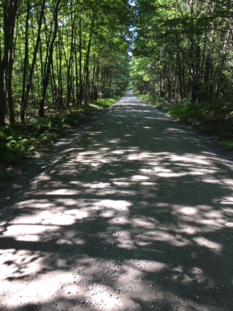
Descending down about a 1/2 mile, I turned right on Mountain Road and then another mile, right on Greenville Turnpike. Greenville goes steeply up for about 1 1/2 miles, then drops down for 2 1/2 miles, just at about where the Rt. 6 climb began. A careful left on Rt. 23, brought me through the Montague, NJ traffic and up past Clove Road. Rt. 23 climbs for about 7 miles, but never really gets too steep. I followed it up to the High Point State Park entrance and hung a left into the park.

IMG_3095

From  there, it’s straight up to the monument. Short, steep climbs on narrow park roads with little to no traffic. I quickly turned around at the monument in an effort to get back to town before the sun went down. The descent is fast and furious, through the park and back down Rt. 23 for a 1/2 mile to a left hand turn on Saw Mill Road. Saw Mill is a road I’ve previously mentioned. The grade is a bit downhill from Rt. 23 and through it’s many twists and turns, it eventually makes it’s way over to Deckertown Turnpike after about 4 miles.IMG_3096

A right on Deckertown and I’m ready to pedal up and down the many little hills that make up this roller coaster stretch of road that leads all the way back to the Milford Bridge. After a half mile on Deckertown, I got up out of the saddle for a push up the hill and pop, my chain breaks. This should normally not be a problem, because I usually have a spare link in my seat pack. Today, I decided to carry a new tool and tube in my back pocket and took my seat pack off the bike, forgetting about the chain link, and as luck would have it, well…………..So, as I walked my bike up the hills and glided down, I called around and thanks to TC of Action Bikes and Outdoor, who dispatched his lovely and pregnant wife Meghan(who was on her way home from work) over to pick me up. I was so grateful as the mosquitoes were eating me alive. A lesson learned in preparedness and for all of the activity trackers, I certainly got my steps in for that day.

What’s Playing: (What am I’m listening to while writing or what’s dancing around in my head while riding) Today –Counting Crows – Rain Kingaugust-and-everything-after-4dcfda1791f21


Memorial Day Rides

Humidity, Humidity! Memorial Day weekend was hot and sticky! Not exactly ideal weather to ride, but I would rather ride than complain about the weather. The sun was out for most of the weekend, so regardless of the humidity, a lot of people were outdoors to kickoff the summer season.

IMG_5969


I led 2 of the 5 rides that went out this weekend. Both were hot and humid, but a few brave souls pedaled on. Dave’s trail ride had great attendance, as did Becky’s beginner road ride on Sunday. Kyle’s MTB ride in Port Jervis went off without a hitch.

All and all, it was a great weekend of events at Action Bikes and Outdoor.TC Crawford, the owner of the shop, really kicked things up a notch this year. The band, Fantasia Project was fantastic and played to enthusiastic fans all day long. The drive in movie, (The Great Outdoors) under the stars was awesome and also well attended.

Here are a few photos from the weekend:


Hopefully, the next ride I post will be the overnight bike packing trip. As long as the rain holds out, one night this week could prove to be my night in the great outdoors!


Group Rides

It’s that time of year. Action Bikes and Outdoor are starting their group rides for the summer season. Officially kicking off this holiday weekend, with their Memorial Day sale and many events:

A 25 mile road ride will depart the shop at 5pm tonight. It will be at a moderate pace (14-16 MPH). No one gets left behind!

IMG_2535

Tomorrow morning, another road ride will depart the shop at 11am. This time, 35 miles, but also at a moderate pace. No one gets left behind!

Tomorrow at 12pm (noon), the shop will be giving a flat tire clinic. Don’t get left out on the road waiting for a ride, because you can’t fix your own flat. This 45 minute clinic will give you the skills and know how to get rolling again.

Tomorrow at 1pm, an 8 mile trail ride will leave the shop and roll through Milford and onto the Mcdade trail and back. All abilities are welcome. No one gets left behind!

IMG_3041

Tomorrow 2-6pm, it’s music time – Fantasia Project will be playing on the patio at Action Bikes and Outdoor.

Tomorrow night, Action Bikes and Outdoor will have a Drive In Movie at sunset. They have secured a radio station for audio and will be showing “The Great Outdoors” (rated PG).

Sunday at 10am – The Frisky Goat Coffeehouse is sponsoring a beginner road ride. This ride will be led by Becky! It will be 12 miles long. All riders and all bikes are welcome. This is the perfect ride to get started this season or try out that new bike! No one gets left behind!

Sunday, also at 10am – There will be a Port Jervis Mountain Bike Ride. Come  check out what all the excitement is about.  If you are a mountain bike rider, you must attend this ride! Meeting at the end of Reservoir Avenue in Port Jervis at 10am. The address is 71 Reservoir Ave. Port Jervis, NY 12771. Once you arrive, bear left on the dirt road for a 1/4 mile. Park in the small parking area on the right hand side.

No excuses, get out and ride!


Bashakill Vinyards – Almost

Sunday was the day, the day we were to ride to the Bashakill Vinyards. We almost made it. Well, there was an incident or should I say, an accident. The ride did start out fairly well. At 31 miles in, things went sour quickly.

First, let me say that we had near perfect weather. 60 degrees and cloudy. Eric, Steve, Deb, TC and myself,  headed out of Action Bikes and Outdoor in the heart of Milford, at just after 10am. We cruised at a moderate pace through Milford Borough, down past the Metz Ice House and over the Milford/Montague Bridge.

IMG_2994

We turned right onto Old Mine Road and rolled through the trafficless, quiet landscape for just about 7 miles. Reaching Dingmans Turnpike, we hung a left and rode up Tuttles Corner Hill. After climbing over to Layton, NJ, we turned left onto Layton Hainsville Road and zipped through the farms and quaint homes to Degroat and across Rt. 206 to Cemetary Road. Cemetary Road becomes New Road and winds through a residental neighborhoood while we save for the impending climb.

07

A right on Deckertown Turnpike and we begin climbing. As soon as you turn, the grade of the road immediately steepens. Up we went for 4 miles until descending sharply to Saw Mill Road. A left and we are pedaling through High point State Park. Saw Mill is a cool roller coaster road that swoops you up and down for 4 miles to the end at Rt. 23. After a left hand turn, we bombed down Rt. 23 for a few miles and into Montague, NJ.  That’s where things went awry.

As we rolled straight through the commercial area of Montague, NJ, where traffic for Rt. 84 was backed up about a half mile, a car made a left, right in front of Deb, causing her to crash into the side of it.

Deb showed incredible bike handling skills to stay upright. She simply ran out of road, before colliding with the vehicle. The NYS State Police, NJ State Police, Montague Fire Department and Blue Ridge Ambulance company all responded to the scene. After a short ride to the hospital and a battery of tests, Deb is home recovering.

IMG_3008

Our ride ended at the accident scene and although we did make it to the winery, we missed Deb and Eric and do not consider the ride complete. A 2nd Bashakill ride is planned for early August and we hope Deb will be fully recovered and ready to ride!


Coffee, Rain & Poison Ivy

On a rather chilly Sunday morning, I met up with Steve and Eric at Dingmans Falls for a 7am ride up and down the Delaware River. We parked right on Rt. 209 at the base of the falls, just passed Rt. 739. From the falls, we headed out north on Rt.209 through the Delaware Water Gap National Recreation Area.

Dingmans_Falls
Dingman Falls

For eight and a half miles, we roller coastered up Rt. 209, past Adams Creek and the Zimmerman Farm. For most of the way, we rode alongside the McDade Trail, just up the hill from the river. We pulled into Milford and hit the Frisky Goat Coffee House (where we should have started) for a chance to warm up, sip a delicious cup of java and take a bathroom brake away from one of Mother Nature’s annoying phenomenoms (more on this later).

IMG_2964

We left town and shot down Rt.209/Rt. 6, a fast, slightly downhill stretch that takes you from Milford, through the box store littered Westfall Township and Matamoras, with little to no traffic at this hour. Over the Bridge, we dropped under the trestle and navigated the city of Port Jervis, NY until we rode over the Neversink River and turned right on River Road and pedaled up past Silver Canoes and up the first hill. River Road has a few short hills but is relatively flat.  About 4 miles in, we noticed an abandoned house in the woods. This seemed like a good time for a photo.

IMG_2960

What I didn’t know was that I leaned my bike, right in the middle of what appeared to be a load of poison ivy. Eric and Steve both pointed out that the recent rain, probably brought about a good share of the dreaded plant. I really had no idea how to spot poison ivy. So, I did a little research to hopefully keep you and me clear of it.

poison_ivy_220x165
Poison Ivy

You’ll notice three pointed leaves that change colors with the seasons:

Reddish in the spring, Green in the summer, Yellow, orange, or red in the fall. On some plants, the leaves have notched edges. On others, the leaves’ edges are smooth. Poison ivy can grow as a bush or vine. You may see the vines climbing up the sides of trees or buildings(Look to the left of my bike, growing up the tree). The plants sometimes have white berries, which help it spread. Birds eat the berries and transplant the seeds on new areas along with their droppings. This may be why poison ivy is so common. Steer clear of this and spend less time itching and more time riding!

From River Road, we turned right on Old Mine Road for a quiet 7 mile roll through the woods, when it started raining. I thought great, no yard work today, but by time we hit the Dingmans Bridge and got back to our cars, the rain stopped and the sun was shining.

With about 32 miles and little to no climbing, this is an intermediate ride that can be done on just about any type of bike.

What’s Playing: (What am I’m listening to while writing or what’s dancing around in my head while riding) Today – ELO – Mr. Blue Sky

6ecaab72cf90147c213df29657f0e9ff-600x602


Morning Gravel AM

After a couple of beautiful days, the rain is headed back. While doing some early morning road rides this week, Eric thought we should get a gravel ride in this morning before Mother Nature exercised her right to spring. With only 2 hours before I had to be at work, we settled on Five Mile Meadow Road and the surrounding trails. As I’ve previously stated, Five Mile Meadow Road, which connects Rt. 739 and Silver Lake Road, is hard packed gravel for about 6.4 miles. We started out on Five Mile, and found our way onto Standing Tall Trail, a snow mobile trail deep in the Delaware State Forest.

image
I didn’t have to ride through, but it was fun!

There is a creek crossing about a mile into the trail, that’s maybe crossable at best. The trail is lined with wire fencing in conjunction with Pennsylvania’s Deer Management Program. Ending at Silver Lake Road, we turned left, followed the broken pavement for a mile, and did the Little Mud Pond gravel horseshoe. Little Mud Pond is a gravel road that’s a little more than a mile through a beautiful lake community that reminds you of an old fishing village.

image

Once out on Silver Lake road again, we pedaled down and hung a left back onto Five Mile Meadow. We went up the first hill, and right onto Bald Hill Road. Bald Hill is a well groomed combination of smooth crushed gravel and dirt. Hunting cabins litter both sides of the road for 2 1/2 miles until it comes to an abrupt end in a dirt circle. Private Property separates Bald Hill from the back of the Dingman Delaware School campus.

image

We zipped back up Bald Hill, right on Five Mile Meadow, and grinded our way back to the deer trail that takes us back around to my house. We were both very content to get a ride in this morning as the rain started to come down, just as we exited the woods. A quick shower and off to work, daydreaming about where to ride this weekend.

What’s Playing: (What am I’m listening to while writing or what’s dancing around in my head while riding) Today – Joe Cocker – When the Night Comes

220px-One_Night_of_Sin


Bashakill Ride – Update

Just a reminder:

The Bashakill Vinyards and Winery ride is still on for Sunday, May 22nd. The time has been changed to 10:00am. We will Depart Action Bikes and Outdoor at 611 Broad St. Milford, PA 18337 and ride a scenic route through Pennsylvania, New Jersey and New York, a total of 50 miles, at a moderate pace.

Muppets-Group-Bicycle-Ride-e1346927325409
Example of how to properly ride in a group

Transportation back to the start will be provided. There are a limited number of spots for bikes going back, so please call the shop and confirm that you are riding. There is no cost for the ride, however, Bashakill’s wine tasting is $4 if they have more than 4 wines available to taste. You do get a cool souvenir wine glass with your tasting. There will be food available for purchase at the winery or your welcome to bring your own.

smIMG_0991

Local musician, Keith Newman will be playing from 2-6pm.

Keith Newman has been playing the Catskills rock circuit since his teenage years, as part of various bands and in collaboration with other local musicians. As a solo vocalist who accompanies himself on six and twelve string guitar and harmonica, he continues to play a wide variety of acoustic music. His repertoire includes covers by artists including the Beatles, Bob Dylan, The Rolling Stones, Grateful Dead, Simon & Garfunkel, Jackson Brown, Neil Young, Cat Stevens, Pink Floyd, The Eagles and more.

Hope to see you there!


24 Hour Solo Bikepacking Trip: part 1

I’ve recently been bitten by the backpacking/bike camping bug. First, I would like to get out, and do a solo 24 hour bike camping trip. I’m thinking that this would be a good reset after a stressful week. Also, flying solo would be a great way to find my strengths and weaknesses on the trail and in the woods. I plan on preparing for as much as possible and packing whatever I think I will need, then adjusting my packing for later trips accordingly.

Living in the Milford area gives me more than a few options. Since I do not intend on making a campfire, my choice of campsites are many. I’ll just pick an area, do a recon ride to scout out a camp site, and map out the route later at home. Now, what to bring?

Fly Creek UL 2 Tent


A list of what to Pack:

Cooking Equipment/Food: Alcohol stove, denatured alcohol, matches, kettle, fork, folding knife, spoon, stainless steel cup, coffee filter, and pour over bracket. As this is only a 1 night trip, I will try to get by with some homemade soup, energy bars, water, coffee, and a PB&J

Clothes/Shoes: 1 set of bib shorts and jersey, 2 pairs of socks, 1 sweatshirt and long tights, gloves, beanie, t-shirt, extra pair of underwear, sneakers, riding shoes, helmet, and sunglasses

Tools: Multi tool, tire lever, mini pump, 2 tubes, patch kit, camera, cell phone

Shelter/Sleeping: 2 man tent, footprint, sleeping bag, inflatable sleeping pad, inflatable pillow, candle lantern

First Aid: Rollup first aid kit, sunscreen, bug spray

I’ll probably ride my Van Dessel WTF. It’s a steel bike that should hold everything fairly well. I will probably pack everything in my Revelate Designs Viscacha seat bag, my Revelate Tangle frame bag, and my Bushwhacker Cody handlebar bag. I’ll carry 2 large water bottles and a 70oz blatter in a backpack.

cropped-img_19077.jpg

Riding directly out of my house and into the Delaware State Forest would be ideal for my 1st solo. However, I think the best way to get it in is to just get it in.

Part 2 will be my assessment of the trip. I’ll post some photos, thoughts, and details. Until then, get outside, ride your bike, paddle your kyack, and read my blog!


A New Discovery – Maybe not that New

Finally, a semi dry day. This morning, the weather forecast called for 42 degrees and cloudy skies, but no rain! After near drought conditions and 3 forest fires nearby, the rain was certainly welcomed, but not 8 straight days of it. Well, with a temporary break in the pattern, an early morning ride was beckoning.

IMG_2875

I hooked up with Eric, and departed Action Bikes and Outdoor at 7:30am. It was a little chilly, but some climbing early on would heat things up a bit. We crossed the Milford Bridge, and darted up Deckertown Turnpike. It was immediately apparent that the past weeks rain turned the brown, dreary landscape into the green, mountainous beauty that makes the tri-state area so desirable. We turned right on New Road before Deckertown really got steep. New Road is slightly downhill for 3 miles. Just before we would have crossed over Rt. 206, we hung a left on Degroat Road for what turned out to be a cool detour.

IMG_2880

We came upon Luna Parc, an artistic wonderland, hidden in the woods. Luna Parc is the home of madcap artist Ricky Boscarino. His largest work in progress is his home and the atelier Luna Parc, which began in 1989. While not open to the public, 3 day open house tours are known to occour.

IMG_2884
Luna Parc

Just up the road, we made a right on Meyers Road. For another mile and a half, we cruised through a quiet, serene setting, before coming to Rt. 206. Turning right, we made 2 quick lefts, and dropped onto Layton Hainsville Road. Making our way into Layton, we passed a few runners and walkers, probably itching to get outside. Another right hander, and we went right through Layton and onto Bevans Road.

IMG_2890

We snaked our way to Peter’s Valley, and took respite at the Peter’s Valley store and gallery. IMG_2888

Up the famed Peter’s Valley climb, we plateaued, and descended down across Rt. 560 and onto Old Mine Road. Apparently, it’s turkey season for the local hunters, as cars were parked all along the roadway. Although pot holed for the last 3 miles, Old Mine Road is fast, and dumps you right at the base of the aforementioned Milford Bridge. Once across, we dropped down passed the Metz Ice house and back up into Milford for a recovery spin back to the shop.

What’s Playing: (What am I’m listening to while writing or what’s dancing around in my head while riding) Today – The Psychedelic Furs – Pretty in Pink (I don’t know why, but probably because of Luna Parc)

talk-talk-talk-5319418f31208 (1)


Rain, Rain go away!

No riding today, it’s raining again. I’m not up for another rain ride. Thursday afternoon, I rode from Dingmans Falls to Bushkill on the McDade Trail. I was not totally prepared for the rain and got soaked. Although wet, it was very meditative as I did not see a soul on the trail. I think my 50 year old body is still drying out.

Green woods on a rainy day

I’m not complaining, as we need the water. With a milder than normal winter, and not much rain so far in the early spring, multipe day forest fires have been popping up all over the Poconos and Catskills. So, with an end to the fires, the below photo is how I’m feeling right now!

15SUBKELLY1-superJumbo
Gene Kelly making the most of the rain!

A quick check of the weather and it’s supposed to rain for the next few days. Ok, enough! Tuesday morning road ride from Action Bikes and Outdoor in Milford 7am, rain or shine.


Sullivan County – Beautiful

There ‘s no other way to describe Sunday’s weather, except stunning, simply stunning! A bright sunny day with flawless blue skies, moderate wind and 52 degrees. An absolute perfect day for a bike ride. Because it was so nice, I had to make sure to get some yard work in as these beautiful spring, weekend days are at a premium. That being said, I woke up extremely early and cleaned out the shed, put out the patio furniture and began my spring assault on the lawn.

Earlier in the week, I pre planned a Sunday ride with a couple of friends. So, I kissed my understanding and awesome wife goodbye and headed out to meet Eric H. and Debbie at Hupka’s Auto Body in Matamoras, PA, just outside Milford.

IMG_2791

We rode out of the auto body shop and onto Mountain Avenue, right on Delaware drive and over the Port Jervis Bridge. A left on Water Street to River Road to Ferry Street and a left on West Main Street. We followed West Main out of the West End neighborhood, across Rt. 97 and onto Rt. 42, passing through Sparrowbush, NY. We followed Rt. 42 for about 11 miles up to Forestburgh Road. Rt. 42 , a well paved road with a five foot shoulder, climbs the whole way. By the time we made the left on Forestburgh Road, we amassed over 1,400 feet of elevation with little respite.

IMG_2769

Forestburgh Road dropped us down to the scenic Mongaup Falls Reservoir, a contributory to the Delaware River, and back up a ridiculously steep hill. Compared to the Poconos, the Catskill Mountains are just that, mountainess. A few more miles and a bit more climbing and the road comes to a split. We veered right onto Leers Road and descended until the road ended. A right on Mohican Lake Road for some more climbing through the town of Highland Lake.

IMG_2770

Mohican Lake Road becomes Highland Lake Road and descends down to the small, quiet town of Eldred, NY. Since, Eldred is our turn around point of sorts, we decided take a lunch break at Peck’s Market (they have a nice covered patio with a pic nic table). This seemed like a great time to tell Eric and Deb that although they said this was their first ride of the year, both of them were riding extremely well. Their winter workouts and diet certainly paid off.

Pedaling out of Eldred, we ascended a very steep Proctor Road (I should have had a lighter lunch before a climb like that). Once we reached the top, we rode the ups and downs for about 8 miles to the Upper Mongaup Road, which rolls for a few more miles where we hung a left on Knight Rd, dropped sharply down and made a left on Rio Dam Road. Rio Dam Road is a twisty ascent before dropping you right onto the Rio Dam, a massive structure that sends water to New York City and electricity to surrounding towns.

IMG_2785
A Photo Op on the Rio Dam. We were really excited to be there!

As soon as we rolled off the dam, we immediately climbed another monster incline. Pedal stroke by pedal stroke, we grinded up the hill, until we summited and turned right on Rt. 42. The climbing was finished for the day, but the thrill was about to begin as we plummeted back down Rt. 42 for about 7 miles. We turned left on Berme Road and rode back through the small, hauntingly desolate town of Sparrowbush.

IMG_2795
Although renovated, one of many vacant shops in Sparrowbush, NY
IMG_2799
Riverside Creamery

Heading out of town, we made a left on Rt. 97 and slithered through the west end of Port Jervis. Just before the bridge, we stopped at the Riverside Creamery for an ice cream cone. The Creamery is located on Water St., right on the Delaware River. An absolute oasis, great food and fantastic ice cream. We crossed the bridge and pedaled along the river, back up Avenue C and onto Mountain Avenue for a short sprint to Hupka’s Auto Body.

I’m not sure what was better, the ride or the incredible weather, maybe both! If you want to challenge yourself, this ride is well worth it. 50+ miles and 4,790 feet of climbing make this ride one of the more rewarding adventures on 2 wheels.

What’s Playing: (What am I’m listening to while writing or what’s dancing around in my head while riding) Today – Prince – Purple Rain

Princepurplerain


Review: Cannondale CAAD 12

Eric reviews the Cannondale CAAD 12:

image764

What to do when the N+1 urge strikes, where N= the number of bikes currently owned.  I don’t just jump in to what I consider a big ticket item until I’m tired of looking through multiple websites, physical examples and talking to people for their opinion.  It was time, time to upgrade my entry-level road bike to something more fitting of the style of riding I’ve grown to love.  My first road bike took me places far and wide; physically, geographically and on several other areas that needed exploring. I really enjoyed that bike, but more so I wanted to go faster, farther and hang with a group of riders I normally only see from a distance, as I tried to hang on to a wheel during the group rides.  That’s what started the process.

I spoke with TC at Action Bikes and Outdoors about the brands they represent in the shop and I also looked at a half dozen other brands that seem to capture what I was after.  TC was in no hurry to put me on a bike that he just wanted to sell, rather he wanted to be sure he understood what I was after, price point, group set upgrade, more aggressive frame posture, a lighter bike, a stiffer and more responsive ride.

IMG_2811


It was time. So after a few days of website scrutiny, reading gear reviews online and in magazines and talking to a few riders I set my sights on the Cannondale CAAD 12, outfitted with Shimano’s proven 105 group set.  The CAAD 12 comes in 7 possible models from the 105 gruppo, up to their top shelf offering the CAAD 12 Black Inc. A few models come fitted with disc brakes, all are made of Cannondale’s superior aluminum tubes , SmartFormed 6069 Alloy, SPEED SAVE, BB30, Di2 Ready with a Speed Save BallisTec full carbon fork collared by a tapered head tube all set in a race geometry that isn’t a torture rack.


The 105 gruppo is at the bottom of the model range but don’t be fooled.  This bike jumps when asked, the BB30 bottom bracket translates a great deal of pedaling effort into forward motion, the frame design, from years of testing and real life application is far more than you would expect.  The 105’s shifting is crisp, dependable and encourages the rider to push faster and further. Cannondale delivers a great package with some finer touches such as Mavic’s Aksium complete wheel set.  The gearing comes in 52/36 up front and an 11 speed 11-28 cassette in an attempt to satisfy a wide audience of riders who want to climb and ride in a pace line. Internal cabling is standard on all CAAD 12 models and ticked off one of the boxes near the top of my demands.  Lastly the color, I have a CAAD X, the cyclocross model in Cannondale’s black and white paint scheme so I was hoping for an option to the primer grey and they delivered.  Team Color has a glossy, slightly metallic black as the base color with a metallic grey on the down tube, seat stays and the underside of the top tube.  Cannondale’s pro peloton racing team’s signature green covers the fork and seat tube along with some branding graphics.

IMG_2809

Lastly, the saddle, a Selle Royal won’t be seen in the professional ranks but I can tell you it’s not a leather clad brick or a couch cushion.  It’s light, flexes and doesn’t seem to need a break in period.

After talking it all over with TC, who seemed ready to ride along with me on the maiden voyage, the bike arrived less than a week later and during that time a few notable publications named this particular CAAD 12 105 the 2016 Bike of the Year. Now I feel pretty smart riding this bike around and look forward to years of enjoyment and keeping up during the group rides.


I Love New York-Point Peter

A few mornings ago, I was driving on Rt. 84, and got off on the Port Jervis exit. I noticed the I Love New York circular heliport looking artwork in the grass on the side of the highway. As I have passed this a bunch of times, I’ve often remembered the I Love New York TV commercials from the 1970’s. This got me thinking (I know that’s dangerous).

After my appointment, I would drive back to Milford, get on my bike, ride through Montague, NJ, onto the highway, and take a picture with my bike, on the I Love NY sign. As luck would have it, Eric called, wanting to ride. So we met at Action Bikes and Outdoor, and off we went.IMG_2753

We left the shop, traversed Milford, and made our way over the Milford Bridge. We rode up Deckertown Turnpike, made a left onto New Road, and rode over to Clove Road. Turning right on Clove, we roller coastered for about 4.5 miles to Montague, and hung a left on Rt. 23. A mile down the road, we rode on the exit ramp against traffic to get up to the highway. After taking a few photos, I realized that this was a remarkably stupid idea. Not very well thought out. Will never do it again!

From there, we pedaled through the city of Port Jervis and up Rt. 97, made a right on Skyline Drive, and began the climb up to Point Peter. Skyline Drive is a steep climb for about 2.5 miles. Switchback after switchback, we kept ascending until we capped the mountain, and rode back down the other side for about a half mile to Point Peter.

IMG_2756
The Port Jervis Bridge from Point Peter

Point Peter offers incredible panoramic views of Port Jervis, Matamoras, the Delaware River, and the High Point monument in New Jersey. After a few photos, we carefully slipped back down Skyline Drive. If you ever want to feel like the road was built especially for you, ride down Skyline Drive sometime. You’ll want to to ride back up just to descend it again!

IMG_2759
American & P.O.W. Flags atop Point Peter

Hang a right on Rt. 97, a mile later  make a sharp left on Sleepy Hollow Road for a recovery spin along the river and through the west end of Port Jervis. A right on Ferry Street and a quick left on River Road, along the Port Jervis Fitness Path, and back on the the Bridge. Once back in Pennsylvania, we hung a right off the bridge onto Delaware Drive, for a spin on the other side of the river.

IMG_2760
Eric hammers on the the fitness path

A left on Avenue C and over to Mountain Avenue, to avoid Matamoras, and a right hand turn on Rt. 209/Rt. 6. Navigating a busy shopping district, we slid through and made our way back to Milford. Although the ride began very recklessly, the ride up and down Point Peter and the ride through west end made for a fantastic ride on a beautiful day!

What’s Playing: (What am I’m listening to while writing or what’s dancing around in my head while riding) Today –Harry Chapin – Greatest Stories Live71jJCu8fbZL._SX425_

Bashakill Vinyards and Winery Ride

On Sunday, May 22, 2016, we will be riding from Action Bikes and Outdoor in Milford to the Bashakill Vinyards and Winery in Wurtsboro, NY. We will leave the shop at 9:00am. The route will be about 50 miles. Transportation back to Milford will be provided (spouses and friends are welcome to meet us there to help with transports). Please call the shop ahead of time or leave a comment here if you intend on riding with us, so we can have enough transportation.

3ab138e292c81d77
Open Sundays too!

Bashakill is an organic winery that produces about 1200 cases a year. The tasting room is a rustic room attached to the side of the garage. There is no charge to taste four of their wines. If they have more than 4 wines available there is a $4 tasting fee, which includes a souvenir glass. They sell by the glass or you can buy a bottle and share it amongst friends. Feel free to bring your own cheese and crackers or a lunch where you can eat on the outside seating area. glass_closeup_web

The have live music on Saturdays and Sundays. They haven’t posted who’s playing on May 22 yet, but they usually have first class entertainment.

New To The Winery
In 2011, they built the BashaKill Wine Cave! They cut into the mountain and poured a 67-yard concrete cave, which is 40 feet deep and 16 feet wide. Being under ground creates a constant temperature with high humidity. This provides the perfect environment for aging their red wines. They usually give tours of the cave periodically during the day.

cave_web
Bashakill Vinyards Wine Cave

So come enjoy a challenging ride with us from Milford to Wurtsboro. It is a no drop ride, so everyone will arrive together. We will pedal through the beautiful tri state area, chow on homemade food, listen to good music and taste some of the finest wines in the Catskills.


Review: Kona Rove Ti

In an attempt to add more content, I’ve decided to do a few reviews. Not to bore you, but to get you and me excited about cycling again as the spring unfolds and summer quickly approaches.

During the winter, I picked up a 2016 Kona Rove Ti Frame. Kona sells the Rove, which is their do all cross and gravel bike, in Aluminum, Steel and Titanium. At this time, the Ti Rove is only available as a frame. With that in mind, I conferred with TC at Action Bikes and Outdoor as to how to properly spec this bike for some on road/off road adventures.

download (1)  1

First, the frame (3AL/2.5V titanium) is made in Tennessee by Lynskey, one of the premiere builders of titanium bikes. I decided to pair it with a Kona Project 2 carbon fork, allowing the frame and fork to take up to a 50mm tire for a super plush ride over the rough stuff. Next, I wanted to use road bike gearing as I will be doing a lot of mixed bag type of rides that will take me on and off road. Specs are as follows: Sram Force carbon crankset, Sram GXP bottom bracket, Sram Rival shifters, Sram Rival derailleurs, Sram 1170 11X32 cassette, Bontrager Affinity Elite tubeless ready disc wheelset, Thomson Elite seatpost and stem, Chris King headset, Shimano mechanical disc brakes, Arundel stainless cages, Shimano Pro saddle and a Salsa Cowchipper handlebar and WTB Nano 40mm tires round it all out.IMG_2605

After about 300 miles of winter and spring riding through gravel, singletrack, grass, pavement, dirt and mud, I can honestly say that the Rove has performed flawlessly. At just about 20lbs with pedals, it flies out of corners and is light enough to climb any hill(especially with the 11-32 cassette). With the Cowchipper bars and tubeless tire setup, it’s as stable as any bike I’ve ridden. And least I say, the ride quality of Ti is incredible!The Kona Rove Ti is the kind of bike you fall in love with for its beauty and ride quality then forge a life-long bond with after epic adventures.IMG_2606

2 Rides, Lot’s of Fun & Adventure

Now that the weather seems to have turned for the better, it’s time to hit the road and get some quality miles in. With temperatures in the 70’s and 80’s this weekend, I had to find time to put tires on blacktop.

Riding out of town is always pretty this time of year. Before the trees become green, an array of flowers are in bloom and many store fronts and homes display just enough to get you really excited for the spring and summer seasons.

IMG_2722
A few sights from Milford including the old Milford Theater(home of the Black Bear Film Festival) and the Dimmick Inn

I rode with John on Sunday from Layton Hainesville Road on the New Jersey side. After an easy spin at conversational pace, we traveled through Layton and over to Peter’s Valley. We hung a left on the Walpack Road and went past the Walpack Inn and around the Walpack loop. The loop is about 12 miles. A roller coaster type road that winds you in and around the National Forest, providing scenic views of the Flatbrook Creek.

IMG_2703
John hammering it over the Walpack Loop on his new Trek Emonda

We re-traced the route back to Layton Hainsville Road and back to Milford. On the way back, a black pickup truck with what appeared to be an intoxicated driver, decided it was not willing to share the road. After a few swerves and short stops, the driver sped away and probably figured that it was better to get back to the bar.

IMG_2704

All and all, a really nice ride on what turned out to be the warmest day of the year, so far. It felt good to finally ride in shorts and short sleeves.

Today, I rode with TC and Eric from Action Bikes and Outdoor. We left the shop at about 7:30am on a crisp, slightly windy April morning. The sun was shining and the birds were chirping. You couldn’t ask for more. After a slow cruise through Milford’s side streets, we dropped down past the Metz Icehouse and up to Rt. 209 and over the Milford Bridge.

2848_Pa520701MilfordLowerMill4rtk110910
Metz Icehouse

We climbed up Deckertown Turnpike, across Rt. 206 and made a right on New Road. We followed New Road into Cemetery Road and crossed over Rt. 206 again and made a left on Layton Hainesville Road. Riding with TC and Eric, I knew the pace would be fast. I grabbed onto a wheel and hung on through Layton and chased them over to Peter’s Valley, a scenic artists colony that’s home to a popular climb among local cyclist.

IMG_2707

Pedaling up the back of Old Mine Road(the Peter’s Valley Climb), I took up my usual position behind TC and Eric, spinning at a brisk pace up the steep 1st few hundred feet. As the hill crests, the grade becomes much more manageable. It’s one of those climbs that you have to really push up the 1st part, to enjoy an easy spin for the rest of the hill. Coming over the top, you shoot straight down hill for a little over a mile and cross over Rt. 560.

IMG_2712

Old Mine Road is a quiet country road that spans from the Dingmans Bridge to the Milford Bridge on the New Jersey side of the Delaware River. On nice days, you will see scores of cyclists and runners enjoying the serene surroundings. A quick trip back over the Milford bridge and into Milford for some well deserved coffee. Quick tip. Get out early if you can, before the weather has a chance to turn on you.

What’s Playing: (What am I’m listening to while writing or what’s dancing around in my head while riding) Today – Creedence Clearwater Revival – Have You Ever Seen the Rain.

download


Greenville Turnpike & 3 States

Everything you wanted to know about the wind but were afraid to ask. Yeah, it was windy today! Did I say it was windy? It was windy!

Having an opportunity to get out and squeeze a ride in on what appeared to be a beautifully sunny day, I met up with Steve at Action Bikes and Outdoor in the heart of Milford. On a whim, we decided on a ride around the Delaware Valley and a climb up Greenville Turnpike.

IMG_2609
Port Jervis/Matamoras Bridge

Leaving the shop, we headed east on Rt. 209/Rt 6. Although flat and fast, we had to deal with a lot of evening traffic, oh and did I say, wind? Just as we crossed Rt. 84, we turned left onto Mountain Avenue to avoid busy Matamoras. Turning right on Delaware Drive, we approached the Port Jervis/Matamoras Bridge and I couldn’t help but think that as we ride through this area on a daily basis, it’s real easy to take for granted the scenery that is all around us. A perfect example was the ride over the bridge and the view of the incredibly serene Delaware River.

IMG_2612

Pushing through the wind, we made our way through the streets of the old, up and coming small city of Port Jervis, NY. (The once rundown, river city is making a comeback with scores of new businesses and great restaurants). Going under the overpass and up Pike Street, we made a right on E. Main Street and pedaled over the Neversink River Bridge and into Montague, NJ.

850px-Port_Jervis,_NY_crop

We hung a left on Greenville Turnpike, got out of traffic, back into New York and started to climb. At a little over 3 miles, Greenville Turnpike starts out a mere gradual uphill for the 1st 1.25 miles. As it bears right, the road inclines sharply and continues to climb for about 2 more miles, passing some hillside homes and a parking area for the trailhead to the Shawangunk Trail in the Huckleberry Ridge State Forest, before dropping back down to where we made a left on Old Mountain Road. Old Mountain Road is carved into the side of the mountain, providing a road surface that is smooth but slanted down to the low side.

IMG_2617


Old Mountain Road drops down to a sudden stop at Rt. 6 in Greenville in front of the Firehouse Deli. A steep, half mile climb awaits as we turn left on Rt. 6. For some reason, the climb seems fast(just one of those roads that feels like your going faster than you should). As we capped the summit, I zipped up and pulled my gloves on and prepared for the long, descent. Did I say it was windy? It felt like the wind was actually pushing us back uphill. Rt. 6 drops through Deerpark, NY for 3.5 miles to the border of Montague and Port Jervis. Pedaling back through Port Jervis, E. Main Street eventually rolls right into Rt. 97. We climbed up to the Main Street overlook and were treated to an excellent view of the city.

IMG_2620

Descending Rt. 97 to Sleepy Hollow Road, we winded through the quiet West End Neighborhood of Port Jervis and back to the bridge and across to Matamoras. As we traveled through Matamoras and into Milford, we were hit hard by the wind. For 5 plus miles, we crawled back to Action Bikes and Outdoors, happy to have gotten it in.

What’s Playing: (What am I’m listening to while writing or what’s dancing around in my head while riding) Today –Genesis – Abacab

genesis-signed-abacab-lp-record-album-phil-collins-tony-banks-mike-rutherford-autograph-3


Cummins Hill Climb

Last evening, I had a chance to get a quick ride in before dark. Not only was it the end of the day, it was also the last chance to get a ride in before unseasonably cold tempatures and snow set in for the next few days. I met up with Mike at Action Bikes and Outdoor at 6pm. Having only about 1.5 hours of light, we decided to hit a short but tough loop that’s known in the area as Cummins Hill.

IMG_2535
Action Bikes and Outdoor & the Frisky Goat Coffee House 611 Broad Street Milford, PA 18337

Leaving the shop, we headed north on Rt. 209/Rt. 6, towards Port Jervis, NY. With alot of traffic at that time of day, we made sure we had our blinkies on to alert cars that we were on the side of the roadway. Rt. 209/Rt. 6 is fast and flat all the way into Matamoras. Passing the box stores and Rt. 84, we went under the overpass and made a left on Mountain Avenue, just before the Firehouse. The scenery immediatley turns from, cars, noise and traffic to quiet, desolate and peaceful. Mountain Avenue is a nice way to connect Rt. 209/Rt.6 with the Delaware River without having to ride through Matamoras (where there is no room for bikes on Pennsylvannia Avenue).

IMG_2521
Delaware Drive

Mountain Avenue winds through some residential areas and comes to an end at Delaware Drive. Making a left on Delaware Drive, we enjoyed a few miles of riding along the Delaware River. With the recent rains, the river was flowing quite quickly, creating a relaxing sound as we approached the climbs.  Right at the end of Delaware Drive, along the river are boat launches for the three major river trip companies in the area.

IMG_2525
View from the Descent into Millrift

Just as Delaware Drive turns into Bluestone Blvd. the road immediately pitches up and the fun starts. Passing a few farms and cool rustic homes, the road climbs up for a few miles before descending down into Millrift, PA. With not much there, except for a bunch of neatly situated, pretty country homes, Millrift gives you some awesome scenery and a chance to refresh your legs before the real climbing begins.

IMG_2526

IMG_2528

In Millrift, Bluestone Blvd. becomes Cummins Hill Road. Cummins Hill ascends for about 4 miles. With little respite, the road twist and turns and snakes through the woods, but never stops going up. The slow pace allows you some breathtaking views. Approaching the top, the road turns right and steepens, taking the last bit of strength that I had in my legs.

IMG_2530

The descent is steep and technical. The low light made it an adventure. Mike seemed to rip right down, while I took my time around the turns and made sure that I would need a new set of brake pads soon. Cummins Hill Road dumps you back on Rt.209/Rt.6. Making a right, we cooled down with a nice cruise aroung Old Milford Road and and back into town.

Screenshot (10)
Strava map

What’s Playing: (What am I’m listening to while writing or what’s dancing around in my head while riding) Today – The Fabulous Thunderbirds – Tuff Enuff

R-2191860-1371934902-5367.jpeg


Pedaling Through the Promised Land

Before long, I’ll be writing about long, somewhat fast road rides. But for now, the winter that never was, continues to linger. As long as it does, shorter, slower rides through the Pennsylvania landscape rule the day.

Located 17 miles west of Milford in Greentown, PA is Promised Land State Park. About 3,000 acres in size, Promised Land State Park is on the Pocono Plateau, 1,800 feet above sea level, and is surrounded by 12,464 acres of Pennsylvania’s Delaware State Forest, including natural areas. Visitors enjoy fishing and boating in two lakes, rustic cabins, camping, miles of biking and hiking trails, and exploring the forests.The forests of the park consist primarily of beech, oak, maple, and hemlock trees. Two lakes and several small streams add to the park’s outstanding scenic beauty.

IMG_2449

I parked in the main parking area at the DCNR Park Office. Steve, at the counter, was very helpful; he pointed me in the right direction, and handed me some maps of the park. Once outside and on my bike, I headed out to Rhododendron Trail. A rather flat but bumpy trail, Rhododendron Trail is a nice way to ease into the trail system. After about 1.5 miles, the trail turned to gravel, and winded through a small village of cabins along the main lake. It ended at the tip of the lake. Crossing the road and onto the tow path, puts you over the wooden bridge and along a gravel path, just above the beach.

IMG_2488

After cruising along the lake and through a few campsites, I came to Tower Trail. A technical, rocky sort of single-track, Tower Trail climbed up a few small hills, and dumped me into a dried up creek bed, before climbing back up and onto Cross Cut Trail. Like Tower Trail, Crosscut Trail is a technical trail that would have been better suited with a mountain bike. Today, I rode my Van Dessel, Whiskey Tango Foxtrot. A steel 700c monster cross bike with 29X2.1 tires, she goes almost anywhere. Still, a MTB with at least front suspension would have handled the terrain a lot better.

IMG_2493

After navigating a section of woods, I found the Boundry Trail. A much more subtle trail, Boundry starts at the north shore of the big lake, and winds through the forest to the southern end of the lower laker, before putting you right back on Tower Trail.

IMG_2502

After a few more miles, I was back at the main parking area. Although windy and 45 degrees, the sun was shining, and the bare trees gave me an awesome view of both lakes from various parts of the trail. Getting in the car and driving a few miles to a place so serene and beautiful is more than worth it. Promised Land State Park will certainly feel my bike roll over it’s trails more than a few times this summer.

What’s Playing: (What am I’m listening to while writing or what’s dancing around in my head while riding) Today – Golden Earring – Cut.

51Y9HUvLhdL

Daylight Savings Time=Fun

Since moving the clocks ahead on Sunday Morning, I have been unable figure out what and where I want to ride. The when is all taken care of. The when is as soon as I leave work. With about 2 1/2 hours of daylight left when I leave the office at 5pm, I could do a road ride from work or a multitude of gravel and dirt rides from Dingmans Ferry or Milford. Today, I chose a dirt/gravel and road ride with Steve. We decided to hit the trails and gravel roads off of Old Mine Road.

IMG_2381

You can get to Old Mine Road from either Dingmans Ferry or from Milford. I prefer to leave from Milford. Leaving from Action Bike and Outdoor in the Heart of Milford, head out to the Milford Bridge. Once over the bridge, on the New Jersey side, hang a right onto Old Mine Road. Travel about 6 1/2 miles and make a right onto Mettler Road. Mettler is a loosely packed gravel road. When you get to the river, turn right onto Van Auken Road and thats where the fun starts. Van Auken is a mix of loose gravel and dirt, that quietly takes you into a trail after about a mile.

IMG_2388

The trail winds through a couple of campgrounds along the Delaware river and treats you to some beautiful views of the river and the Delaware Valley. Your probably ok here with a hybrid, cyclocross or mountain bike. There might be a bit too much rocks and roots for a road bike, though. However, I did go over the bars and into the mud after hitting a large root in the trail. Didn’t feel good at first, but I was lucky enough to pedal out of the woods. The singletrack does wind along the ledge as you climb out of the woods and make a left back onto Old Mine Road. After a half mile, you turn right and climb Jagger Hill.

IMG_2383


A little over a mile of climbing and you come to the top right at the Upper Ridge Road Trailhead. Thats where the climbing continues. Another 3/4 of a mile up in the loosest gravel, dirt and sand you could imagine. Alot of sand on that side of Old Mine, but a really nice section of trail with alot of up and a whole lotta downs!

IMG_2400

The trail comes out on Rt. 560 in Layton, NJ. You have a few choices to get back to Milford. Old Mine Road, Rt. 209 (on the other side of the Dingmans Bridge) or the McDade Trail. This ride is another example of all the terrain that can be ridden in and out of milford.

What’s Playing: (What am I’m listening to while writing or what’s dancing around in my head while riding) Today – Aretha Franklin  – Who’s Zoomin Who

511VR8V76DL


Farms, Barns & Bikes

Although I have been riding a few times a week throughout the winter, I’m hesitant to bore you with the same old rides, as getting out the back door is pretty convenient this time of year. With an early spring like day, I decided to head out right after work, and meet Steve at Dingmans Falls for a quick jaunt through Northern New Jersey. A 4:30pm start gave us just about enough daylight for a nice loop through Sussex County.

IMG_2328

We headed out of Dingmans Falls and over the Delaware River via the Dingmans Bridge (that awesome wooden bridge, where the toll taker stands in the middle). We turned right on Old Mine Road, and immediately climbed up and over into Peter’s Valley (an Artist’s Colony tucked into the woods). At the bottom, we swung a sharp left onto Bevans Road, an old country lane, dotted with farms, separating Peter’s Valley and Layton, NJ.

IMG_2334
Peter’s Valley Climb

Turning left on Layton Hainsville Road, we cruised passed more farms and a few old houses of worship. Layton Hainsville is a roller coaster that twists and turns for a few miles until crossing over Rt. 206 onto Cemetery Road. Cemetery Road goes right through the heart of one of the largest organic farms in the area, and turns into New Road. New Road is as flat as it gets in the Tri State area, crossing over Deckertown Turnpike and dropping us onto Clove Road. Heading back to Deckertown, a right hand turn dumped us down a steep hill at the foot of the Milford Bridge.

IMG_2340
A little Sussex County History

Turning left on Old Mine Road, we went 7 miles along the Delaware River on one of the most scenic roads in the area. Old Mine is pot hole city for about 4 miles, but you hardly notice it as your eyes are fixated on old barns, trails, vistas, and an array of wild animals (White Tail Deer, Coyote, Black Bear, Red Fox, among others). There are a host of trail networks on either side of Old Mine Road. Just veer off, and explore. You won’t be sorry.

IMG_2343
Old Mine Road Facts and Fables

Turning right from Old Mine Road onto Rt. 560, and heading back over the Dingman Bridge to Pennsylvania, we just about had enough light to make it back to our cars.

If you want to do a road ride that is scenic and quiet (not a lot of traffic!), head down to Dingmans Falls. It only 8 miles from Milford on Rt. 209 in the National Park System.

Screenshot (9)


Navigating the High Country

Another warm February day! 50 degrees and sunny! You couldn’t ask for more! While checking out this weekends weather, and since the roads are still covered in way too much salt, I decided to venture out and try a ride pretty far off the beaten path: the climb up the High Knob to the fire tower.

bo 5

I met up with Will at the Maple Run parking area on Rt. 402 in Blooming Grove Township. We turned right out of the parking area onto Rt. 402, and after a mile, we hung a left, hit the gravel, and immediately started to climb. The High Knob Road is a loose gravel surface, making it almost impossible to get out of the saddle on the way up. The road winds its way skyward for about 1.75 miles, and just as you think you’re at the top, the grade steepens sharply. Another quarter mile, and finally I can breathe.

bo

bo 3
Fire Tower and Cell Towers atop the High Knob

At 2100 feet, the High Knob is the highest elevation in Pike County. The view is pretty darn good too! Now, time to descend through the loose stuff. The ride down was fantastic! A nice reward for a tough climb. At the bottom, we beared right onto Hobday Road, a more packed down gravel surface made for a smoother ride. After a few miles, Hobday turned into High Line Road. High Line is a road that seems to literally pull you as you swoop up and down, and twist and turn through the Pennsylvania State Forest.

bo 4

As we came to a 3 way intersection of gravel roads, we were met with a funky sign post, pointing you in the direction towards any one of the many hunting cabins that litter the State Forest. Intrestingly enough, DCNR has put in dozens of camping areas throughout the state forest, complete with fire rings and picnic tables.

We made a right on Hay Road, and followed it for about 1.5 miles through logging country. As the road went from hard packed gravel to 4-5 inch rip rap, we turned around and headed back to the intersection, where we took Pine Flats Road. We came to a creek that, aided by the recent rains, overtook the road. After a few more miles, we made a left on Rt. 402, and climbed our way back to the parking area. We talked of ways to connect this route to a few other gravel roads, making for a 50-70 mile ride on mostly gravel.

Screenshot (7)


Sunrise Trails

Well, winter is finally here. With a couple of moderate snowfalls and a weekend of sub zero temperatures, I think it’s safe to say that it’s winter, even if it did not rear its ugly head until mid-February! Since, my Van Dessel WTF is back in service, I was itching to get out and see what it felt like with 29×2.1 tires. I decided to leave right from my house in Conashaugh Lakes, and ride up to a short deer trail that connects the community with Five Mile Meadow Road.

IMG_2209

It was about 25 degrees and cloudy at noon, and there was a bit of wind. I turned right onto Five Mile, and followed it up and down until I crossed Rt. 739. There is a parking area at 739 with a trail that snakes around it to avoid a locked gate when it’s not hunting season. A gravel jeep road drops down for about 1 1/2 miles, and ends at the edge of Rt. 84. A right takes you into a nice network of trails that is easily rideable on a mtb, cyclocross, or gravel bike.

IMG_2210

The first descent was pretty cool, down a grassy hill with what seemed like roadway rumple strips. After a quick hike a bike across a half -frozen creek, I was back on the trail, and climbing a somewhat steep hill that put me at a spot overlooking 2 creeks coming together. I had to stop for lunch here as it seemed about the flattest spot on the trail.

IMG_2211
Seemed like a good lunch stop

After lunch, I descended down a short rocky section, and was met with some pretty nice single track that swooped and swirled all around what I believe is PA State Gameland, tucked in behind the Sunrise Lakes and Lake Adventure communities. The only downside was the ice that seemed to freeze over low lying sections of the trail. After hitting about 5.5 miles of the trail, I was back on the jeep road and headed back as the cold was penatrating my shoes.

I will explore these trails more as the spring warms things up a bit. An intermediate ride on a trail that begs to be ridden. It’s a secret paradise for mountain bikers and adventure seekers!

IMG_2212


Old Mine, Buttermilk Falls, Walpack & Peter’s Valley

Super Bowl Sunday! So why can’t I just sit on the couch, watch the pre game chatter, and eat everything in sight? A look at the upcoming week’s weather, and I had to get one more ride in before Mother Nature shows us what winter really feels like. The plan was a McDade Trail ride, but Kyle suggested an alternate route that turned out to be a pleasant surprise.

IMG_3634

I met up with Eric and Kyle at Dingman Falls at around 10:30am. At 35 deegrees and sunny, it was perfect weather for a gravel ride. We headed out over the Dingman Bridge and into New Jersey. As described in an earlier post, the Dingman Bridge is a wooden surface bridge. A person stands in the middle, and collects a $1 toll from each passing vehicle. From the bridge, we made the first right onto Old Mine Road and up the Peter’s Valley climb. At the top, a right hand turn puts you on old Old Mine Road, a hard packed gravel road that has seen better days. For 6 miles, you slither down, scoping out dilapidated barns and farmlife from another era.

IMG_2167

Old Mine dumps you onto the Walpack Loop. Making a right, we climbed a bit, came to the fork in the road, and hung a hard right. Going up and over the top, we descended down to the beginning and off to the next off road section. A left hand turn put us on Mountain Road. A mix of dirt, gravel and sand, Mountain Road still had plenty of ice from last weeks snow storm. After about 2 miles, we were treated to an awesome sight, “Buttermilk Falls”.

IMG_2154
Buttermilk Falls

Buttermilk Falls (in the Delaware Water Gap) is a picturesque waterfall right by the road. It cascades spectacularly, 90 feet down the red shale face off the Kittatinny Ridge. It is the only waterfall in New Jersey, apart from Great Falls, with a developed viewing area: the National Park Service has erected an interpretive display and built a wooden walkway to the topnot a bad place to be on a February afternoon. Mountain Road took us through a series of bridges with locked gates across the road.

IMG_2149

Mountain Road came out onto Walpack Road just behind the Peter’s Valley Cemetery. As we came back to Peter’s Valley, we turned left onto Kuhn Road and followed it up to old Old Mine and took a a right. Back on gravel for about 2 more miles, Old Mine came back out on the top of the Peter’s Valley climb. We flew down to Rt. 560, and took another left back over the Dingman Bridge. Cruising back to the Dingman Falls parking area, instead of being happy with this ride, I was contemplating how I could connect this over to Van Ness or the McDade Trail to extend what was already a fantastic ride! 21 miles and 1,500 feet of elevation make this doable for almost anyone looking for a scenic ride.

Screenshot (2)

GUYMARD TURNPIKE

With the warm weather holding out for a few more days, today presented us with a golden opportunity to ride one of my favorite routes, Guymard Turnpike. A road ride, Guymard is on the New York side and we would have to navigate some traffic to get across the bridge.

I met up with Eric and Mike at Action Bikes and Outdoor (the premeiere bicycle and outdoor store in the tri state area), right in the heart of town. We headed out north on Rt. 209 and dodged some midday traffic, enabling us to make our way over the Port Jervis Bridge.

IMG_2119

Going under the train  tressel, we hung a left on Pike Street and weaved our way through the City of Port Jervis and over to Rt. 209, a secondary highway that connects Port Jervis with eastern Orange County, NY. Passing the Horse farm by Neversink Drive, we continued on Rt. 209 another few miles and turned right on Guymard Turnpike.

IMG_2122
Eric’s very pink socks

Guymard is a quiet back country road. It runs from 209 over to Old Mountain Road. Starting out, Guymard is a false flat for about a mile as it passes the KOA Camp Ground and goes over the bridge turning right and bears left. As it bears left, the hill steepens and twist and turns for 2+ miles. As you cap the hill and head down the backside, you are treated to a spectacular view of the Shawangunk Mountain range.

IMG_2123
Beautiful man made lake, halfway up Guymard Turnpike

After a short descent, we turned right on Old Mountain Road. Old Mountain is another secondary road with not much traffic, but the cars do move pretty fast. Old Mountain Road is a true blacktop rollercoaster. Momentum carries you over hill after hill until you reach Rt. 6, where the steepest part of the ride begins. Turning right on Rt. 6, you are immediately hit with a half mile of uphill pedaling. With our already tired legs, we capped the hill and enjoyed a 3 and 1/2 mile descent, dropping us right at the border of Montague, NJ and Port Jervis, NY.

IMG_2127

Turning right into Port Jervis and Left onto River Road and back into Montague, we made our way toward the Milford Bridge. River Road is another rollercoaster, stretching 6 miles through farmland. It ends right at the intersection of Deckertown Turnpike, Rt. 206, Old Mine Road and the Milford Bridge. The bridge, as I’ve written previously, has a steel bike path 5 feet lower than the vehicle lanes, passing over the Delaware River. Once back in Milford, we relaxed and enjoyed some java at the Frisky Goat Cafe. With 35+ miles and 2,388 feet of elevation, this ride is challenging enough for the fittest riders and scenic enough for the most casual riders.

Screenshot (1)

Snow, Sun and Fun!

Another beautifully warm winter day. 50 degrees on January 31st. With Last weekend’s snowfall of about 8 inches and temperatures hovering just above freezing all week, it was time to explore the back roads and see how much riding we could get in.

IMG_2109

I met up with Eric at the parking area on Rt. 739, adjacent to Five Mile Meadow Road. We began with a short climb up Five Mile, which was covered in a mix of snow and ice. It was a difficult climb as we could not seem to get any traction. Between the thaw and the pack down caused by passing pickup trucks, the road was extremely slippery on the ascent and an adventure to say the least on the following descent. Deciding to try another path, we hung a right onto Standing Stone Trail, which is a crushed gravel road, primarily used as a snowmobile trail. Covered in snow, with what looked like the tracks from a snowmobile, Standing Stone Trail was a much more viable option.

IMG_2115

The untouched snow, about 4 inches deep on either side of the snowmobile tracks was a pleasure to plow through. Standing Stone twists and turns with little incline, all the way to Silver Lake Road. We turned right and rode the pavement to Rt. 402. Recent construction has turned Rt.402 from a pothole filled back road into a nicely paved thoroughfare with enough shoulder to ride safely along.

IMG_2094

We made yet another right onto Hemlock Farms Road. From Rt. 402, Hemlock Farms Road climbs for about 3 miles, before offering up a steep descent down towards the golf course. Eric lead the way as we weaved through the golf course, past a cool dock that went out over a lake that made for a nice photo opportunity. As we made our way towards the exit gate of this picturesque country community, we were treated to the sight of more than a few beautiful stone and wood homes, that sit quietly in the Pennsylvania forest.

IMG_2103

We rode out of Hemlock Farms onto Rt. 739 and after another mile, we were back at the parking area. Bottom line…… Do not let the winter keep you inside. whether it’s 20 degrees or 50 degrees, find a way to get outside!


Exploring: off the beaten path

2016 is under way! Now that the winter weather is here, it’s time to layer up and head out in to the cold and enjoy every opportunity to ride, before the snow arrives. This weekend, I decided to take 2 days to explore the old Boy Scout camp that sits just off Five Mile Meadow and across from Saw Creek Road as well as some gravel off shoot roads that were begging me check them out. On Saturday I headed straight out of my house, riding about a mile of pavement, hooked left on to a deer trail and on to Five Mile Meadow Road. About a half mile up and right in to the Boy Scout Camp.

IMG_2033

As I’ve described in a previous post, Five Mile Meadow Road is a crushed gravel road. The path to the Boy Scout camp is a grassy jeep trail. I winded up the trail passed a couple of dilapidated buildings and as I turned the corner past the rustic old cabin, I saw what appeared to be someone sitting on the porch. As I spun around, I noticed camoflouge and a compound bow. “Just glad it was a hunter and not one of the Boy Scouts from 60 years ago”.

IMG_2037

Not wanting to screw up the hunt, I headed out of the camp and on to Saw Creek Road. Another crushed gravel road that spans about 5 miles out to Silver Lake Road. I headed back early, knowing Sunday was going to be a little warmer. I hooked up with Will on Sunday and went right back to the Boy Scout camp. Below the area where I spotted the hunter, a trail led down to a serene lake, surrounded by tall pine trees.

IMG_2045
Rock Hill Pond

We rode up a steep hill and back out of the camp and across to Saw Creek Road. We crossed over a creek that runs right through the road, having to hop off the bikes for just a moment. Riding out to Silver Lake Road, we hung a left then left on to an off shoot gravel road. After a few feet, the gravel tuned to 6-8″ rip rap stone. For 2 miles, we rode over what seemed like a tough trail for even a truck.

Getting back on Five Mile Meadow Road, we ventured over to Bald Hill Road. Bald Hill is a nice mix of dirt and gravel. It drops for about 3 miles and ends. We headed back home before light became a problem.

IMG_2036

Bottom line: If your looking for a nice, quiet off the beaten path ride, you can find miles and miles of gravel, dirt and grass right in our backyard.


Gravel, Dirt & Blacktop (Ride Everything)

60F on December 13th! I could end this post here, that’s how nice of a day it was, but I won’t. If I did, I would not be able to share today’s fun ride on a mixed bag of terrain. Will, Eric, and I rode out of Action Bikes and Outdoor in Milford a little after noon. I over dressed, again (the only one not in shorts). We headed out to Milford Road, and climbed up to Conashaugh Road. With the pavement behind us, we rode the trail on Long Meadow Road and onto Zimmerman Road. Zimmerman is a mix of gravel and dirt, and leads right into the old Zimmerman Farm. It was the home of noted artist Marie Zimmerman (1879-1972). It was added to the National Registry of Historic Places in 1979.

IMG_1983
This late in the fall, the leaves cover the trail

At the farm, we ran into Norman and Jamie. They were having a lot of fun on their awesome Fat Bikes. Zimmerman Road dumps you onto Rt. 209 for about 200 feet, then back up Zimmerman Road and into the Delaware Water Gap National Recreation Area.

IMG_1987
A Barn on Zimmerman Farm that has not been renovated yet
IMG_1991
This Barn stands tall! The wood and beautiful harware are still intact.

We climbed up and over a dirt section, and across 2 dried up river beds that sat a bit lower than the trail, and our bikes had to be walked. I was never a fan of hopping off the bike, but on a day like this, it just adds to the mixed bag of terrain we enjoyed.

q9YpOuZdFAa-SXoaT8zvbXp0WDQj_Brt42pjgW2mttk-1536x2048

We came back to Rt. 209, and crossed over onto the McDade Trail. We rode the gravel for a few miles, and had to come back out onto the pavement for a mile and back on the McDade before reaching the Dingman’s Bridge. A wooden surface bridge that actually has a toll of $1.00. A Toll taker stands out in the middle of the bridge, between both lanes, and continues to turn around to take the toll from drivers travelling in each direction. It certainly takes you back to a simpler time.

IMG_3026.JPG

After crossing over the Delaware River into New Jersey, we turned left on Old Mine Road, and cruised down to Van Ness Road, a dirt and gravel road that leads into a section of single track, past an old baseball field in the middle of the woods.

IMG_1994
Van Ness Road climb

We then came to a climb that appeared from about 200 feet away to be a dirt wall. At the top, my legs burning by now, the road went back into single track for a couple of more miles of ups and downs. Then we came out onto Jagger Road. Turning left, we descended down to Old Mine, and hung a right towards the Milford Bridge. On The Pennsylvainia side we went down Metz Road past the old ice house and onto River Road, a short gravel section with a steep climb back up to 3rd St. A Quarter mile and 10 minutes later, we were sitting in the Frisky Goat Coffee House (in the same building as the bike shop), happy to have ridden this incredible route when it usually is covered in snow by now!

IMG_1995

Walpack & Back

Is it really December? As I am just getting over a nasty head cold, I thought I would spend the day today just relaxing and watch some football. I woke up early, and checked the weather: 37F at 8am. Looks like it might hit 50F. Change of plans. If I layer up and cover my head, I could take advantage of this incredible late autum warmth and get a ride in.

IMG_1937
Milford Bridge Bike Lane going in to Milford

I decided to do one of the areas most popular rides: Milford to the Walpack Inn. I left from Action Bikes and Outdoor in the heart of town, and headed to the Milford Bridge. Bicycles are only allowed in the bike lane on the side of the bridge, a narrow steel surface about 5 feet below the bridge’s vehicle lanes, giving you an awesome view of the Delaware river. Once over the bridge and into Montague, NJ, I climbed up Deckertown Turnpike for 2 miles and made a right onto New Road. New Road rolls down at about a 1% grade for 3.5 miles through a residental area and a couple of horse farms.

IMG_1962
A nice refurbished barn with an old style billboard advertisment

Crossing over Rt. 206, I went left onto Layton Hainesville Road. Littered with farms, churches, and old homes, Layton Hainesville Road drops you right into the small berg of Layton, NJ. A General Store turned Greek restaurant, an old hotel turned pizza parlor and an old mechanic shop are the focal points of a revived town with a reputation for good food. A few more miles and I rolled through Peter’s Valley (an artists’ colony), and made a left on Walpack-Flatbrook Road (Rt.615), a roller coaster type road that rises, descends, and winds throughout the Walpack Recreation Area. At about 16.5 miles, I turned around at the Walpack Inn, a restaurant set in the wooded landscape among every creature the area has to offer.

IMG_1963
The Walpack Inn – A popular weekend eatery.

IMG_1964

Heading back on Walpack-Flatbrook Road, you pass by the Walpack Center, a small former village, consisting of an old US Post Office, a museum, and a few old homes. I went straight at Peter’s Valley and up the backside of the Peter’s Valley Climb. This is the easier direction to climb the hill, but it can get steep, especially right at the beginning. This drops you at Rt. 560, riding straight across on to Old Mine Road, a quiet country road that connects the Dingmans Bridge with the Milford Bridge. Mostly flat, Old Mine Road zig-zags for 7 miles past 2 very old cemetaries in as picturesque a setting as you could imagine, and with almost no traffic.

IMG_1967
Old Mine Road at the switchback

I turned left at the end, and back toward and onto the Milford Bridge for one more view of the Delaware River before returning to Milford. In total, 31 miles, and just over 2,100 feet of climbing. I’ll take a December ride anytime mother nature wants to give it to me!

IMG_1970
Strava map of the Walpack ride


Black Friday McDade Trail

Every now and then, you ride just because you can. This morning presented itself with just that opportunity. With Thanksgiving over and scores of people out shopping the Black Friday sales, myself, Eric, and TC decided to squeeze in a morning ride on the McDade Trail. The trail starts at the Hialeah Trailhead, near the Delaware Water Gap, and ends at Milford Beach in Milford, PA, roughly 32 miles of hard packed gravel and dirt, running through the Delaware Water Gap National Park. Although the trail is mostly flat, there are some climbs between Raymonskill Road and Dingmans Falls that will challenge the strongest of riders.

IMG_1946


Today, we started out at Dingmans Falls, and rode south towards the Bushkill Access (boat launch). It was just below 40F at the start, and as the trail runs right along side the Delaware River, there was plenty of fog coming off the river onto the trail. As we hit the trail, we immediately ran into a hunter, who did not seem happy that we were riding through. Dressed in as much Hi Viz cycling gear as we could find, and with blinking red tail lights hanging off our bikes, we continued down the trail.

IMG_1943

There are numerous bridges scattered throughout the trail, constructed of some sort of composite material that is extremely slippery in the mornings before the dew has dried off. I completely slow down when approaching each bridge as I learned the hard way on a previous ride (road rash or “gravel rash” on my left hip, knee, and elbow.)

IMG_1947
The 2016 Kona Rove TI (More on that in another post)

With time being a factor, we turned around just short of the Bushkill Access, and headed back. Passing a few more hunters, we came to a beautiful strectch of pine trees that made for a great photo opportunity.

IMG_1951

At the parking lot, we loaded up, and each of us hurried off to work as it is still Friday, knowing that we squeezed that one extra ride in this week. Total distance was 21 miles. Longer rides on the trail are planned for the early spring. Here is a Strava screen shot of the trail.

IMG_1953.PNG


High Point

As autumn slowly winds down and winter approaches, the weather is getting colder and the days shorter. This leaves way too much time for yard work and holiday decorating, and not enough for riding. As anyone who knows me knows that I generally become full of excuses when it comes to riding in the cold weather (although, I usually do ride sporadically throughout the winter), the long winter certainly gives me plenty of time to reminisce about all the epic rides of the spring, summer and fall.

Milford’s benchmark road ride is from the center of town up to High Point, New Jersey. The ride is simply refered to by the local cycling culture as High Point. IMG_1525
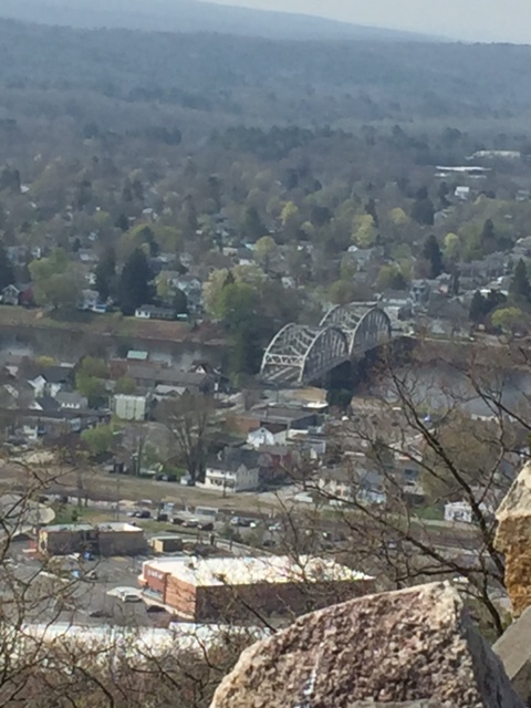
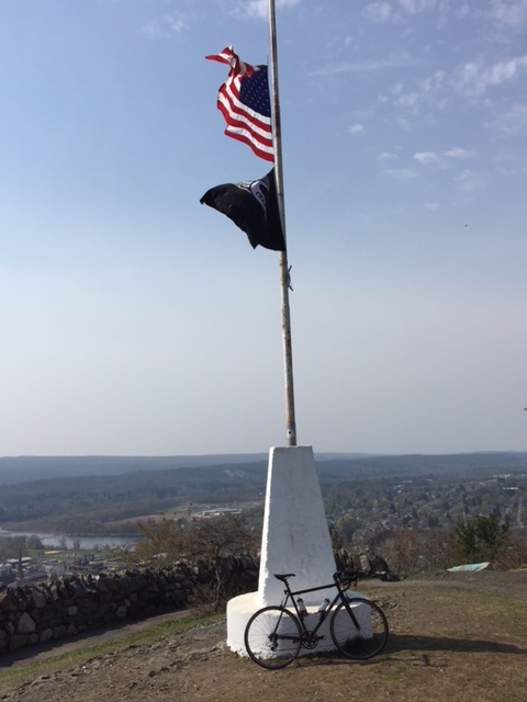
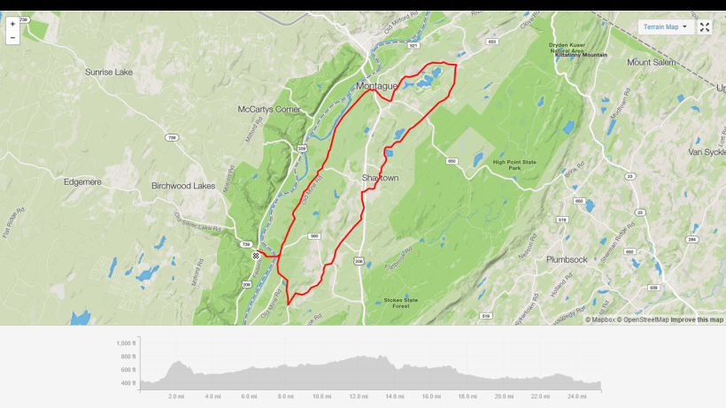
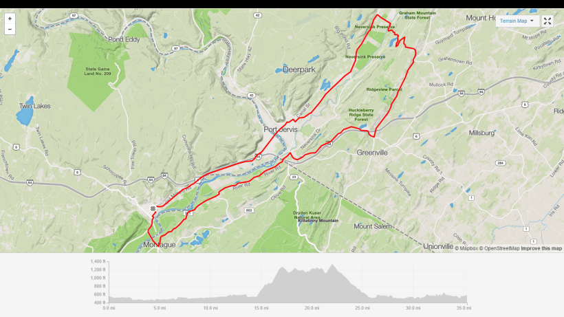
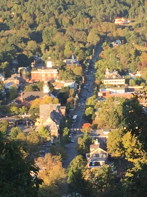
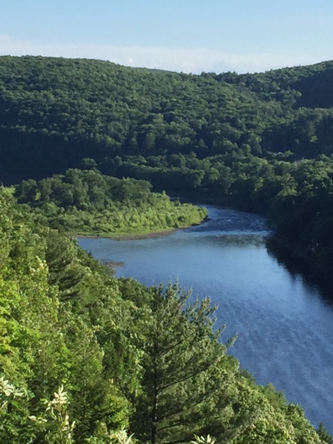
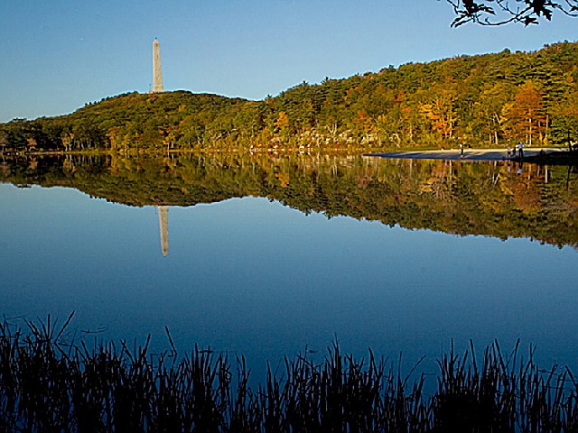
Nestled atop High Point State Park in the Kittatinny Mountains, it is the highest point of elevation (1804′) in the state of New Jersey. The beautiful 220 foot high monument was built in 1928 as a war memorial. The base of the monument offers views of the Pocono Mountains to the west and the Catskill Mountains to the north. New York, New Jersey, and Pennsyvainia are all seen in what appears to be a panaramic view.

280px-High_Point_Monument_and_Lake_Marcia_framed

Starting from town, there are a number of different routes to take you up to the monument. First, the most common is Rt. 209 from Milford to the Port Jervis, New York bridge and under the overpass, and up Pike St. After turning right on Rt. 6 and taking it through Port Jervis and into Montague, New Jersey, you turn right on Rt. 23 and follow all the way up to the entrance to High Point State Park.

Another popular route is from town to the Milford bridge and take Deckertown Turnpike up and over to Sawmill Rd. Follow Sawmill to Rt. 23, and make a right and climb the last 1/2 mile to the park entrance. 11348216_399866180215174_1728510025_n

The toughest route, at least for a rider of my size, is up the Mashipacongs. From town to the Milford Bridge, make a left on River Rd. and follow to New Mashipacong Rd. Climb for a little over 3/4 of a mile, and descend to Clove Rd. Turn right and a quick left onto Old Mashipacong Rd. Climb for just about 2 miles. At the top, go through the gate and left into the park.

Once inside the park, follow for 1 1/2 miles, make a right, and go up the steep grade to the top of the parking area. Then, go left up another steep hill to the monument where you get rewarded with the aforementioned views.

Screenshot (2)


Five Mile/Flat Ridge Gravel

On Sunday, I took the Van Dessel Whiskey Tango Foxtrot for a cruise along Five Mile Meadow Road and Flat Ridge Road with Kyle who was riding his Van Dessel Country Bob. The tempature hit a surprising 50 degrees as we started out in Lords Valley, PA at Rt. 739 and winded down a gravel jeep trail to Rt. 84 and back. The road goes over a wooden bridge and funky looking beaver dam. After heading back and crossing over Rt. 739, we climbed over and past the old Boy Scout Camp into the Pennsyvania State Forest.cropped-img_19077.jpgFive Mile Meadow Road winds along on hard packed gravel for around 6.4 miles(shouldn’t it be Six Mile Meadow Road), climbing and descending all the way to Silver Lake Road in Dingmans Ferry. Along the way are tiny hunting cabins, situated just off the road. The road is never plowed in the winter but is still pretty accessible on a fat bike or snow shoes. cropped-cropped-img_190922.jpg
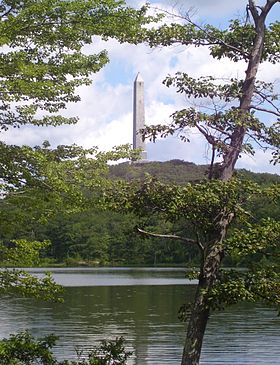
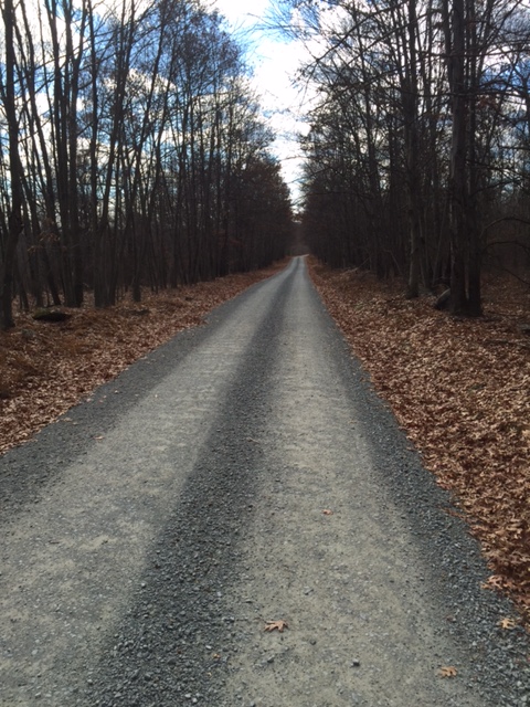
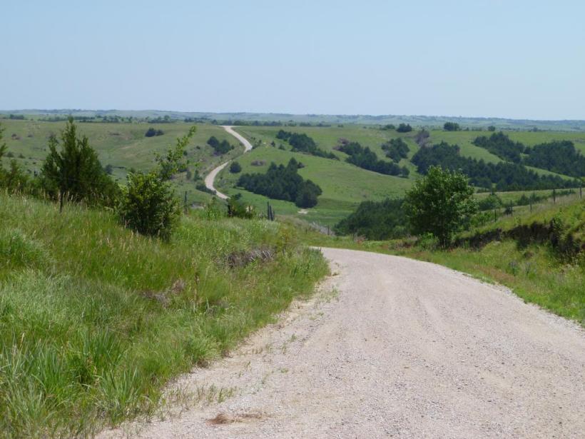
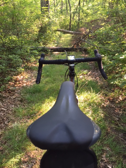
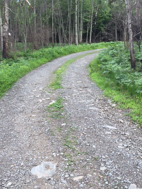
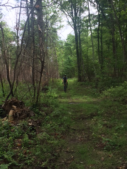
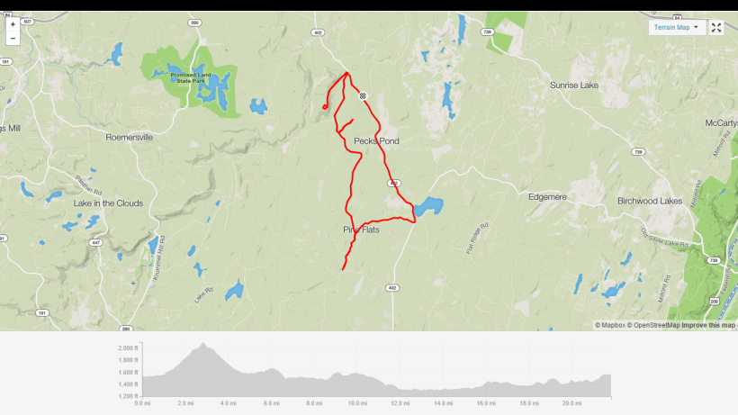
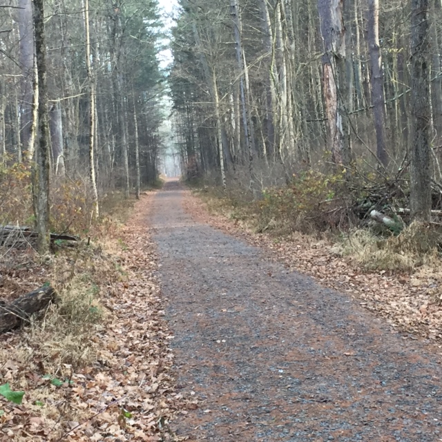
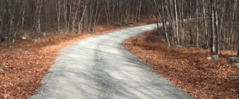
After making a right onto the pavement on Silver Lake Road, you climb a steep hill for about a half a mile then turn left onto Flat Ridge Road. Flat Ridge is more hard packed gravel, with the climbs not being as steep as Five Mile, but longer. Flat Ridge ends at about the 6 mile mark and becomes a trail that winds around Minisink Lake in Bushkill.IMG_1912

We opted to turn around and explore some of the off shoot gravel roads that surround the area. The entire region is littered with gravel emergency access roads throughout the Pennsylvania State Forest.IMG_1911
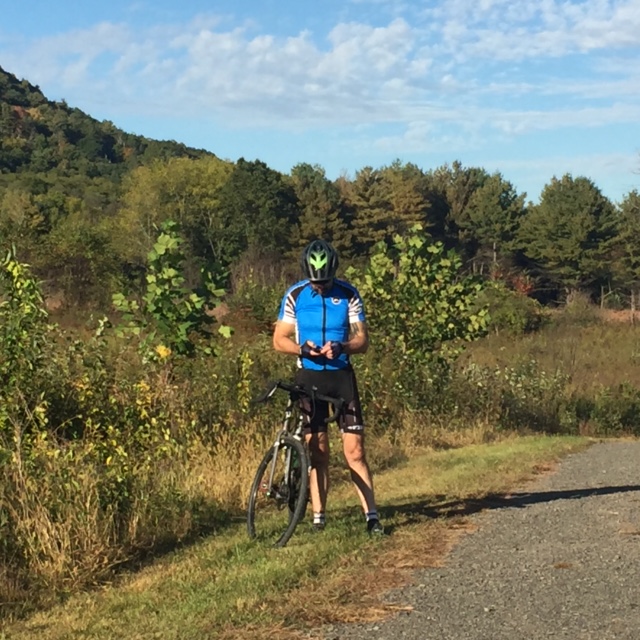
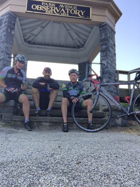
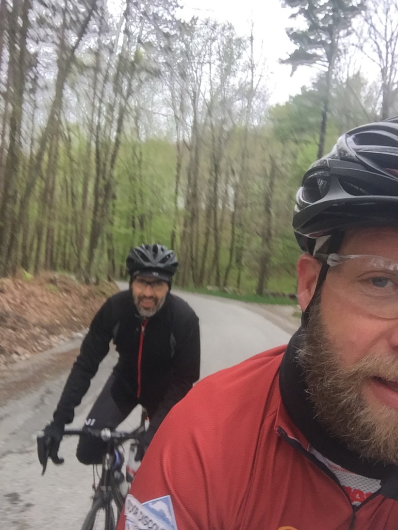
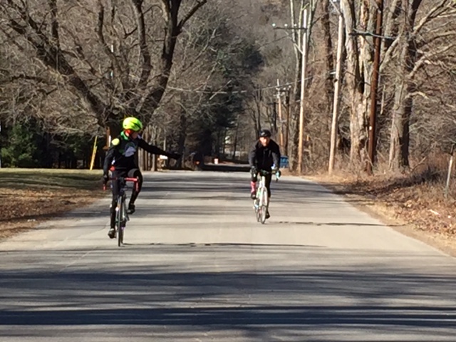
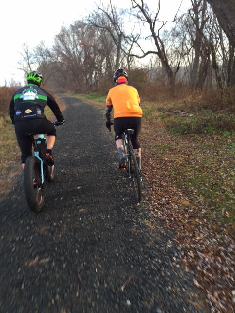
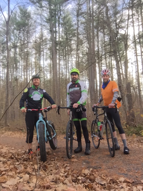
Heading back, my legs were shot. Kyle, a stronger rider, pulled back a little so I could keep him in sight. When we hit the last incline on Five Mile Meadow, it started to get cold. We sped down the road and across Rt. 739 to the parking area. The entire ride amounted to 25.5 miles and a little over 2,000 feet of elevation, but adding some of the emergency access roads could yield a nice 50 mile gravel ride.

IMG_1908

Here is the link for the Strava map – https://www.strava.com/activities/433431978.


Riding Milford, PA

This blog came to be when I realized there was simply not enough information available about cycling in the Milford, Pennsylvania area. With many miles of pavement, gravel roads, and lots of trails, Milford is an ideal cycling spot and a great place for the outdoor enthusiast.

Milford is a historic town that sits in the Delaware Valley in Pike County, along the Delaware River, bordering both New York and New Jersey. Milford has lots of cafes, restaurants, and quaint shops that make it a great place to start or finish a ride.

Stay tuned for lots of articles and photos on gravel rides, road rides, and even some mountain bike rides, all in the Milford area!