BikePacking, Part 2

The bikepacking bug came biting again. Last week, I received a message from Will and Kyle that they were planning an overnighter in Promised Land State Park. The thought of a fire, dehydrated food and camp coffee, oh yeah, I was in. I’ve been cultivating my next overnighter on the bike since my last trip. Will plotted out a route from Shohola, so all we had to do was pack, pedal and relax.

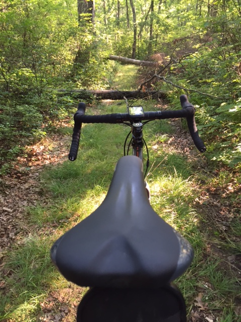
I planned on taking my Van Dessel WTF again with my large seatbag, frame bag and handlebar bag. Knobby tires on a route that included 90% pavement was probably not the smartest idea I’ve had. I went with a Camelback instead of a backpack, because I freed up some room with a hammock instead of a tent.

IMG_3715

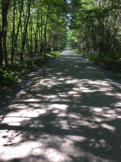
Friday came and the weather was perfect for a summer outing. At 85 degrees during the day and 60 degrees at night, with no rain in the forecast, we were able to pack light as we did not need to consider the thought of a storm. I met Will at Bridge Park, on Twin Lakes Road in Shohola. Kyle had a prior obligation and left from home. We rode to Rt. 6 and pedaled up to Rt. 434(Well Road) and made a left. We climbed up and over Rt. 739 where the road changed to Blooming Grove Road. As soon as you cross over Rt. 739, you enter the twilight zone. Well, not really, but it certainly seemed like life slowed down a bit.

IMG_3720

I think we saw one or two cars, the entire time on Blooming Grove Road. The landscape included quiet, country homes, set way back off the road and farms situated on lush green grass with well maintained barns. As we crossed Rt. 402 and came into the town of Blooming Grove, we passed what appeared to be the only commercial establishment, the Blooming Grove Tavern. The parking lot was at full capacity.

IMG_3719

We made a left on Egypt Road and were treated to a really nice red barn, a waterwheel and a lazy creek. Egypt Road seemed to go slightly up for the entire 3 miles. A left hand turn at the end, put us on Rt. 390, the main thoroughfare leading into Promised Land. We rolled up and down Rt. 390 for 6 miles and made a right on Lower Lake Road. We dropped down the narrow park road for 2 miles to our campsite. As we pulled up, Kyle was already there waiting to tell us about the alternate route he took on mostly dirt roads.

We dismounted, began to unpack and setup camp. I chose to go with a hammock this time, instead of a tent, so my setup was fairly easy and quick. After our last trip, TC from Action Bikes and Outdoor in Milford, highly recommmended a hammock and I don’t think I’ll ever go back in a tent again.

IMG_3723

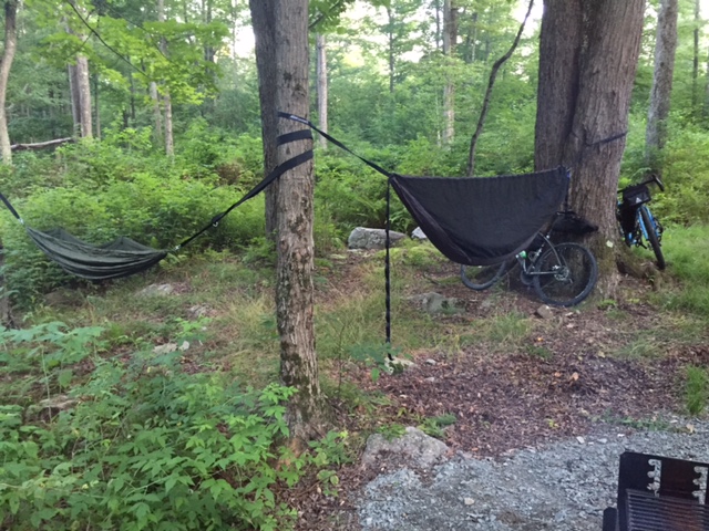
We collected wood and fired up our camp stoves to get ready for a well deserved dinner after a hard ride with over 2,200 feet of climbing on loaded gravel bikes. By the time we finished eating, the fire was roaring and we shared some laughs. I indulged in a little red wine (Sangiovese), that I transported in a steel growler on the front fork of my bike. By 10pm, exhausted, I retired to my hammock and pulled the bug fly over my head and slipped into a deep sleep.

IMG_3726

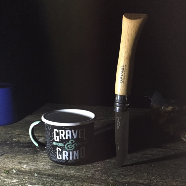
Again, I had to work the next day, so I woke up early and packed up my gear as I boiled water. After securing everything to my bike, I gulped down a hot cup of coffee and headed out. I snaked up Lower Lake Road and out on Rt. 390. That early in the morning, the traffic was a lot lighter than the previous evening.

IMG_3728

About halway home, I had to stop and take a picture at the Blooming Grove Tavern. The terrain was a lot less hilly in this direction and when I hit Rt. 739 I turned right and rode directly to my house. Another trip in the books. The next one will have to be away from a campground as camping in the deep woods provides a unique challenge that begs to be explored.

What’s Playing: (What am I’m listening to while writing or what’s dancing around in my head while riding) Today – Peter Wolf – Lights Out

MI0001622381


Advertisement

Pike County Loop

The other day, I did a really cool ride, that tested my climbing legs, with a few long but gradual hills. I wanted to try something a little different, with pieces of other routes mixed in to a form a loop that started off really slow, leveling out in the middle, it got pretty fast for the last 10 miles, thanks to a few leg loving descents.

Although, the weather was near perfect, and I was completely rested and ready for an epic ride, I hit a few bumps in the road that derailed me a bit, but not enough to spoil this awesome experience.

I departed Action Bikes and Outdoor in the heart of Milford, and made my way over to Rt. 6. Just before Apple Valley Restaurant, I made a left on Owega Turnpike and eased past some well manicured properties and up to Grey Towers.Grey Towers was the home of Gifford Picnchot, the first Chief of the US Forest Service and Pennsylvania’s Governor for 2 terms. Built in 1886, Grey Towers is a historic site that was donated by Gifford’s son to the US Forest Service in 1963 along with the 102 acres that it sits on. As I pulled my phone from my jersey pocket, to take a photo, I hit my first bump. My phone was dead. A miscalculation that does not happen often. So any photos here were taken from the internet. I pedaled back onto Owega Turnpike and back to Rt. 6. and labored uphill for about 4 miles.

grey-towers---2004-0924jpg-8e6c031ac5336775

I turned left on Frenchtown Road and cruised past some nicely situated farm homes. Frenchtown connects Rt. 6 to Raymonskill Road. Turning right on Raymonskill, the road drops for a little less than a mile as I made the sharp turn onto Nelson Road. A short climb and a left on Aspen Drive took me through the Woodlands, a gated but accessible lake community. I made a right on Log Tavern Road and climbed up past the Pike County Library, the new Dingmans Park and another left on busy Rt. 739, the main thoroufare through Dingman Township and Dingmans Ferry. This is where the road drops down all the way across Milford Road, Rt. 209 and the Dingmans Bridge. A left on Old Mine Road and I cruised through the scenic by way that connects the Dingmans Bridge and the Milford Bridge. About halfway, I hit my other bump in the road in the form of a flat rear tire.

CIMG1799

After a quick tube change, I was on my way back to Milford. As I crossed the Milford Bridge, I realized that sometimes the best rides are the ones you do not plan. Just see where the road takes you!

What’s Playing: (What am I’m listening to while writing or what’s dancing around in my head while riding) Today – The Police – Message in a Bottle

13120911192516546411806145


MillBrook Village

Today was not an ideal day to ride a bike. It was hot, it was humid and it rained hard. I planned to go out at 7am with Eric, but, allergies kept me awake late, so I put it off for after work. I wanted to get a little climbing in today, so I thought a Walpack loop with an extra hill or two, would do the trick. I parked at Dingman Falls and rode out over the Dingman Bridge. Turning right on Old Mine Road for the Peter’s Valley climb, got my legs burning early on. I felt real good as I capped the hill and descended into and through the Peter’s Valley School of Craft. I winded my way down the Walpack Road and hugged the right side of the road as traffic through this usually desolate area was heavier than usual. As I passed the Walpack Center and capped the next hill, I could see where all the cars were headed, The Walpack Inn. I should have realized it was dinner time.

Pedaling into the loop, I beared right and clawed my way up and over the only significant climb in the loop. From here on in, it was a roller coaster ride for about 6 more miles until I turned right on a small bridge over the Flatbrook Creek. Immediately, the chopped up, pot hole filled road goes skyward.

IMG_3623
Millbrook Village School House

I navigated around the pot holes as the hill never seemed to end. As I approached the top, it got dark and I could hear thunder from somewhere in the distance. I dropped down the other side and cruised into Millbrook Village, a rustic looking 19th Century hamlet that’s part of the  Delaware Water Gap National Recreation Area. As soon as I dismounted, the rains came (I was only able to snap off a couple of pictures as the rain fell hard). As hard as it rained, it felt good. I climbed back up and rode my brakes back down to the loop as I wanted to avoid slipping on the wet tarmac and rolling into one of the craters disguised as pot holes.

IMG_3628

Back on the loop, I pedaled past the Flatbrook Creek and back around towards the Delaware. As I came out of the loop and passed the Walpack Inn again, the rain stopped and the sun came out. The rain cooled things off a bit and the sun helped dry up my soaked jersey and shorts. I by-passed the Peter’s Valley hill and rode into Layton to tackle the much easier Tuttles Corner Road. The descent to the Dingmans Bridge is the highlight of that stretch of roadway. You can easily hit 40-45 MPH on the 1.5 mile drop.

I rolled into the Dingman Falls parking lot grateful to get a ride in but eager to get back over to Millbrook to explore that area a little more.

What’s Playing: (What am I’m listening to while writing or what’s dancing around in my head while riding) Today – Toto – Hold the Line

Toto-Toto-Frontal


Back in the Saddle

It’s been a couple of weeks since I’ve been able to get on a bike. Sometimes, life gets in the way and then you find your way back. This Sunday morning, I got out of bed and decided to just ride out of the garage, through my community and onto the gravel that is Five Mile Meadow Road. You see, what’s been keeping me away from my bike is still there and I was beginning to think that going for long bike rides was selfish and my way of running away from things. How wrong I was. This ride, through the beautiful state forest, helped me realize how grateful I am to be able to get away for a few hours and just pedal through the woods. I can still get back to reality, just with a renewed perspective.

IMG_3579

Anyway, I scooted up through my community and into the deer trail that leads to Five Mile Meadow Road. I turned right and immediately felt relaxed. I hung a left on Standing Stone Trail. It’s amazing how the weeds have grown through the middle of the road since my last ride there. The creek crossing was rideable today, although I stopped for a quick photo. I plowed through the loose gravel, as this wonderful 3 mile stretch is closed to vehicular traffic and the road surface does not get too packed down. Standing Stone takes you through the Pennsylvania Deer Management area that is fenced off for a few miles, along most of the road.

IMG_3588

Turning left on Silver Lake Road, I hit the pavement for about a mile and took a diversion through Little Mud Pond Road, a 1 mile horse shoe that puts you right back on Silver Lake Road. I then turned left back onto Five Mile Meadow. After a short climb, I made a right hand turn and dropped down Bald Hill Road. Bald Hill is a neat crushed gravel road that pretty much descends for 2.5 miles and comes to an end. An overgrown trail leads into private property. I have never explored here, as there are more than a few No Tresspassing signs. I turned around and headed back up to Five Mile Meadow, climbing through the dense woods.

Hunting cabins, complete with OutHouses and no running water, litter the landscape, through the Delaware State Forest. Some are run down and some look well taken care of. I ripped up Five Mile Meadow and slipped into the deer trail and back into my community. I rode towards the back of my community on gravel roads that are a little less forgiving. Large stones that just do not seem to penetrate the hard clay that make up the road surface. I found a clearing and another creek that seemed like a good spot for a drink and another photo.

 If your going to escape for a little while, there’s no better way than just hopping on your bike and pedaling into the woods at a relaxed pace. You really can just forget about the world for a change and enjoy the serenity.