After my first two rides here, I envisioned this post to be a negative, stay out of Rockford type piece. I could not find suitable roads. The one bike path/sidewalk was a pot holed mess. Then, after some research, I uncovered a few hidden gems.
A short downtown ride proved to be the first of many interesting routes around the screw city (for the numerous fastener factories in and around Rockford). As I cruised past Beyer Stadium (or what’s left of it), I glanced over at the ticket booth to see that it was the home of the Rockford Peaches of the All American Girls Professional Baseball League. The stadium and team were featured in the classic movie, A League of their Own. I stopped and walked around. The stands have been removed and the field renovated. But, the original ticket booth still stands.
On the weekend, I wanted a bit more. So, a quick search on Ride with GPS brought me to Caledonia, a very small town about 4 miles outside Rockford. This was the highlight of my first week here. Rolling hills, quiet roads and beautiful farmland for as far as the eye could see. For 50 miles, I might have seen 4 cars. But probably 30 cyclists. A good ratio in my opinion.
Looking for something more local, that I could ride from the hotel, I headed down Bell School Road to Harvey Road and found Harlem Road, a rolling thoroughfare that’s winds through corn and farmland for about 8 miles. I turned around and found Rock Cut Park on my way back. This incredible 3,100 acre forest packs singletrack, paved cycle paths, two serene lakes and beautiful roadway all inside a very picturesque setting. I did several rides here, exploring all sides of the park.
What I learned: Do not judge a book by it’s cover. Explore, uncover and find the beauty in all areas of this incredible country.
On Sunday, I traveled to Honesdale, PA with Eric, Matt, Bob and Kyle, to do the Maple City Century, a mixed terrain 100 miler that consisted of about 85% gravel and dirt roads and just over 9,000 feet of climbing. The route brings you through most of rural Wayne County and borders the Delaware River and New York State in several sections. If you haven’t been to this part of Northeastern PA, check it out, it’s beautiful, especially during the fall foliage season.
100, 62 and 30 mile options are offered. Each route different, but challenging in their own way. The 30 mile option gave riders a glimpse of what pedaling in Wayne County is all about, on mostly dirt and gravel roads.The 62 and 100 mile routes include long, steep climbs through farm land, logging roads and every kind of back road you can imagine.
Action Bikes and Outdoor was well represented
It was chilly at the start, about 36 degrees, but warmed up to the mid 60’s at mid day. I did not get a chance to sample the 30 and 62 mile routes. I was up in the air about whether to do the 62 or 100 but made a game time decision to push through the 100 mile course. I was rewarded for my efforts with amazing views, awesome rest stops and a chance to ride with some fantastic people. Matt and Bob rode the 62 miler as Matt took care of repairs for the riders at the start and had to wait for the masses to depart. Kyle and Eric joined me on this epic journey.
The 100, left from behind the Post Office in Honesdale at 8:20am and rolled through town with a Police escort. 2 miles later, the gravel adventure began. I compartmentalized the ride into 4 sections, divided by the 3 rest stops. The first section was hilly to say the least. But, anyone who cycles in Northeastern, PA knows there are no flat roads here. Just ups and downs and ups and downs.
The ride organizer made all routes available for download to a GPS enabled device. Cue sheets were also made available. However, the course was expertly marked out with easily visible color coded signs at every turn. At mile 33, we arrived at the first rest stop and were greeted with friendly volunteers and an array of energy bars, gels, fruit, trail mix, water and energy drink. Volunteers signed in all riders, to ensure they reached the checkpoint safely.
Eric certainly approved of the descent!
The next section began with a hill, just up the road from the rest stop. Another 15 or so miles or gravel and we hit Brown Trout Trail. This extremely technical, section lasted for five miles. With the side of a mountain to the right and a cliff to the left, the six foot wide trail seemed suited for a full suspension MTB, Fat Bike or ATV. With a waterfall coming right through, a washed out portion of the trail required a little hike a bike. This was the most challenging part of the course.
Just as we pushed off Brown Trout Trail, we arrived at rest stop #2. What a welcome sight after bouncing around for more than 40 minutes. After filling bottles and devouring everything in sight, we saddled up and headed out into the beautiful countryside. We saw some odd old homes, rustic churches and more than a few cattle.
At mile 75, we pulled into rest stop #3. This seemed like a great place to sit down and stretch a bit. With only 25 miles to go, finishing certainly seemed like a reality. Just a few more hills and a lot more gravel!
Thanking the Gods for a beautiful day!
I kept telling myself that the big climbs were behind us. That didn’t work very well as hill after hill punished every weary leg that pedaled on. I have to say that Eric really got me through this ride. He kept me going when I wasn’t feeling too good. As for Kyle, we only saw him for a few seconds at the start. Every time we hit a sketchy section of trail, I did imagined Kyle laughing and riding right through. It was still light out when we rolled back into Honesdale, 8 hours and 47 minutes later. A quick clothing change at the car and a brief walk to the Irving Cliff Brewery for a well deserved post ride feast.
A beer growler for every participant
Kudos to Ride Director Zach Wentzel and his staff for putting on a first class ride. The course markers were spot on, the rest stops were fully stocked and the volunteers were friendly and helpful. The course was everything it was supposed to be and more. It’s already on the calendar for next year. September 24th, 2017. Save the date!
It’s 8am on a Sunday Morning. I’ve just unloaded my bike from the top of my car. I’m doing some last minute checks to make sure I have enough food and water to get me through the day, as I’m about to embark on a 30-35 mile bike ride through mostly gravel roads in the Delaware State Forest. That day, I rode through the state forest, onto the pavement for a couple of miles and back into the forest, with a couple of diversions on dirt roads and grassy trails to end with 32 miles of an all road adventure.
This type of riding is most commonly called “gravel grinding”. Some call it “adventure cycling” and some refer to it as “all road riding”. Whatever you call it, it’s just plain fun.
2017 Kona Sutra LTD
Gravel Grinding has been popular in the midwest for the better part of a decade. Many of the big gravel races in the US are found there because of the extensive network of gravel and dirt roads that sprawl across the region. Here in the northeastern part of the country, gravel grinding is catching on. In this area alone, we have access to numerous gravel roads that are part of the state forest as well as the McDade Trail, which is a 32 mile gravel and dirt trail, connecting Milford to Stroudsburg as part of the Delaware Water Gap National Recreation Area, along with many other off the beaten path options.
The best part about gravel grinding is that you don’t need a specific bike to get you going. You can pedal across gravel or dirt on a mountain bike, road bike, cyclocross bike, dual sport bike, comfort bike, whatever, just make sure you have enough tread on your tires to shed a little mud and stone. However, most bicycle companies are now producing “gravel bikes”. A good choice for people who just want to have 1 bike. A bike that allows a lot of options for two wheeled adventure. You can hit the gravel, ride in a gran fondo, throw racks and fenders on for loaded touring or just use it as an everyday commuter. Action Bikes and Outdoor, right in the heart of Milford, stock several models of gravel bikes, along with every type of bike and accessory as well as kayaks, paddles and most things for the outdoor enthusiast. Stop in, they are happy to offer advice on where to ride. They even have great paper maps and resources to help you on your journey.
The beauty of gravel grinding is it gets you out of traffic and puts you right in the middle of nature. There’s no need to hammer through the woods. Slow down, enjoy the scenery and take in everything that nature has to offer. You won’t regret it. In fact, there seems to be a growing number of riders in our area that love having the opportunity to pedal in areas that until recently seemed foreign. On both sides of the Delaware River, there are trails and roads that lead to waterfalls, farms, corn fields, breathe taking views, wildlife sightings, streams, creeks and lakes.
If you are up for the adventure, try one of the areas local gravel races. The Maple City Century, on September 25, 2016 starts in Honesdale and takes you through beautiful and scenic Wayne County on mostly dirt and gravel roads. In October, Action Bikes and Outdoor sponsor the Erie 80. An 80K gravel, dirt and paved MTB ride that shows you all
that Port Jervis has to offer. If you are not looking for an organized race, there is usually a group riding from somewhere. Mostly from the shop parking lot.
So if I’ve peaked your interest just a little bit, get out and pedal a quiet country road, you’ll be planning your next gravel ride before you load your bike back on the car.
Getting out today was harder than I thought. I got up at 6:30am to meet Eric for a morning ride. I took the dog for a walk and got wet as it rained hard for about 10 minutes. I text Eric and opted for a few more hours sleep over a wet ride. He manned up and went out for a rain ride. I waited until 3pm, when it was dry and the forecast looked clear to venture out into the woods.
I’m planning to ride in the Maple City Century next Sunday in Honesdale, PA. It’s a 100 mile gravel adventure with lots of climbing. So, I wanted to just get a few extra miles in on some loose gravel roads to help prepare for the event.
I rode out of my driveway and up through my community, then veered into the woods via a deer trail and onto Five Mile Meadow Road. I haven’t been on a bike since Tuesday, so I took it easy as I let my legs warm up to the hills. I headed out to Silver Lake Road and climbed up the monster hill before turning left onto Flat Ridge Road.
About halway up Flat Ridge, I met up with Bob, another local cyclist that was also training for the Maple City Century. He was doing almost he same ride that I was doing today. After, pedaling up to Minisink Lake and turning around, I came back down Flat Ridge and took Bob’s advice when I turned right on Coon Swamp Road. Coon Swamp is gravel and loose packed dirt. It continues for a couple of miles and comes to an end at the top of a hill, with a cool camping spot, over looking Coon Swamp Lake.
Coming out of Coon Swamp, just before I got back to Flat Ridge, I was startled as I noticed a black shape in the roadway. It was a huge black bear. I fumbled for my phone to take a photo, but he scampered away as I tried to get closer. Probably better off for me. It never ceases to amaze me what beautiful creatures they are.
Back on Flat Ridge, I rode on, knowing how lucky I am to have this incredible state game land, with all the gravel emergency access roads, right in my backyard. I descended down Silver Lake Road and hung a left back onto Five Mile Meadow Road. From there, I pedaled through the deer trail and home.
I’ve written about this area a few times before, but I felt compelled, as a new road or trail, especially one that ends high above a lake, providing superior views, needs me to tell you about it, so you can go ride it and see for yourself!
What’s Playing: (What am I’m listening to while writing or what’s dancing around in my head while riding) Today – The Babys – Isn’t It Time
The final day of the TDF is always bittersweet. I’m happy to get home and get back to my daily routine, but I’m also sad that it will be another year before I get to see all the awesome people that I have the privelage to be associated with for the last 15 years.
We started with a transport over to Liberty State Park in Jersey City. After a few wrenches were turned and photos were snapped, we were led out by a multitude of New Jersey Police agencies with a fantastic escort through Jersey City, Hoboken, Fort Lee and all the wonderful cities and towns along the Jersey side of the Hudson River. What came next was unusual. The Port Authority Police Department along with the Fort Lee Police Department and the NYPD, shut down the George Washington Bridge to escort us into the greatest city on the world.
The riders were given the entire right lane of the bridge. Most charity tours are relegated to the bike path along side the bridge. We snaked into Manhattan and eventually onto Riverside Drive for a cool ride above the river and down the west side. We hit the Henry Hudson Parkway and again had a lane shut down for us. For 15 years, we have been treated well by our own department, but never to this extent.
Dropping down to 12th Avenue, we were given free passage all the way to the Freedom Tower and the 9/11 Memorial. After a moment of silence to remember all victims of that horrible day, we pedaled over to Battery Park, where we were treated to a ceremony, honoring our efforts.
As the TDF came to a close, we said our goodbyes and expressed our hope to see everyone next year. Our year end meeting is in October, where we will vote on how all monies raised will be donated. We will also finalize our route for next year and immediately start planning for the 2017 event. You can check out what we do and how we do it by dropping by our web page at http://www.tourdeforceny.com. I leave you with yet, a few more photos:
This may have been the best weather we have ever had for the Tour de Force. Low 80’s and absolutely no wind. The road was flat as can be for most of the way. Really, things could not have gone better today.
Normally, I would take this 1 day that I ride to hammer as hard as I can and finish as fast as possible. But, today, I decided to ride with my pal and ex-partner, Mike and his son Sean. Mike is a unique rider. He is the only person to have ridden every mile of every year for the first 15 years of the Tour de Force.
We pedaled out of Island Beach State Park in Tom’s River, NJ and rode along the coast for the first 35 miles. When we reached Belmar, we rode up on the Boardwalk for a few hundered feet. From mile 38 to mile 49, the route took us onto the Atlantic Highlands Rail Trail. A scenic fitness path, it kept the riders off the busy Jersey Shore streets.
A few miles after coming off the trail, we were treated to a series of hills, that to be honest were just about the only inclines on the route. At the top of one of the hills, a 9/11 memorial sat in a garden, overlooking Sandy Hook and the Atlantic Highlands.
We cruised along the rest of the course together and enjoyed the sea air, all thanks to the incredible effort of our support team. The sag support and rest stops are second to none. These volunteers, are what make this well oiled machine run so smoothly. The local Police Departments took care of the busy intersections, allowing our riders to pass through saftely.
Pulling into the beach in Old Bridge, NJ, where the riders grouped up to be escorted over the Liberty Bridge, I was happy to have had the opportunity to ride today. I jumped into a car and headed to the hotel in Woodbridge, our finish line for the day, to get ready to greet the riders with medals to commerate their amazing efforts. Now, I leave you with a few more pics of this amazing day:
What a beautiful day. Low 80’s and sunny with just a little wind. The day started with a ferry ride from Lewes, Delaware to Cape May, NJ. Getting everyone on the ferry was a challenge with all the support vehicles, but the ferry crew was more than up to the task. The Cape May Ferry is always a nice trip. It gives everyone a chance to talk. Night time is filled with food, spirits and tired bodies. So, a little diversion in the morning, never hurts.
The ride was short, only 54 miles. Out to Rt. 9 with a tour of historic Cape May. The riders pedaled through the fantastic sea air for the better part of 3-4 hours, ending in a parking lot near the Tropicanana Hotel and Casino, in Atlantic City, NJ.
Days 1 and 4, riders wear the current year’s jersey. Day’s 2 ans 3, custom jerseys from hometowns and various teams the have been created for the ride, rule the day.
A short day callls for a short post. Here are a few photos from today:
Well, day 1 is upon us. This is the day that first time riders, will find out if they trained hard enough, prepared properly and packed everything they will need for this 4 day event. Each rider, raises a minimum amount to gain entry into the ride. Even the support staff have to meet a fundraising goal. Riders and support staff, come from all corners of the country.
In 2002, our original starting point was the Pentagon in Washington, DC, and we rode to the World Trade Center in New York City. We have done that ride as well as the reverse route several times. We have also ridden from New York to Boston (Yankee Stadium to Fenway Park) and Boston to New York. This year we decided to start at RFK Stadium in Washington and ride to the NYC Police Memorial, around the corner from the World Trade Center.
The Metropolitan Police Department escorted the ride out from RFK to the Capitol and around the District and handed us off to the Pince Georges County Police as we crossed the Maryland line. I drive a support vehicle for 3 out of 4 days, as the logistics of the tour have not allowed myself or my colleagues the opportunity to ride the entire way for several years now. I plan to ride day 3 as that appears to be the lightest traffic day with little to no problems all the way to the finish.
Once we hit the first rest stop at mile 22, we led the riders out 8 more miles and released them at their own pace. Immediately, the pack went from a long sea of blue to a spread out group with each rider finding his or her cadence. We keep cars with the front of the pack as well as a sweep vehicle to trail the last rider. Several support vehicles, buses and trucks are along the route to lend support to riders in need. Mechanics ride back and forth along the route to assist with any issues (mostly tube punctures).
Mile 40 at the Maryland Transportation Authority was the lunch stop. (The tour provides breakfast and lunch each day as well as 4 nights lodging in superior hotels and a banquet on the 3rd night). After crossing the Bay Bridge, riders head over to Rt. 404 to complete the last 60 miles to Rehoboth Beach, our destination for day 1.
0
Rt. 404 is a long, flat section of road that winds through corn fields in rural Maryland and Delaware. Farms stands are everywhere, offering local fruit and vegetables, giving us the freshest supplies for our remaining rest stops. When the last rider reached the hotel, the party began. The entire parking lot is lined with TDF trailers, with just the right amount of beverages to rehydrate our weary riders.
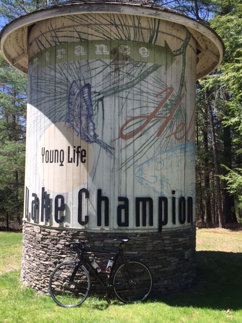
The bikepacking bug came biting again. Last week, I received a message from Will and Kyle that they were planning an overnighter in Promised Land State Park. The thought of a fire, dehydrated food and camp coffee, oh yeah, I was in. I’ve been cultivating my next overnighter on the bike since my last trip. Will plotted out a route from Shohola, so all we had to do was pack, pedal and relax.
I planned on taking my Van Dessel WTF again with my large seatbag, frame bag and handlebar bag. Knobby tires on a route that included 90% pavement was probably not the smartest idea I’ve had. I went with a Camelback instead of a backpack, because I freed up some room with a hammock instead of a tent.
Friday came and the weather was perfect for a summer outing. At 85 degrees during the day and 60 degrees at night, with no rain in the forecast, we were able to pack light as we did not need to consider the thought of a storm. I met Will at Bridge Park, on Twin Lakes Road in Shohola. Kyle had a prior obligation and left from home. We rode to Rt. 6 and pedaled up to Rt. 434(Well Road) and made a left. We climbed up and over Rt. 739 where the road changed to Blooming Grove Road. As soon as you cross over Rt. 739, you enter the twilight zone. Well, not really, but it certainly seemed like life slowed down a bit.
I think we saw one or two cars, the entire time on Blooming Grove Road. The landscape included quiet, country homes, set way back off the road and farms situated on lush green grass with well maintained barns. As we crossed Rt. 402 and came into the town of Blooming Grove, we passed what appeared to be the only commercial establishment, the Blooming Grove Tavern. The parking lot was at full capacity.
We made a left on Egypt Road and were treated to a really nice red barn, a waterwheel and a lazy creek. Egypt Road seemed to go slightly up for the entire 3 miles. A left hand turn at the end, put us on Rt. 390, the main thoroughfare leading into Promised Land. We rolled up and down Rt. 390 for 6 miles and made a right on Lower Lake Road. We dropped down the narrow park road for 2 miles to our campsite. As we pulled up, Kyle was already there waiting to tell us about the alternate route he took on mostly dirt roads.
We dismounted, began to unpack and setup camp. I chose to go with a hammock this time, instead of a tent, so my setup was fairly easy and quick. After our last trip, TC from Action Bikes and Outdoor in Milford, highly recommmended a hammock and I don’t think I’ll ever go back in a tent again.
We collected wood and fired up our camp stoves to get ready for a well deserved dinner after a hard ride with over 2,200 feet of climbing on loaded gravel bikes. By the time we finished eating, the fire was roaring and we shared some laughs. I indulged in a little red wine (Sangiovese), that I transported in a steel growler on the front fork of my bike. By 10pm, exhausted, I retired to my hammock and pulled the bug fly over my head and slipped into a deep sleep.
Again, I had to work the next day, so I woke up early and packed up my gear as I boiled water. After securing everything to my bike, I gulped down a hot cup of coffee and headed out. I snaked up Lower Lake Road and out on Rt. 390. That early in the morning, the traffic was a lot lighter than the previous evening.
About halway home, I had to stop and take a picture at the Blooming Grove Tavern. The terrain was a lot less hilly in this direction and when I hit Rt. 739 I turned right and rode directly to my house. Another trip in the books. The next one will have to be away from a campground as camping in the deep woods provides a unique challenge that begs to be explored.
What’s Playing: (What am I’m listening to while writing or what’s dancing around in my head while riding) Today – Peter Wolf – Lights Out
The other day, I did a really cool ride, that tested my climbing legs, with a few long but gradual hills. I wanted to try something a little different, with pieces of other routes mixed in to a form a loop that started off really slow, leveling out in the middle, it got pretty fast for the last 10 miles, thanks to a few leg loving descents.
Although, the weather was near perfect, and I was completely rested and ready for an epic ride, I hit a few bumps in the road that derailed me a bit, but not enough to spoil this awesome experience.
I departed Action Bikes and Outdoor in the heart of Milford, and made my way over to Rt. 6. Just before Apple Valley Restaurant, I made a left on Owega Turnpike and eased past some well manicured properties and up to Grey Towers.Grey Towers was the home of Gifford Picnchot, the first Chief of the US Forest Service and Pennsylvania’s Governor for 2 terms. Built in 1886, Grey Towers is a historic site that was donated by Gifford’s son to the US Forest Service in 1963 along with the 102 acres that it sits on. As I pulled my phone from my jersey pocket, to take a photo, I hit my first bump. My phone was dead. A miscalculation that does not happen often. So any photos here were taken from the internet. I pedaled back onto Owega Turnpike and back to Rt. 6. and labored uphill for about 4 miles.
I turned left on Frenchtown Road and cruised past some nicely situated farm homes. Frenchtown connects Rt. 6 to Raymonskill Road. Turning right on Raymonskill, the road drops for a little less than a mile as I made the sharp turn onto Nelson Road. A short climb and a left on Aspen Drive took me through the Woodlands, a gated but accessible lake community. I made a right on Log Tavern Road and climbed up past the Pike County Library, the new Dingmans Park and another left on busy Rt. 739, the main thoroufare through Dingman Township and Dingmans Ferry. This is where the road drops down all the way across Milford Road, Rt. 209 and the Dingmans Bridge. A left on Old Mine Road and I cruised through the scenic by way that connects the Dingmans Bridge and the Milford Bridge. About halfway, I hit my other bump in the road in the form of a flat rear tire.
After a quick tube change, I was on my way back to Milford. As I crossed the Milford Bridge, I realized that sometimes the best rides are the ones you do not plan. Just see where the road takes you!
What’s Playing: (What am I’m listening to while writing or what’s dancing around in my head while riding) Today – The Police – Message in a Bottle
Today was not an ideal day to ride a bike. It was hot, it was humid and it rained hard. I planned to go out at 7am with Eric, but, allergies kept me awake late, so I put it off for after work. I wanted to get a little climbing in today, so I thought a Walpack loop with an extra hill or two, would do the trick. I parked at Dingman Falls and rode out over the Dingman Bridge. Turning right on Old Mine Road for the Peter’s Valley climb, got my legs burning early on. I felt real good as I capped the hill and descended into and through the Peter’s Valley School of Craft. I winded my way down the Walpack Road and hugged the right side of the road as traffic through this usually desolate area was heavier than usual. As I passed the Walpack Center and capped the next hill, I could see where all the cars were headed, The Walpack Inn. I should have realized it was dinner time.
Pedaling into the loop, I beared right and clawed my way up and over the only significant climb in the loop. From here on in, it was a roller coaster ride for about 6 more miles until I turned right on a small bridge over the Flatbrook Creek. Immediately, the chopped up, pot hole filled road goes skyward.
Millbrook Village School House
I navigated around the pot holes as the hill never seemed to end. As I approached the top, it got dark and I could hear thunder from somewhere in the distance. I dropped down the other side and cruised into Millbrook Village, a rustic looking 19th Century hamlet that’s part of the Delaware Water Gap National Recreation Area. As soon as I dismounted, the rains came (I was only able to snap off a couple of pictures as the rain fell hard). As hard as it rained, it felt good. I climbed back up and rode my brakes back down to the loop as I wanted to avoid slipping on the wet tarmac and rolling into one of the craters disguised as pot holes.
Back on the loop, I pedaled past the Flatbrook Creek and back around towards the Delaware. As I came out of the loop and passed the Walpack Inn again, the rain stopped and the sun came out. The rain cooled things off a bit and the sun helped dry up my soaked jersey and shorts. I by-passed the Peter’s Valley hill and rode into Layton to tackle the much easier Tuttles Corner Road. The descent to the Dingmans Bridge is the highlight of that stretch of roadway. You can easily hit 40-45 MPH on the 1.5 mile drop.
I rolled into the Dingman Falls parking lot grateful to get a ride in but eager to get back over to Millbrook to explore that area a little more.
What’s Playing: (What am I’m listening to while writing or what’s dancing around in my head while riding) Today – Toto – Hold the Line
It’s been a couple of weeks since I’ve been able to get on a bike. Sometimes, life gets in the way and then you find your way back. This Sunday morning, I got out of bed and decided to just ride out of the garage, through my community and onto the gravel that is Five Mile Meadow Road. You see, what’s been keeping me away from my bike is still there and I was beginning to think that going for long bike rides was selfish and my way of running away from things. How wrong I was. This ride, through the beautiful state forest, helped me realize how grateful I am to be able to get away for a few hours and just pedal through the woods. I can still get back to reality, just with a renewed perspective.
Anyway, I scooted up through my community and into the deer trail that leads to Five Mile Meadow Road. I turned right and immediately felt relaxed. I hung a left on Standing Stone Trail. It’s amazing how the weeds have grown through the middle of the road since my last ride there. The creek crossing was rideable today, although I stopped for a quick photo. I plowed through the loose gravel, as this wonderful 3 mile stretch is closed to vehicular traffic and the road surface does not get too packed down. Standing Stone takes you through the Pennsylvania Deer Management area that is fenced off for a few miles, along most of the road.
Turning left on Silver Lake Road, I hit the pavement for about a mile and took a diversion through Little Mud Pond Road, a 1 mile horse shoe that puts you right back on Silver Lake Road. I then turned left back onto Five Mile Meadow. After a short climb, I made a right hand turn and dropped down Bald Hill Road. Bald Hill is a neat crushed gravel road that pretty much descends for 2.5 miles and comes to an end. An overgrown trail leads into private property. I have never explored here, as there are more than a few No Tresspassing signs. I turned around and headed back up to Five Mile Meadow, climbing through the dense woods.
Hunting cabins, complete with OutHouses and no running water, litter the landscape, through the Delaware State Forest. Some are run down and some look well taken care of. I ripped up Five Mile Meadow and slipped into the deer trail and back into my community. I rode towards the back of my community on gravel roads that are a little less forgiving. Large stones that just do not seem to penetrate the hard clay that make up the road surface. I found a clearing and another creek that seemed like a good spot for a drink and another photo.
If your going to escape for a little while, there’s no better way than just hopping on your bike and pedaling into the woods at a relaxed pace. You really can just forget about the world for a change and enjoy the serenity.
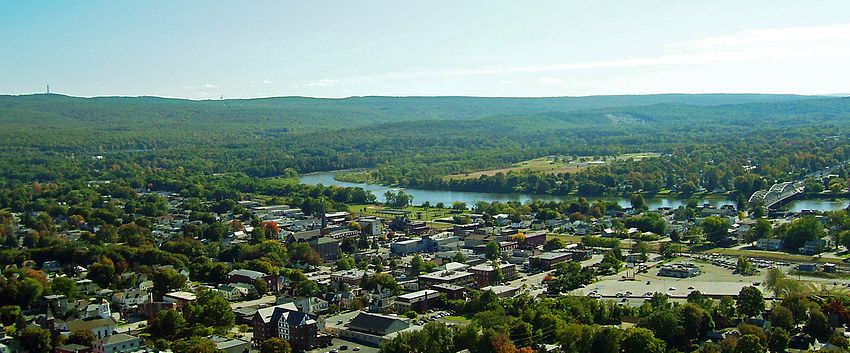
This past weekend, Mike H, Steve and I, traveled up to Plattsburgh, NY to do a Century ride through the Adirondacks. A ride that is near and dear to my heart. This ride is put on by the Adirondack Garda. All proceeds are donated to the Tour de Force, a charity ride that raises money for the families of Police Officers killed in the line of duty, nationwide. I’ll detail the Tour de Force in a later post.
This is the 3rd annual Valcour Brewing Company Century Ride. It was previously called the Dry Dock 100. I rode in the 2014 event and I was extremely excited to be able to have a chance to be a part of it again. The inaugural ride was a 103 miles. A figure eight that started in Plattsburgh, came back into town at mile 50 for a fantastic lunch stop and looped out and back for another beautiful 50+ miles.
The 2016 event featured 4 rides. 25, 50, 78 and 103 miles through the beautiful Adirondack Park and alongside Lake Champlain. Each ride featured perfect roads, absolutely stunning scenery, a quality lunch stop, well stocked rest areas and 2 awesome post ride parties. All riders, received an Adirondack Garda t-shirt, Valcour Brewing Company/VBC Century pint glass and some first rate swag. The gun went off at 8:30am for the 50/78/103 mile rides. The 25 miler, was an out and back, that started after lunch.
For the 103 miler, it was a tale of two different types of weather. First, the rest stops were at miles 25, 50, 75 and 94. For the first 25 miles, there was a strong head wind. You sort of forgot about the wind as you came to the top of a hill and were hit with an incredible mountain top view. As you made the turn and looped back into Plattsburgh from the 1st rest stop to lunch, the wind changed directions and the road grade cooperated. That might have been the fastest 25 miles I have ever ridden.
We were treated to a nice lunch on Lake Champlain. Darcy, Ann and a bunch of other volunteers, really did a wonderful job. From the sign in to the aid stations(which were top notch), everything was done to make sure the riders slipped through the course with ease. The Plattsburgh Police Department and the New York State Police did a fantastic job with the lead out and traffic control at the intersections.
After lunch, about a mile in, you hit the only big hill on the course. It twists and turns as you climb for approximately 1.5 miles. You drop back down into farmland and fight the wind for another 20 or so miles. Along the way, we passed over 100 cyclist from Canada that were pedaling through one of the best cycling regions in the country. At mile 75 we rolled into the 3rd rest stop just off the border of Quebec on Lake Shore Drive. Across the lake, you could see Vermont. The wind turned to our backs again as we made our way into Plattsburgh along the lake.
The last 2 miles are on a bike path, along Lake Champlain, that leads you right into the VBC parking lot and through the finishing chute. We were greeted with cheers and directed upstairs for the post ride party. Valcour had several different beers to choose from in a saloon that overlooked the lake. Down the hall, the Adirondack Garda provided a delicious recovery feast. We went back to our rooms to shower up and headed over to an undisclosed location for a pool party, complete with margarita machine, beer, BBQ, hot tub and great people to sit around with, relax and reminisce about a great day.
The following day, Bob and Bruce took any willing riders on a 50+ mile recovery ride up through the Lake Placid area, with a ferry ride across the lake to Vermont for lunch. We were sorry to miss this excursion as we opted to head home in the morning, but heard it was a good time! Just a few more pics of this fantastic event:
With a break in the humidity for a day, a gravel grinder through the Delaware State Forest seemed like a good idea. I’ve written a few posts about different areas of the forest (Five Mile Meadow Road, Standing Tall Trail, Flat Ridge Road area, Whittaker Road and the High Knob Road, High Line Road area), but this time, the idea was to come up with a way to connect them and extend the ride.
I made plans to ride with Will and Kyle at 9am on Sunday. Will mapped out a route that would connect all of the aforementioned areas into a nice loop. I rode from home and met up with Will and Kyle at the Rt. 739 Parking area.
We headed north on Rt. 739 and made a left on an undisclosed road. To connect the loop, we would have to pedal on a jeep trail and gravel road through private property for about 2.5 miles. Back on the pave, we made a left on Rt. 402 for about a half mile, then onto the High Knob Road. Electing not to climb up to the fire tower, we connected the High Knob Road (a relatively flat, hard packed gravel road) with High Line Road and descended for a few miles down to Hay Road and into the woods.
The old jeep trail was overgrown. We pedaled through the area that was engulfed with the early spring forest fires. You could see some burnt trees on the ground, but the growth was overtaking the black ash. However, a few hunting cabins were not able to survive the fires. We crossed an old wooden plank foot bridge and continued on the trail.
One of the hunting cabins that did not survive the forest fire
Hay Road is closer to a backwoods trail then it is to a road. We came out of the woods and made a left hand turn on Snow Hill Road, a quiet country road that is roughly paved in sections and gravel in others. A left on Resica Falls Road put us back on pavement for about a quarter mile, before hanging a right on Whittaker Road. After a mile of gravel, Whittaker turned into another jeep trail that was a little less over grown and a little less rocky, which made the descents a lot of fun.
As we came out of the woods again, we rode around the back end of Minisink Lake and onto Flat Ridge Road. For 3.5 miles, the gravel on Flat Ridge is small and hard packed, which provides a really nice surface. Another left put us on Silver Lake Road for a mile and a right put us on Standing Tall Trail. This is a neat gravel road that winds through a deer management section that is fenced off on the left hand side of the road. After 2 miles, a creek comes right through the road. Kyle rode through as Will and I walked through, carrying our bikes. Another mile and our paths went different ways. Will and Kyle made a left on Five Mile Meadow Road for a 2 mile ride to the parking area and I headed in the other direction to a deer trail in the woods that leads to my community.
What a nice ride through a really quiet section. If you slow it down a little, there is plenty to see. Kyle rode up on a black bear on Whittaker Road (A little noise and it walked away). There are some quaint little cabins and plenty of places to camp. The loop was just about 45 miles with some good climbs (nothing too hard). This ride is doable on a cyclocross, mountain or hybrid bike. Though, it would be a little too tough for a road bike.
What’s Playing: (What am I’m listening to while writing or what’s dancing around in my head while riding) Today – Creedence Clearwater Revival – “Have you ever seen the rain”
Thursday afternoon was what some would call a perfect day. 85 degrees and sunny with just a bit of wind. I could have cut the lawn and gotten started on a few weekend projects. Nah, it was way too nice out. This day had climbing written all over it. I got out of work on time at 4:30pm and drove to Dingmans Falls to meet Eric for a ride into New Jersey and up Sunrise Mountain.
We rolled out at 5:00pm and headed over the Dingmans Bridge. Turning right on Old Mine Road, we climbed the Peter’s Valley hill and over into the small Artist commune. We hung a sharp left on Bevans Road and pedaled out to Layton and across to Rt. 560 and eventually veered right on Rt. 206, which is a dangerous road at best. Not a lot of shoulder and way too many cars. The roadway goes uphill for about 1.5 miles before leveling out. A left hand turn on Upper North Shore Road in Stokes State Forest, and a left at the fork on Sunrise Mountain Road.
Sunrise Mountain Pavilion
Sunrise climbs for about 6 miles before coming to another fork in the road. You will want to stay right to get to the overlook. The grade steepens for 3/4 of a mile, but you are treated to a beautiful view of the Kittatinny Mountains. Rolling back down, you take a right at the fork on Crigger Road, where you now descend for a few miles before coming to a refreshing sight on the left hand side of the road. It’s a natural spring. The water is ice cold and tastes great. A perfect place to refill your bottles and maybe cool off a bit.
Continuing down Crigger Road, you go up and down and finally reach Deckertown Turnpike, where you turn left (you can turn right if you want to extend the ride over to High Point). Deckertown Turnpike is a road that goes up and down, but a fast descent will carry you up and over most of the hills. After a few miles, it drops down for a stretch until you make a left on New Road. A flat and fast section, New Road becomes Cemetary Road. Just before Rt.206, you turn left on Degroat Road and wind around a few farms before coming back to and making a right on Rt. 206. a Quick left on an unnamed road and another left on Layton Hainsville Road.
Overlook
Another fast section, Layton Hainsville drops you back into Layton. A right hand turn at the Layton General Store on Rt. 560 and you climb just a little bit more, before descending down to the Dingmans Bridge and back across to Pennsylvania.
This was a beautiful ride, one that I would like to connect with High Point on another adventure and make it a day trip. With a lot of climbing, this is an intermediate to hard ride, but the reward is it’s beauty.
What’s Playing: (What am I’m listening to while writing or what’s dancing around in my head while riding) Today – The late, great Harry Chapin – A Better Place to Be
Summer is officially in full swing. That means the sun is shining and thoughts of long days in the saddle are here. Usually, 25-30 miles through the state forests, around the tri-state area and along the Delaware River, makes for a good enough ride, but Sunday presented an opportunity to stretch things out a bit.
Steve and I are getting ready for a long ride in upstate New York next month and Mike is preparing for a full Ironman Triathlon in October. So, we ventured out at 6:30am.
For Mike, this was no ordinary training ride. This was his first ride in over a month after suffering a concussion, separated shoulder and various other injuries in a serious crash. With not being able to train for most of the month, Mike is determined to get back to his pre-crash form. With that in mind, we pedaled out of Action Bikes and Outdoor early enough to be almost completely void of traffic. We headed down to Matamoras via Rt. 209/Rt. 6 and made a left on Mountain Avenue.
Apparently enamored by the river today, we rode along Delaware Drive and over the Port Jervis Bridge, hanging an immediate left into West End, and rode along the New York side of the river. We came out on Rt. 97 (took a photo opportunity at the Conservatory) and rode through Port Jervis to River Road. We pace lined down River Road to work on our fitness and connected it to Old Mine Road at the Milford Bridge. Old Mine is full of potholes for the first 3 miles, so we took it easy until we reached the new pavement.
We then picked up the pace a bit until we rolled over the Dingmans Bridge. Turning right on Rt. 209, we roller coastered over the last 8 miles back into Milford. Mike finished safely and reported no pain at the end of the ride. We were just honored to be a part of his recovery.
What’s Playing: (What am I’m listening to while writing or what’s dancing around in my head while riding) Today –Dire Straits – Walk of Life
With Milford being located in the Tri-State area, rides in Pennsylvania, New Jersey, and New York are all within reach. Some days, all 3 states are incorporated in local rides, like Sunday, when we rode through each state with a Point Peter climb. But Tuesday was all about New York. Western Orange County has many beautiful roads. The roadway is well paved, the homes are stately, and the scenery is second to none.
I met up with Kyle at Action Bikes and Outdoor in Milford, and we pedaled down Rt.209/ Rt. 6 towards Matamoras. We veered left onto Mountain Avenue, hammered down to the Delaware River, and continued over the Port Jervis Bridge. Once in New York, we rode through the small river city, over to Port Jervis High School, and out onto Rt. 209 towards Middletown. This section of 209 is flat and fast. There is a narrow shoulder, but it’s enough to ride safely. As soon as you pass the horse farm on the right and Neversink Drive, go another mile and Peenpack Trail is on the left.
Peenpack is a nicely paved road that snakes up and around some well groomed country homes. You climb up Peenpack for about 4 miles, before dropping down across Rt. 42 and back up to a left hand turn on Old Forestburg Road. You basically just fly down until you reach Rt. 42 again, and make a right, pedaling another half mile you hang a sharp right onto Wilson Road.
Wilson immediately sends you back uphill, steeply at first but leveling out before capping the hill and flying down to Rt. 97. There, you make a right, and start the climb up to the Hawk’s Nest. Every 1/4 of a mile or so, there is a pull off that allows you some of the most breathtaking views of the Delaware River Valley. The road twists and turns for a few miles with a long descent back into Sparrowbush, NY. A right hand turn onto Sleepy Hollow Rd. puts you along the river and through Port Jervis’s West End neighborhood.
We cruised over the Port Jervis Bridge and back into Matamoras, PA. While pedaling along the PA side of the river, I realized how lucky we are to be able to ride in so many cool places and over such diverse terrain. After left a onto Mountain Avenue, we cooled down as we rode back into Milford.
Although the elevation gain is not terribly high, this is a difficult ride as it requires extremely good bike handling skills. The downhill sections are steep, and wind around corners before coming to sudden stops. Use caution whenever riding on Rt. 97. A blinking red taillight alerts drivers that your sharing the road.
The last few days, I have been away, scouting out hotels and rest stops for a 4 day charity ride that I organize with my brother, a friend, and a dedicated volunteer staff. I’ll post some details as the event draws closer. For that reason, I have not been able to ride in 5 days, so I contacted Eric and we planned a morning Father’s Day ride, finishing up early enough to get home and spend some quality time with our families.
We really lucked out at 7am with blue skies and almost perfect weather. We met up at the parking area at Dingmans Falls, and headed out on Rt. 209 towards Milford. Eric did a long ride with a lot of climbing the previous day, so we decided that only 1 big hill would be appropriate for the day.
We reached Milford, where we took 3rd Street, and hung a left onto George Street. Next, we made a right onto 4th Street, and followed it around and out to Rt. 209/ Rt. 6. Pedaling downhill towards Matamoras, the roads were empty. Every traffic light was green, and turning left on Mountain Avenue, we cruised toward the Delaware River and over the Port Jervis Bridge. Moving under the train trestle and up Pike Street, we made a left onto Rt, 97, over the first hill by the observatory, and turned right onto Skyline Drive. That’s where the climbing began. It’s 2.5 miles of switchbacks until the road summits, and then drops back down a little to Point Peter. As I’ve written in an earlier post, Point Peter offers panoramic views of Port Jervis, Matamoras, the Delaware River, and the High Point monument.
We did the Skyline Drive loop, and descended back into Port Jervis. Then we navigated through town, and headed over to River Road. Wanting to get back home, we rode in a mini paceline all the way to the Milford Bridge, and took Old Mine Road back to the Dingmans Bridge, passing a few cyclists and runners who were enjoying the beautiful morning.
Crossing over the old wooden bridge, we pedaled our way back to Rt. 209, and cooled down on the Dingmans Falls Road to the welcome center. At 40+ miles and 1 climb, this is an intermediate ride with the reward at the halfway point.
What’s Playing: (What am I’m listening to while writing or what’s dancing around in my head while riding) Today – Bruce Hornby and the Range – The Show Goes On
Yes, it finally happened: I got out on an overnight backpacking trip. Although I did not go it alone, as originally planned, it was an eye opening adventure that is sure to happen again. When I mentioned it to TC at Action Bikes and Outdoor, he was all over it. He planned a route that would have us pedal from Bushkill to Milford on the McDade Trail, with an overnight in Dingmans Ferry, alongside the Delaware River.
Kyle and Will were recruited for the initial trip, and away we went. Kyle rode out from Milford to Bushkill, and met us at the Bushkill Access (boat launch). Ray and Meghan gave TC, Will, and myself a first class shuttle over to Bushkill.
At 70 degrees and sunny, it was a beautiful evening to test out a fully loaded bike on loose gravel, and at 7pm, it left us ample time to ride 10 miles and setup camp. I was riding my Van Dessel WTF with my Revelate Designs seat pack and frame bag, and my Bushwhacker Cody handlebar bag. I bolted 1 Salsa Anything Cage to my fork to carry an unusually large steel bottle, and finally I wore a backpack, complete with a 70 ounce water blatter.
After 10 miles of pedaling, we reached our campsite. It was a nice clearing, with a cluster of trees, between the McDade Trail and Delaware River. As I pulled my tent and sleeping gear from my seat-bag, TC, Will, and Kyle set up their hammocks. Although experienced campers, they were each trying out a hammock for a full night in the woods for the first time. With our bedroom in the woods fully assembled, it was time to build a fire and cook dinner.
After eating gourmet food by the fire, and laughing a little, TC made a bear bag, collected our extra food, and deposited it over a tree branch back in the woods. Returning to my tent, I made an attempt to light my candle lantern in complete darkness, to no avail. So, I crawled into my sleeping bag and called it a night. The temperature dropped to around 40-45 degrees, making for optimal sleeping weather. In the morning, I had little time to break down my tent and replace everything back in my bags and get to the office for a weekend work commitment.
Everything seemed to be working in my favor. After a great nights sleep, my gear slipped back on my bike without a problem. I met the guys by the fire, boiled some water, grinded some beans, and enjoyed my first real camp coffee.
I made my way up the trail to my car, only 4 miles away, and headed to work. Everyone else rode the full way back to Milford. As I pedaled back, I was already planning how to pack for the next trip. One things for sure: next time, I will be in no hurry in the morning, and the riding will be a little further.
What I did I learn? Bikes, tents, and coffee make a weekend adventure priceless!
Finishing work on Wednesday at 4:30PM instead of 6:00pm, afforded me the opportunity to get the ride in that I’ve been wanting to do. I’ve been planning on a 40 miler with over 4,000 feet of climbing. I wanted to incorporate Pennsylvania, New York and New Jersey. When I left work, I headed straight for Milford.
I headed out of Action Bikes and Outdoor at 5:00pm under blue skys and temperatures in the mid 70’s with not much humidity, near perfect conditions for a bike ride. I shot down Rt. 209 and Rt. 6 through Milford, Westfall Township and into Matamoras. Traffic was a little thick at this time, so I turned left on Mountain Avenue and avoided Matamoras Boro. I hit the river and turned right on Delaware Drive and then left over the Port Jervis Bridge and into New York. I went under the train trestle and buzzed through the river town, over the Neversink River and turned left on Rt.6 (also known as Slate Hill Road). Rt.6 climbs gradually for about 3 1/2 miles until it caps at the Greenville exit for Rt. 84.
Descending down about a 1/2 mile, I turned right on Mountain Road and then another mile, right on Greenville Turnpike. Greenville goes steeply up for about 1 1/2 miles, then drops down for 2 1/2 miles, just at about where the Rt. 6 climb began. A careful left on Rt. 23, brought me through the Montague, NJ traffic and up past Clove Road. Rt. 23 climbs for about 7 miles, but never really gets too steep. I followed it up to the High Point State Park entrance and hung a left into the park.
From there, it’s straight up to the monument. Short, steep climbs on narrow park roads with little to no traffic. I quickly turned around at the monument in an effort to get back to town before the sun went down. The descent is fast and furious, through the park and back down Rt. 23 for a 1/2 mile to a left hand turn on Saw Mill Road. Saw Mill is a road I’ve previously mentioned. The grade is a bit downhill from Rt. 23 and through it’s many twists and turns, it eventually makes it’s way over to Deckertown Turnpike after about 4 miles.
A right on Deckertown and I’m ready to pedal up and down the many little hills that make up this roller coaster stretch of road that leads all the way back to the Milford Bridge. After a half mile on Deckertown, I got up out of the saddle for a push up the hill and pop, my chain breaks. This should normally not be a problem, because I usually have a spare link in my seat pack. Today, I decided to carry a new tool and tube in my back pocket and took my seat pack off the bike, forgetting about the chain link, and as luck would have it, well…………..So, as I walked my bike up the hills and glided down, I called around and thanks to TC of Action Bikes and Outdoor, who dispatched his lovely and pregnant wife Meghan(who was on her way home from work) over to pick me up. I was so grateful as the mosquitoes were eating me alive. A lesson learned in preparedness and for all of the activity trackers, I certainly got my steps in for that day.
What’s Playing: (What am I’m listening to while writing or what’s dancing around in my head while riding) Today –Counting Crows – Rain King
Humidity, Humidity! Memorial Day weekend was hot and sticky! Not exactly ideal weather to ride, but I would rather ride than complain about the weather. The sun was out for most of the weekend, so regardless of the humidity, a lot of people were outdoors to kickoff the summer season.
I led 2 of the 5 rides that went out this weekend. Both were hot and humid, but a few brave souls pedaled on. Dave’s trail ride had great attendance, as did Becky’s beginner road ride on Sunday. Kyle’s MTB ride in Port Jervis went off without a hitch.
All and all, it was a great weekend of events at Action Bikes and Outdoor.TC Crawford, the owner of the shop, really kicked things up a notch this year. The band, Fantasia Project was fantastic and played to enthusiastic fans all day long. The drive in movie, (The Great Outdoors) under the stars was awesome and also well attended.
Here are a few photos from the weekend:
Hopefully, the next ride I post will be the overnight bike packing trip. As long as the rain holds out, one night this week could prove to be my night in the great outdoors!
Sunday was the day, the day we were to ride to the Bashakill Vinyards. We almost made it. Well, there was an incident or should I say, an accident. The ride did start out fairly well. At 31 miles in, things went sour quickly.
First, let me say that we had near perfect weather. 60 degrees and cloudy. Eric, Steve, Deb, TC and myself, headed out of Action Bikes and Outdoor in the heart of Milford, at just after 10am. We cruised at a moderate pace through Milford Borough, down past the Metz Ice House and over the Milford/Montague Bridge.
We turned right onto Old Mine Road and rolled through the trafficless, quiet landscape for just about 7 miles. Reaching Dingmans Turnpike, we hung a left and rode up Tuttles Corner Hill. After climbing over to Layton, NJ, we turned left onto Layton Hainsville Road and zipped through the farms and quaint homes to Degroat and across Rt. 206 to Cemetary Road. Cemetary Road becomes New Road and winds through a residental neighborhoood while we save for the impending climb.
A right on Deckertown Turnpike and we begin climbing. As soon as you turn, the grade of the road immediately steepens. Up we went for 4 miles until descending sharply to Saw Mill Road. A left and we are pedaling through High point State Park. Saw Mill is a cool roller coaster road that swoops you up and down for 4 miles to the end at Rt. 23. After a left hand turn, we bombed down Rt. 23 for a few miles and into Montague, NJ. That’s where things went awry.
As we rolled straight through the commercial area of Montague, NJ, where traffic for Rt. 84 was backed up about a half mile, a car made a left, right in front of Deb, causing her to crash into the side of it.
Deb showed incredible bike handling skills to stay upright. She simply ran out of road, before colliding with the vehicle. The NYS State Police, NJ State Police, Montague Fire Department and Blue Ridge Ambulance company all responded to the scene. After a short ride to the hospital and a battery of tests, Deb is home recovering.
Our ride ended at the accident scene and although we did make it to the winery, we missed Deb and Eric and do not consider the ride complete. A 2nd Bashakill ride is planned for early August and we hope Deb will be fully recovered and ready to ride!
On a rather chilly Sunday morning, I met up with Steve and Eric at Dingmans Falls for a 7am ride up and down the Delaware River. We parked right on Rt. 209 at the base of the falls, just passed Rt. 739. From the falls, we headed out north on Rt.209 through the Delaware Water Gap National Recreation Area.
Dingman Falls
For eight and a half miles, we roller coastered up Rt. 209, past Adams Creek and the Zimmerman Farm. For most of the way, we rode alongside the McDade Trail, just up the hill from the river. We pulled into Milford and hit the Frisky Goat Coffee House (where we should have started) for a chance to warm up, sip a delicious cup of java and take a bathroom brake away from one of Mother Nature’s annoying phenomenoms (more on this later).
We left town and shot down Rt.209/Rt. 6, a fast, slightly downhill stretch that takes you from Milford, through the box store littered Westfall Township and Matamoras, with little to no traffic at this hour. Over the Bridge, we dropped under the trestle and navigated the city of Port Jervis, NY until we rode over the Neversink River and turned right on River Road and pedaled up past Silver Canoes and up the first hill. River Road has a few short hills but is relatively flat. About 4 miles in, we noticed an abandoned house in the woods. This seemed like a good time for a photo.
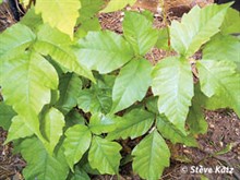
What I didn’t know was that I leaned my bike, right in the middle of what appeared to be a load of poison ivy. Eric and Steve both pointed out that the recent rain, probably brought about a good share of the dreaded plant. I really had no idea how to spot poison ivy. So, I did a little research to hopefully keep you and me clear of it.
Poison Ivy
You’ll notice three pointed leaves that change colors with the seasons:
Reddish in the spring, Green in the summer, Yellow, orange, or red in the fall. On some plants, the leaves have notched edges. On others, the leaves’ edges are smooth. Poison ivy can grow as a bush or vine. You may see the vines climbing up the sides of trees or buildings(Look to the left of my bike, growing up the tree). The plants sometimes have white berries, which help it spread. Birds eat the berries and transplant the seeds on new areas along with their droppings. This may be why poison ivy is so common. Steer clear of this and spend less time itching and more time riding!
From River Road, we turned right on Old Mine Road for a quiet 7 mile roll through the woods, when it started raining. I thought great, no yard work today, but by time we hit the Dingmans Bridge and got back to our cars, the rain stopped and the sun was shining.
With about 32 miles and little to no climbing, this is an intermediate ride that can be done on just about any type of bike.
What’s Playing: (What am I’m listening to while writing or what’s dancing around in my head while riding) Today – ELO – Mr. Blue Sky
After a couple of beautiful days, the rain is headed back. While doing some early morning road rides this week, Eric thought we should get a gravel ride in this morning before Mother Nature exercised her right to spring. With only 2 hours before I had to be at work, we settled on Five Mile Meadow Road and the surrounding trails. As I’ve previously stated, Five Mile Meadow Road, which connects Rt. 739 and Silver Lake Road, is hard packed gravel for about 6.4 miles. We started out on Five Mile, and found our way onto Standing Tall Trail, a snow mobile trail deep in the Delaware State Forest.
I didn’t have to ride through, but it was fun!
There is a creek crossing about a mile into the trail, that’s maybe crossable at best. The trail is lined with wire fencing in conjunction with Pennsylvania’s Deer Management Program. Ending at Silver Lake Road, we turned left, followed the broken pavement for a mile, and did the Little Mud Pond gravel horseshoe. Little Mud Pond is a gravel road that’s a little more than a mile through a beautiful lake community that reminds you of an old fishing village.
Once out on Silver Lake road again, we pedaled down and hung a left back onto Five Mile Meadow. We went up the first hill, and right onto Bald Hill Road. Bald Hill is a well groomed combination of smooth crushed gravel and dirt. Hunting cabins litter both sides of the road for 2 1/2 miles until it comes to an abrupt end in a dirt circle. Private Property separates Bald Hill from the back of the Dingman Delaware School campus.
We zipped back up Bald Hill, right on Five Mile Meadow, and grinded our way back to the deer trail that takes us back around to my house. We were both very content to get a ride in this morning as the rain started to come down, just as we exited the woods. A quick shower and off to work, daydreaming about where to ride this weekend.
What’s Playing: (What am I’m listening to while writing or what’s dancing around in my head while riding) Today – Joe Cocker – When the Night Comes
Finally, a semi dry day. This morning, the weather forecast called for 42 degrees and cloudy skies, but no rain! After near drought conditions and 3 forest fires nearby, the rain was certainly welcomed, but not 8 straight days of it. Well, with a temporary break in the pattern, an early morning ride was beckoning.
I hooked up with Eric, and departed Action Bikes and Outdoor at 7:30am. It was a little chilly, but some climbing early on would heat things up a bit. We crossed the Milford Bridge, and darted up Deckertown Turnpike. It was immediately apparent that the past weeks rain turned the brown, dreary landscape into the green, mountainous beauty that makes the tri-state area so desirable. We turned right on New Road before Deckertown really got steep. New Road is slightly downhill for 3 miles. Just before we would have crossed over Rt. 206, we hung a left on Degroat Road for what turned out to be a cool detour.
We came upon Luna Parc, an artistic wonderland, hidden in the woods. Luna Parc is the home of madcap artist Ricky Boscarino. His largest work in progress is his home and the atelier Luna Parc, which began in 1989. While not open to the public, 3 day open house tours are known to occour.
Luna Parc
Just up the road, we made a right on Meyers Road. For another mile and a half, we cruised through a quiet, serene setting, before coming to Rt. 206. Turning right, we made 2 quick lefts, and dropped onto Layton Hainsville Road. Making our way into Layton, we passed a few runners and walkers, probably itching to get outside. Another right hander, and we went right through Layton and onto Bevans Road.
We snaked our way to Peter’s Valley, and took respite at the Peter’s Valley store and gallery.
Up the famed Peter’s Valley climb, we plateaued, and descended down across Rt. 560 and onto Old Mine Road. Apparently, it’s turkey season for the local hunters, as cars were parked all along the roadway. Although pot holed for the last 3 miles, Old Mine Road is fast, and dumps you right at the base of the aforementioned Milford Bridge. Once across, we dropped down passed the Metz Ice house and back up into Milford for a recovery spin back to the shop.
What’s Playing: (What am I’m listening to while writing or what’s dancing around in my head while riding) Today – The Psychedelic Furs – Pretty in Pink (I don’t know why, but probably because of Luna Parc)
There ‘s no other way to describe Sunday’s weather, except stunning, simply stunning! A bright sunny day with flawless blue skies, moderate wind and 52 degrees. An absolute perfect day for a bike ride. Because it was so nice, I had to make sure to get some yard work in as these beautiful spring, weekend days are at a premium. That being said, I woke up extremely early and cleaned out the shed, put out the patio furniture and began my spring assault on the lawn.
Earlier in the week, I pre planned a Sunday ride with a couple of friends. So, I kissed my understanding and awesome wife goodbye and headed out to meet Eric H. and Debbie at Hupka’s Auto Body in Matamoras, PA, just outside Milford.
We rode out of the auto body shop and onto Mountain Avenue, right on Delaware drive and over the Port Jervis Bridge. A left on Water Street to River Road to Ferry Street and a left on West Main Street. We followed West Main out of the West End neighborhood, across Rt. 97 and onto Rt. 42, passing through Sparrowbush, NY. We followed Rt. 42 for about 11 miles up to Forestburgh Road. Rt. 42 , a well paved road with a five foot shoulder, climbs the whole way. By the time we made the left on Forestburgh Road, we amassed over 1,400 feet of elevation with little respite.
Forestburgh Road dropped us down to the scenic Mongaup Falls Reservoir, a contributory to the Delaware River, and back up a ridiculously steep hill. Compared to the Poconos, the Catskill Mountains are just that, mountainess. A few more miles and a bit more climbing and the road comes to a split. We veered right onto Leers Road and descended until the road ended. A right on Mohican Lake Road for some more climbing through the town of Highland Lake.
Mohican Lake Road becomes Highland Lake Road and descends down to the small, quiet town of Eldred, NY. Since, Eldred is our turn around point of sorts, we decided take a lunch break at Peck’s Market (they have a nice covered patio with a pic nic table). This seemed like a great time to tell Eric and Deb that although they said this was their first ride of the year, both of them were riding extremely well. Their winter workouts and diet certainly paid off.
Pedaling out of Eldred, we ascended a very steep Proctor Road (I should have had a lighter lunch before a climb like that). Once we reached the top, we rode the ups and downs for about 8 miles to the Upper Mongaup Road, which rolls for a few more miles where we hung a left on Knight Rd, dropped sharply down and made a left on Rio Dam Road. Rio Dam Road is a twisty ascent before dropping you right onto the Rio Dam, a massive structure that sends water to New York City and electricity to surrounding towns.
A Photo Op on the Rio Dam. We were really excited to be there!
As soon as we rolled off the dam, we immediately climbed another monster incline. Pedal stroke by pedal stroke, we grinded up the hill, until we summited and turned right on Rt. 42. The climbing was finished for the day, but the thrill was about to begin as we plummeted back down Rt. 42 for about 7 miles. We turned left on Berme Road and rode back through the small, hauntingly desolate town of Sparrowbush.
Although renovated, one of many vacant shops in Sparrowbush, NY
Riverside Creamery
Heading out of town, we made a left on Rt. 97 and slithered through the west end of Port Jervis. Just before the bridge, we stopped at the Riverside Creamery for an ice cream cone. The Creamery is located on Water St., right on the Delaware River. An absolute oasis, great food and fantastic ice cream. We crossed the bridge and pedaled along the river, back up Avenue C and onto Mountain Avenue for a short sprint to Hupka’s Auto Body.
I’m not sure what was better, the ride or the incredible weather, maybe both! If you want to challenge yourself, this ride is well worth it. 50+ miles and 4,790 feet of climbing make this ride one of the more rewarding adventures on 2 wheels.
What’s Playing: (What am I’m listening to while writing or what’s dancing around in my head while riding) Today – Prince – Purple Rain
Now that the weather seems to have turned for the better, it’s time to hit the road and get some quality miles in. With temperatures in the 70’s and 80’s this weekend, I had to find time to put tires on blacktop.
Riding out of town is always pretty this time of year. Before the trees become green, an array of flowers are in bloom and many store fronts and homes display just enough to get you really excited for the spring and summer seasons.
A few sights from Milford including the old Milford Theater(home of the Black Bear Film Festival) and the Dimmick Inn
I rode with John on Sunday from Layton Hainesville Road on the New Jersey side. After an easy spin at conversational pace, we traveled through Layton and over to Peter’s Valley. We hung a left on the Walpack Road and went past the Walpack Inn and around the Walpack loop. The loop is about 12 miles. A roller coaster type road that winds you in and around the National Forest, providing scenic views of the Flatbrook Creek.
John hammering it over the Walpack Loop on his new Trek Emonda
We re-traced the route back to Layton Hainsville Road and back to Milford. On the way back, a black pickup truck with what appeared to be an intoxicated driver, decided it was not willing to share the road. After a few swerves and short stops, the driver sped away and probably figured that it was better to get back to the bar.
All and all, a really nice ride on what turned out to be the warmest day of the year, so far. It felt good to finally ride in shorts and short sleeves.
Today, I rode with TC and Eric from Action Bikes and Outdoor. We left the shop at about 7:30am on a crisp, slightly windy April morning. The sun was shining and the birds were chirping. You couldn’t ask for more. After a slow cruise through Milford’s side streets, we dropped down past the Metz Icehouse and up to Rt. 209 and over the Milford Bridge.
Metz Icehouse
We climbed up Deckertown Turnpike, across Rt. 206 and made a right on New Road. We followed New Road into Cemetery Road and crossed over Rt. 206 again and made a left on Layton Hainesville Road. Riding with TC and Eric, I knew the pace would be fast. I grabbed onto a wheel and hung on through Layton and chased them over to Peter’s Valley, a scenic artists colony that’s home to a popular climb among local cyclist.
Pedaling up the back of Old Mine Road(the Peter’s Valley Climb), I took up my usual position behind TC and Eric, spinning at a brisk pace up the steep 1st few hundred feet. As the hill crests, the grade becomes much more manageable. It’s one of those climbs that you have to really push up the 1st part, to enjoy an easy spin for the rest of the hill. Coming over the top, you shoot straight down hill for a little over a mile and cross over Rt. 560.
Old Mine Road is a quiet country road that spans from the Dingmans Bridge to the Milford Bridge on the New Jersey side of the Delaware River. On nice days, you will see scores of cyclists and runners enjoying the serene surroundings. A quick trip back over the Milford bridge and into Milford for some well deserved coffee. Quick tip. Get out early if you can, before the weather has a chance to turn on you.
What’s Playing: (What am I’m listening to while writing or what’s dancing around in my head while riding) Today – Creedence Clearwater Revival – Have You Ever Seen the Rain.
Everything you wanted to know about the wind but were afraid to ask. Yeah, it was windy today! Did I say it was windy? It was windy!
Having an opportunity to get out and squeeze a ride in on what appeared to be a beautifully sunny day, I met up with Steve at Action Bikes and Outdoor in the heart of Milford. On a whim, we decided on a ride around the Delaware Valley and a climb up Greenville Turnpike.
Port Jervis/Matamoras Bridge
Leaving the shop, we headed east on Rt. 209/Rt 6. Although flat and fast, we had to deal with a lot of evening traffic, oh and did I say, wind? Just as we crossed Rt. 84, we turned left onto Mountain Avenue to avoid busy Matamoras. Turning right on Delaware Drive, we approached the Port Jervis/Matamoras Bridge and I couldn’t help but think that as we ride through this area on a daily basis, it’s real easy to take for granted the scenery that is all around us. A perfect example was the ride over the bridge and the view of the incredibly serene Delaware River.
Pushing through the wind, we made our way through the streets of the old, up and coming small city of Port Jervis, NY. (The once rundown, river city is making a comeback with scores of new businesses and great restaurants). Going under the overpass and up Pike Street, we made a right on E. Main Street and pedaled over the Neversink River Bridge and into Montague, NJ.
We hung a left on Greenville Turnpike, got out of traffic, back into New York and started to climb. At a little over 3 miles, Greenville Turnpike starts out a mere gradual uphill for the 1st 1.25 miles. As it bears right, the road inclines sharply and continues to climb for about 2 more miles, passing some hillside homes and a parking area for the trailhead to the Shawangunk Trail in the Huckleberry Ridge State Forest, before dropping back down to where we made a left on Old Mountain Road. Old Mountain Road is carved into the side of the mountain, providing a road surface that is smooth but slanted down to the low side.
Old Mountain Road drops down to a sudden stop at Rt. 6 in Greenville in front of the Firehouse Deli. A steep, half mile climb awaits as we turn left on Rt. 6. For some reason, the climb seems fast(just one of those roads that feels like your going faster than you should). As we capped the summit, I zipped up and pulled my gloves on and prepared for the long, descent. Did I say it was windy? It felt like the wind was actually pushing us back uphill. Rt. 6 drops through Deerpark, NY for 3.5 miles to the border of Montague and Port Jervis. Pedaling back through Port Jervis, E. Main Street eventually rolls right into Rt. 97. We climbed up to the Main Street overlook and were treated to an excellent view of the city.
Descending Rt. 97 to Sleepy Hollow Road, we winded through the quiet West End Neighborhood of Port Jervis and back to the bridge and across to Matamoras. As we traveled through Matamoras and into Milford, we were hit hard by the wind. For 5 plus miles, we crawled back to Action Bikes and Outdoors, happy to have gotten it in.
What’s Playing: (What am I’m listening to while writing or what’s dancing around in my head while riding) Today –Genesis – Abacab
Before long, I’ll be writing about long, somewhat fast road rides. But for now, the winter that never was, continues to linger. As long as it does, shorter, slower rides through the Pennsylvania landscape rule the day.
Located 17 miles west of Milford in Greentown, PA is Promised Land State Park. About 3,000 acres in size, Promised Land State Park is on the Pocono Plateau, 1,800 feet above sea level, and is surrounded by 12,464 acres of Pennsylvania’s Delaware State Forest, including natural areas. Visitors enjoy fishing and boating in two lakes, rustic cabins, camping, miles of biking and hiking trails, and exploring the forests.The forests of the park consist primarily of beech, oak, maple, and hemlock trees. Two lakes and several small streams add to the park’s outstanding scenic beauty.
I parked in the main parking area at the DCNR Park Office. Steve, at the counter, was very helpful; he pointed me in the right direction, and handed me some maps of the park. Once outside and on my bike, I headed out to Rhododendron Trail. A rather flat but bumpy trail, Rhododendron Trail is a nice way to ease into the trail system. After about 1.5 miles, the trail turned to gravel, and winded through a small village of cabins along the main lake. It ended at the tip of the lake. Crossing the road and onto the tow path, puts you over the wooden bridge and along a gravel path, just above the beach.
After cruising along the lake and through a few campsites, I came to Tower Trail. A technical, rocky sort of single-track, Tower Trail climbed up a few small hills, and dumped me into a dried up creek bed, before climbing back up and onto Cross Cut Trail. Like Tower Trail, Crosscut Trail is a technical trail that would have been better suited with a mountain bike. Today, I rode my Van Dessel, Whiskey Tango Foxtrot. A steel 700c monster cross bike with 29X2.1 tires, she goes almost anywhere. Still, a MTB with at least front suspension would have handled the terrain a lot better.
After navigating a section of woods, I found the Boundry Trail. A much more subtle trail, Boundry starts at the north shore of the big lake, and winds through the forest to the southern end of the lower laker, before putting you right back on Tower Trail.
After a few more miles, I was back at the main parking area. Although windy and 45 degrees, the sun was shining, and the bare trees gave me an awesome view of both lakes from various parts of the trail. Getting in the car and driving a few miles to a place so serene and beautiful is more than worth it. Promised Land State Park will certainly feel my bike roll over it’s trails more than a few times this summer.
What’s Playing: (What am I’m listening to while writing or what’s dancing around in my head while riding) Today – Golden Earring – Cut.
Since moving the clocks ahead on Sunday Morning, I have been unable figure out what and where I want to ride. The when is all taken care of. The when is as soon as I leave work. With about 2 1/2 hours of daylight left when I leave the office at 5pm, I could do a road ride from work or a multitude of gravel and dirt rides from Dingmans Ferry or Milford. Today, I chose a dirt/gravel and road ride with Steve. We decided to hit the trails and gravel roads off of Old Mine Road.
You can get to Old Mine Road from either Dingmans Ferry or from Milford. I prefer to leave from Milford. Leaving from Action Bike and Outdoor in the Heart of Milford, head out to the Milford Bridge. Once over the bridge, on the New Jersey side, hang a right onto Old Mine Road. Travel about 6 1/2 miles and make a right onto Mettler Road. Mettler is a loosely packed gravel road. When you get to the river, turn right onto Van Auken Road and thats where the fun starts. Van Auken is a mix of loose gravel and dirt, that quietly takes you into a trail after about a mile.
The trail winds through a couple of campgrounds along the Delaware river and treats you to some beautiful views of the river and the Delaware Valley. Your probably ok here with a hybrid, cyclocross or mountain bike. There might be a bit too much rocks and roots for a road bike, though. However, I did go over the bars and into the mud after hitting a large root in the trail. Didn’t feel good at first, but I was lucky enough to pedal out of the woods. The singletrack does wind along the ledge as you climb out of the woods and make a left back onto Old Mine Road. After a half mile, you turn right and climb Jagger Hill.
A little over a mile of climbing and you come to the top right at the Upper Ridge Road Trailhead. Thats where the climbing continues. Another 3/4 of a mile up in the loosest gravel, dirt and sand you could imagine. Alot of sand on that side of Old Mine, but a really nice section of trail with alot of up and a whole lotta downs!
The trail comes out on Rt. 560 in Layton, NJ. You have a few choices to get back to Milford. Old Mine Road, Rt. 209 (on the other side of the Dingmans Bridge) or the McDade Trail. This ride is another example of all the terrain that can be ridden in and out of milford.
What’s Playing: (What am I’m listening to while writing or what’s dancing around in my head while riding) Today – Aretha Franklin – Who’s Zoomin Who


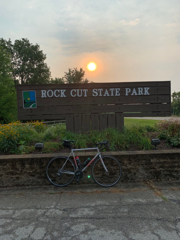


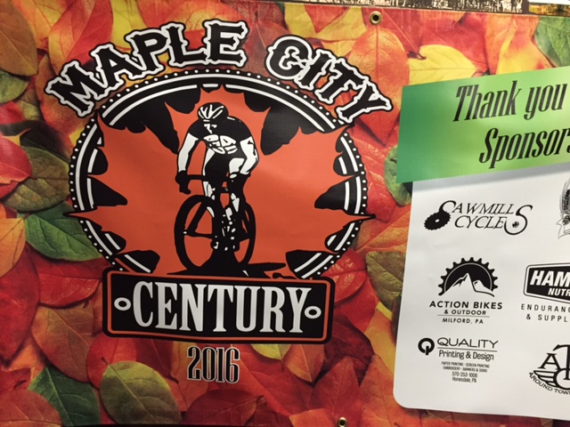


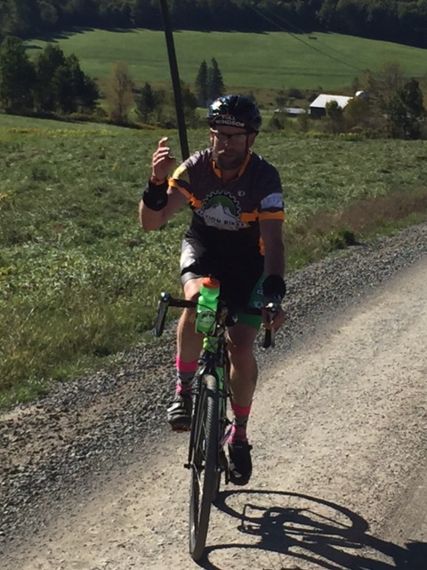


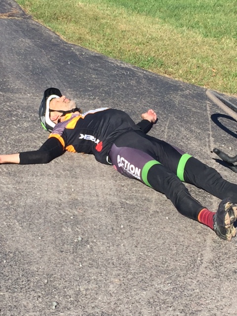


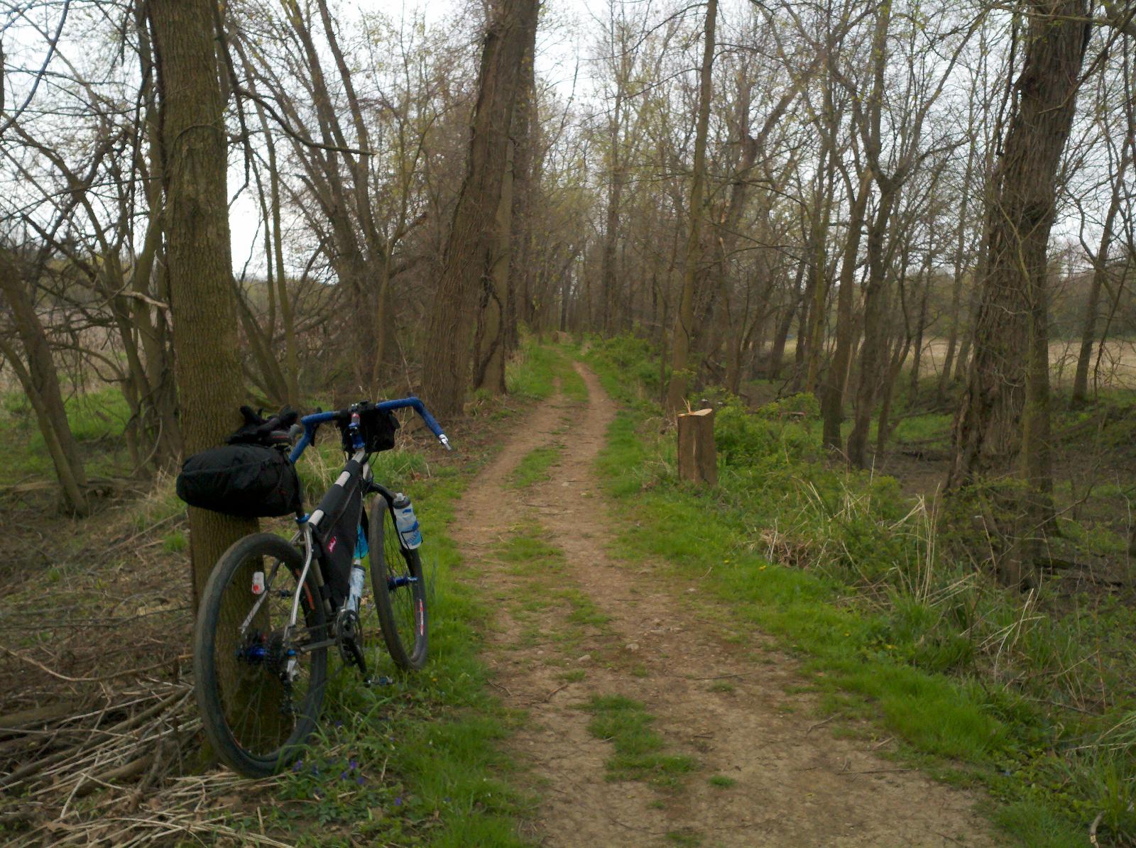


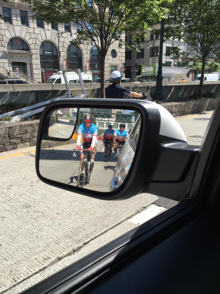


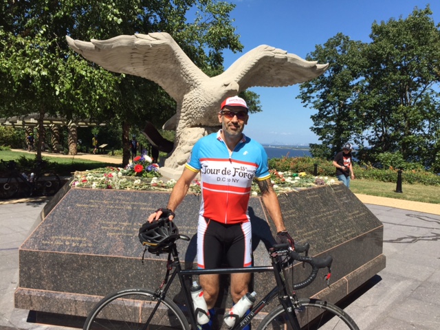


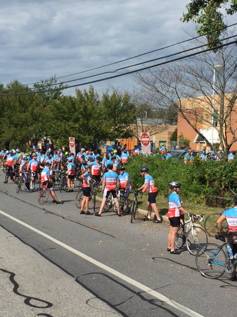
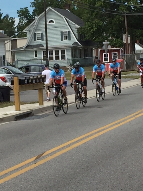 0
0


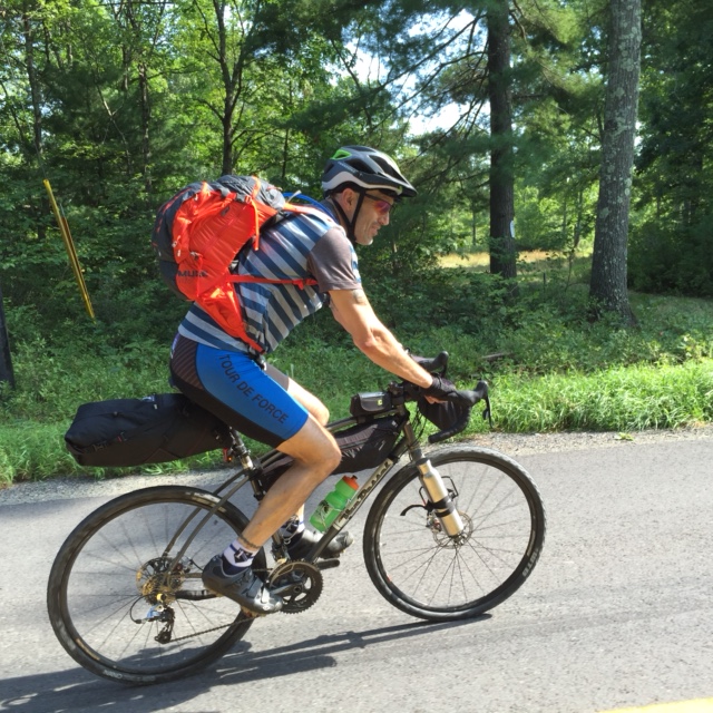


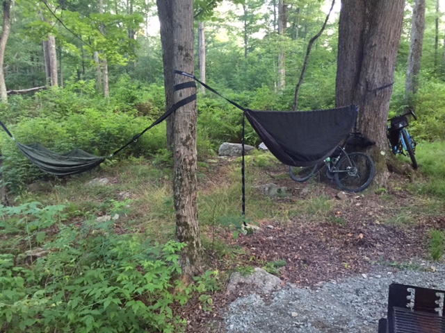


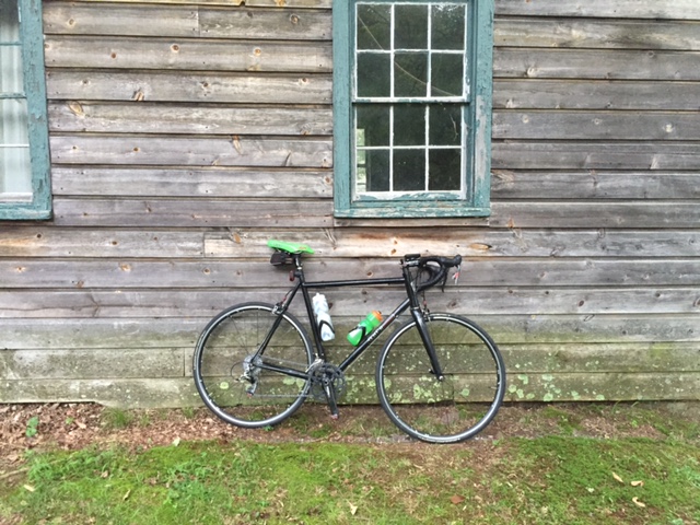


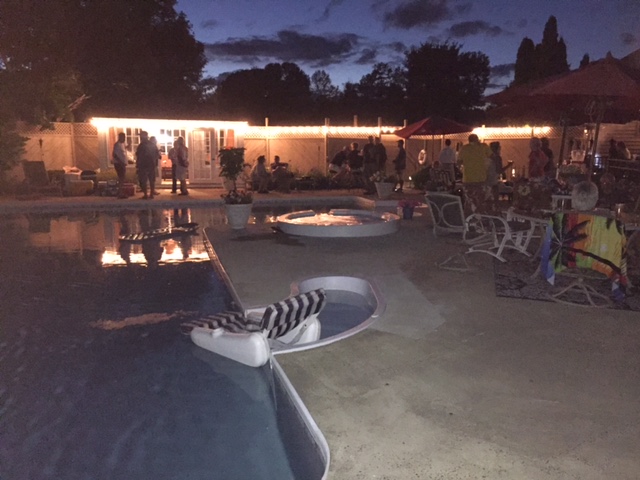


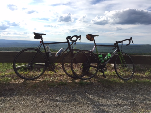


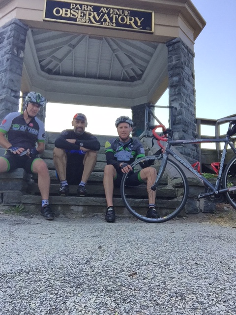


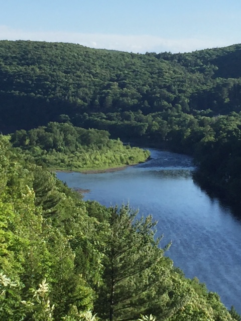


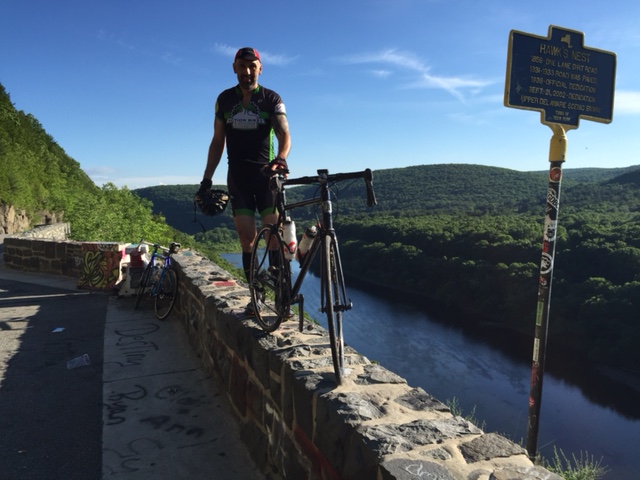
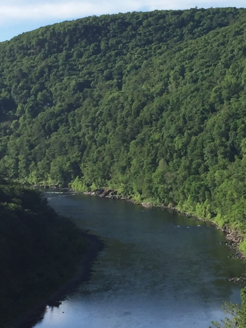


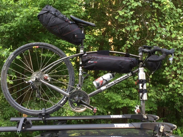


 Descending down about a 1/2 mile, I turned right on Mountain Road and then another mile, right on Greenville Turnpike. Greenville goes steeply up for about 1 1/2 miles, then drops down for 2 1/2 miles, just at about where the Rt. 6 climb began. A careful left on Rt. 23, brought me through the Montague, NJ traffic and up past Clove Road. Rt. 23 climbs for about 7 miles, but never really gets too steep. I followed it up to the High Point State Park entrance and hung a left into the park.