Buckhorn Fire Tower

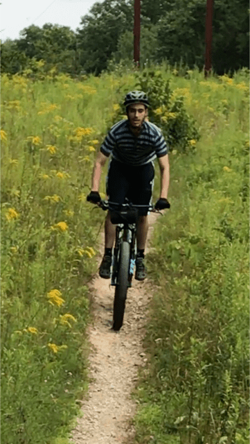
Sometimes you learn a new route and fall in love. Matt told me about a ride he did with his dad last week. Being a mostly gravel route, I have to say it peaked my interest. Yesterday afternoon, I hooked up with Eric at Action Bikes and Outdoor to make a trip from the shop to the Buckhorn Fire Tower.

IMG_5896

We departed at 5pm, zig zagged out of town and climbed up Rt. 6 to Schocopee Road. Schocopee is a newly paved road that continues to go skyward, especially as you bear right onto Fire Tower Road, where he gravel starts.

IMG_5895

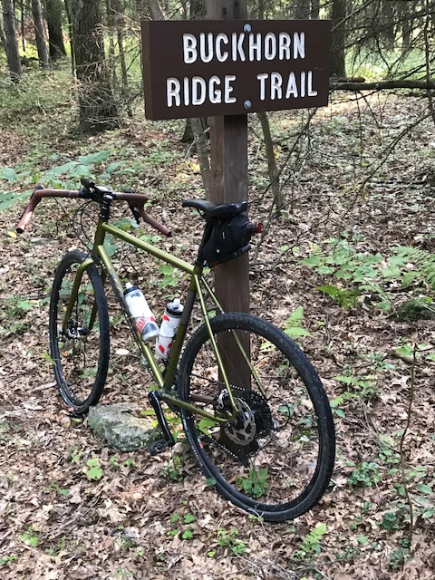
We took Fire Tower Road until it ended in a gravel parking lot. About a half mile before the lot is a left on Buckhorn Ridge Trail. A short trip on the trail and you’re at the Fire Tower. I’m not sure if this relic is still in use. It’s pretty wobbly and most of the nearby pine trees sit a bit higher than the tower, blocking views of he forest. From the looks of things, this was quite a party spot, some time ago.

IMG_5939

We descended back down to Schocopee Road, made a right and climbed up to Lily Pond. This section of Schocopee is gravel, pave, gravel, as it dips and rises through the forest, bringing you to a beautiful park. You could ride around the lake, although time did not allow it.

IMG_5915

We did a lot of climbing on our way up to the fire tower and again as we reached Lily pond, so you can imagine just how delightful the descent back to town was! We ripped down to Rt. 6 and cut through Old Owego Road as we snaked through town and back to the shop.

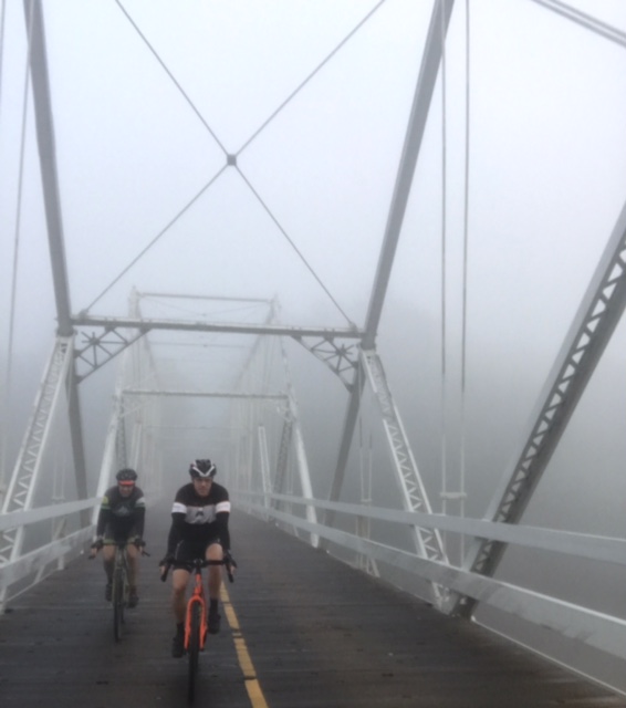
No music today, just some more pics of the his really pretty area.

Advertisement

When We Gravel, We Grind

With the Maple City Century quickly approaching, Eric, Darin and I took advantage of the unseasonably cool, late August weather and grinded out a 40ish mile gravel ride. Starting just after dawn gives you enough time to get miles in and still have most of the day with the family.

IMG_5872

We Pedaled out of Dingman Falls and over the Dingman Bridge. Needless to say, it was quite foggy. We climbed just above Peter’s Valley and dumped into the gravel section of Old Mine Road. Besides the many potholes and puddles, this a very fun section. Downhill on gravel for the better part of 6 miles, makes riding along the Delaware River a cool experience.

IMG_5875

We turned left on Pompey Road, climbed up, making a left into Ridge Road, a dirt trail littered with rocks and roots for the first mile. It then turns to high weeds on a broken up double track (leaving spools of grass in cassettes and around pedal spindles).

IMG_5869

Ridge Road comes out onto Thunder Mountain Road. The transition from overgrown forest to gravel road was sort of a relief. After 45 minutes, you realize you only went 3 miles. Bonus, the fog was burned off by the bright sun, one day before the solar eclipse. Thunder Mountain runs up to Kuhn Road and right through the heart of the Peter’s Valley School of Craft. We turned right on Kuhn and left on Walpack Road, over the hill and back over the Dingman Bridge.

IMG_5852

Back at the cars, we changed out our water bottles and headed down to the McDade trail for the 2nd part of the ride. About 2 miles in, a half eaten fish falls from the sky, or the trees. Darin spotted an Eagle that flew directly above us and over the river. Apparently, we interrupted the eagles’ breakfast.

We continued at a pace that was probably too fast for me, but I needed the punishment. We arrived at the Bushkill Boat Access and after a brief rest, turned around and rode a torrid pace back to our cars. Apparently, we weren’t the only ones enjoying this beautiful day. There seemed to be quite a few people hiking, bird watching and trail running.

IMG_5868

This is not the first time I’ve pedaled either of these routes, but I never put them together before and I’m glad we did. By he way, most photos while riding are taken by Eric, who always seems to have his phone on the ready!

IMG_5874

What’s playing (what am I listening to while writing or what’s dancing around in my head while riding) Today – Jigsaw – (you’ve blown it all) Sky High IMG_0425


Bontrager Ion 800 RT – Reviewed

Having been caught out on the trail or the road, too many times after the sun has gone down, I’ve had to use a head light to find my way. My old light, while powerful, was wired to a battery pack, that was stashed under the stem. Bulky and cumbersome.

I recently acquired a Bontrager Ion 800 RT and put it to immediate use. I went out for an evening gravel ride from Milford, down the McDade Trail and up through both sections of Zimmerman Farm. I cruised down Rt. 209 and back on the McDade for a few miles before turning around and retracing the route. By time I hit Zimmerman Road, it was pretty dark. I clicked on the Ion 800 RT, and was surprised at how well it lit up he trail. I cruised Zimmerman, Rt. 209, McDade and back through town with complete confidence.

bontrager-daytime-running-lights-8

The next day, I did a morning road ride and used the Ion 800 RT’s daytime flashing mode. This unique function can be seen from over 1.5 KM away. Critical when riding on busy streets. Let’s face it, most people text and drive. There are so many distractions to keep driver’s from seeing everything in the roadway. We wear helmets to protect our heads in the event of a crash, Why not give yourself the best chance to avoid that crash!

The following was taken from Trek’s website:

  • Transmitr remote displays battery status indicating when charge is needed
  • See with our focused optics and over 270 degrees of visibility
  • 800 Lumens via high-power CREE LED
  • 800LM-1.5hrs, 450LM-3hrs, 200LM-6hrs, night flash-20hrs, day flash 20hrs
  • Fully charges in 6 hours through sealed Micro USB port
  • Includes 20 degree +/- adjustable Sync bracket that fits bars from 22.2-35.0mm
  • Blendr compatible, secure bar mount available  14303_A_2_Ion_800_RT

The Ion 80 RT is a nice compliment to the Flare R tail light. Both have night time as well as day time modes. To boot, the Ion 800 RT weighs much less than most head lights. I am extremely pleased and will use daytime modes whenever I’m on a paved roadway.


Stewart State Forest

About a 40 minute drive from Milford, sits Stewart State Forest, known to many as the Stewart Buffer Land. Matt and I decided to make the trip east on Rt. 84 yesterday (with a pit stop at Arlene and Tom’s Restaurant in Port Jervis to fuel up) for what proved to be a really nice day out on the trails.

IMG_5761

There are a few designated parking areas. We decided to make Weed Road our base camp. We started out on the Orchard Trail and did not see a rock or root all the way to Giles Road. We jumped over to Rock Wall Trail and found out quickly how it got it’s name. In the first half mile, you traverse 4 rock walls, and yeah, the rocks and roots appeared.

IMG_5792

We followed Rock Wall to Mid Earth to New Road. We made a left on White Cloud Trail, climbed a few hundred feet and dropped back down through the wetlands and back up to Bypass Trail and over to Windsor Trail. Looping back to Weed Road we pedaled up the gravel hill and back to the parking area for lunch.

IMG_5797

After a couple of pb&j sandwiches, we headed back down Weed Road, hungry for more singletrack. We found a jewel! Causeway Trail to Shields Trail to Drakes Trail is like a deep forest pump track. Hoping over to Mid Earth, we crossed New Road and took Senior to Waterfall.

IMG_5764

Waterfall really tests you. It’s a little bit technical singletrack and a little bit hike a bike, up rock formations that appear like waterfalls. We followed Waterfall to Prime to Sara’s Way to Windsor Trail and back to New Road. New Road becomes Weed Road as we pedaled into the parking area. At a high of 74 degrees, we were treated to a beautiful day for what turned out to be a wonderful ride.

What’s  playing (what am I listening to while writing or what’s dancing around in my head while riding) Today – Santana – Evil Ways IMG_0405


Hill Challenge Update

July’s hill climbing challenge did just what it was designed to do, get you out there pedaling. Ok, we’ll get me out there pedaling. A couple other local riders nailed it as well. Congratulations go out to Bill and Eric. They will drink from their well earned Riding Milford/Action Bikes and Outdoor, ceramic coffee mugs. I will too, although I snatched my mug as soon as they arrived.


Just to show how a goal can push you, here are a few stats from the month of July that are attributable to the hill challenge:

Bill, finished the challenge in only 11 days.

The three riders that finished the challenge, logged a total of 1,266 miles and 88,562 feet of elevation.

Pretty good for a few middle aged  men!

Unfortunately, I’m going to suspend the challenge. I do not want anyone getting hurt while climbing up hills and hammering down the other side. We will think up another way to get you outside and on your bike, soon. Until then, ride on!