
Is it really December? As I am just getting over a nasty head cold, I thought I would spend the day today just relaxing and watch some football. I woke up early, and checked the weather: 37F at 8am. Looks like it might hit 50F. Change of plans. If I layer up and cover my head, I could take advantage of this incredible late autum warmth and get a ride in.
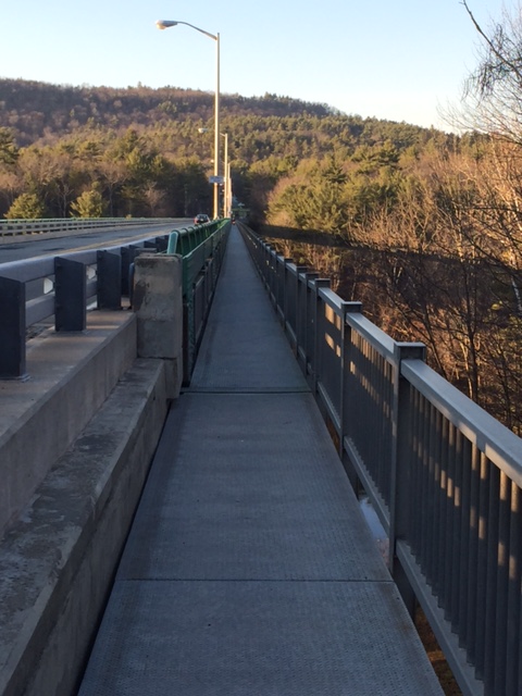
I decided to do one of the areas most popular rides: Milford to the Walpack Inn. I left from Action Bikes and Outdoor in the heart of town, and headed to the Milford Bridge. Bicycles are only allowed in the bike lane on the side of the bridge, a narrow steel surface about 5 feet below the bridge’s vehicle lanes, giving you an awesome view of the Delaware river. Once over the bridge and into Montague, NJ, I climbed up Deckertown Turnpike for 2 miles and made a right onto New Road. New Road rolls down at about a 1% grade for 3.5 miles through a residental area and a couple of horse farms.
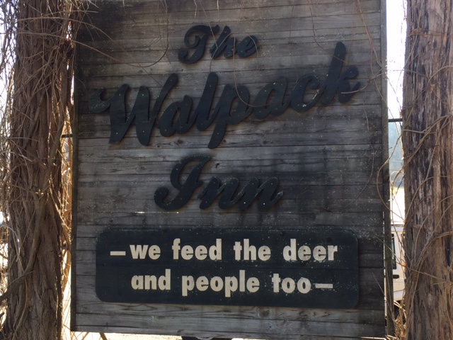
Crossing over Rt. 206, I went left onto Layton Hainesville Road. Littered with farms, churches, and old homes, Layton Hainesville Road drops you right into the small berg of Layton, NJ. A General Store turned Greek restaurant, an old hotel turned pizza parlor and an old mechanic shop are the focal points of a revived town with a reputation for good food. A few more miles and I rolled through Peter’s Valley (an artists’ colony), and made a left on Walpack-Flatbrook Road (Rt.615), a roller coaster type road that rises, descends, and winds throughout the Walpack Recreation Area. At about 16.5 miles, I turned around at the Walpack Inn, a restaurant set in the wooded landscape among every creature the area has to offer.
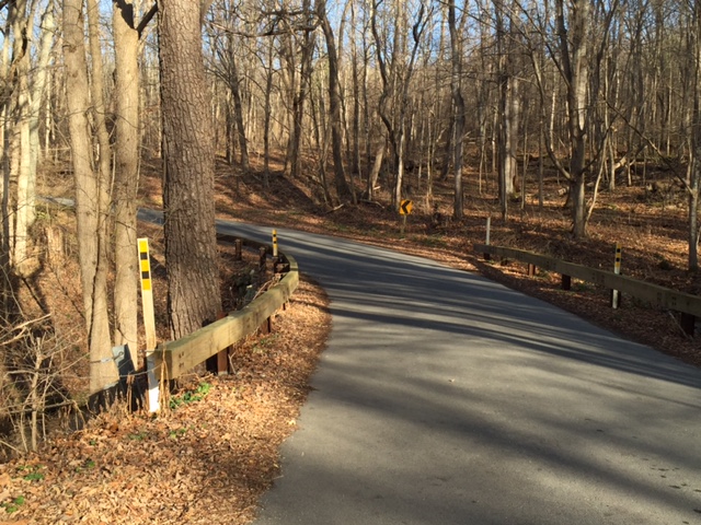
Heading back on Walpack-Flatbrook Road, you pass by the Walpack Center, a small former village, consisting of an old US Post Office, a museum, and a few old homes. I went straight at Peter’s Valley and up the backside of the Peter’s Valley Climb. This is the easier direction to climb the hill, but it can get steep, especially right at the beginning. This drops you at Rt. 560, riding straight across on to Old Mine Road, a quiet country road that connects the Dingmans Bridge with the Milford Bridge. Mostly flat, Old Mine Road zig-zags for 7 miles past 2 very old cemetaries in as picturesque a setting as you could imagine, and with almost no traffic.
I turned left at the end, and back toward and onto the Milford Bridge for one more view of the Delaware River before returning to Milford. In total, 31 miles, and just over 2,100 feet of climbing. I’ll take a December ride anytime mother nature wants to give it to me!

