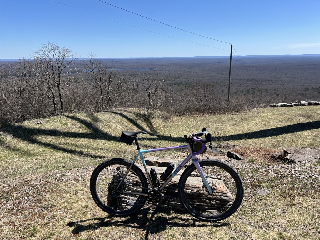
Last Saturday, 11 riders met up on a cool morning at the parking area for Five Mile Meadow Road on Rt. 739. Riders from New York, New Jersey and Pennsylvania made up the group that would eventually ascend and turn around at the High Knob Fire Tower, one of 36 inactive towers that were built around 1918, to protect the lush green Pennsylvania Forests during the high fire season. The High Knob sits at 2054 feet, overlooking most of Pike County.

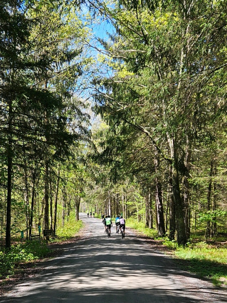
We pedaled out of the parking area and immediately climbed up the front of Five Mile Meadow Road. The hard packed gravel surface has been in good condition after a rather mild winter. After passing the old Boy Scout camp, we turned right on Ben Bush Road and connected over to Standing Stone Trail. Standing Stone drops slightly for 2 miles to Silver Lake Road, where we would cover more than half of all paved roadway on this route. After turning left on Little Mud Pond and quickly spinning through the small lakeside cabin community, we crossed over Silver Lake Road onto the Burnt Mills Trail.

Burnt Mills is a technical old snowmobile trail system that now gets more ATV use. It zig zags for about 4 miles and comes out on Flat Ridge Road, another hard packed gravel road. After 1.25 miles, we crossed over Bushkill Falls Road and jumped back onto the Burnt Mills Trail for 2.5 miles of the roughest terrain we would see all day. Burnt Mills comes out to a large parking lot on Rt. 402. After a half mile on Rt. 402, we turned left onto Pine Flats Road. Pine Flats is another fantastic gravel roadway that connects over to Highline Road. Highline is a series of short, but steep gravel climbs for about 5 miles before a right hand turn on Hobday Road drops you off at the base of the High Knob.
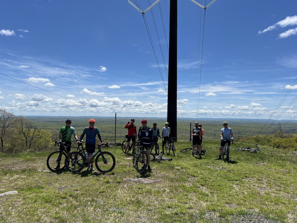
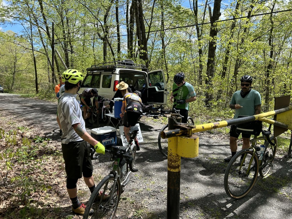
At the High Knob, Carissa was waiting for us with a fantastic aid station, supplied by Action Bikes and Outdoor. She had water, electrolyte mix, energy bars and fruit. It was an oasis before the climb. The climb to the High Knob Fire Tower starts out at a moderate gradient and gradually gets steeper as you make your way around to the top. It’s about 500 feet in 1.75 miles. At the top, we took in the view of Pike County, snapped a few photos and hit the descent.
The route back was pretty similar, although we pedaled the entire length of Flat Ridge Road (eliminating the front half of Burnt Mills) and the entire length of Five Mile Meadow Road (eliminating Standing Stone and Ben Bush). In all, the route covered 50.8 miles with 4,030 feet of elevation gain. The surface was 47.1 miles of gravel and dirt with 3.7 miles of paved roads.

Checkout some more photos of this fantastic ride. Also check with Action Bikes and Outdoor for their weekly ride schedule for more great rides in the Milford area.